2020s Maps of Pulaski County, Indiana
Explore 15 historic maps of Pulaski County from the 2020s. These maps offer a rare glimpse into what life looked like during the 2020s — showing old roads, neighborhoods, homes, and landmarks that have changed or disappeared over time.
Whether you're researching your family's past, planning a metal detecting trip, or studying how Pulaski County's landscape evolved across the 2020s, these high-resolution maps are a powerful tool for exploring the history of this region.
- Focus on a specific era: All maps on this page are from the 2020s, giving you a focused view of this time period.
- See what’s changed: Compare century-old streets, trails, and buildings to today's modern landscape using overlays and satellite layers.
- Research with precision: Use these maps for genealogy, historical research, land use analysis, or educational projects.
- View, download, or print: Maps are fully viewable online in high resolution, and can be downloaded or printed for your own records.
Start exploring Pulaski County's history through authentic maps from the 2020s. This is your window into the past.
Pulaski County, IN maps
(15)- 2022 Map of Bass Lake, 2022 Print
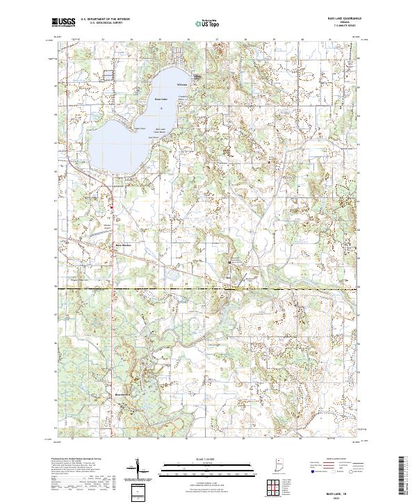 2022 Bass Lake2022 Print · USGSStarke and Pulaski Counties are shown in the early 2020s, centered on the recreational and agricultural landscape surrounding Bass Lake. Researchers can trace old property boundaries near Beardstown, find the North Bend Cem, or locate regional aviation sites like Wheeler Airport.
 - 2022 Map of Winamac, 2022 Print
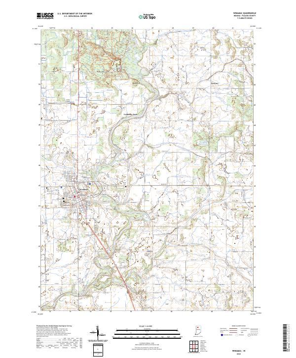 2022 Winamac2022 Print · USGSWinamac and the surrounding Pulaski County countryside are shown here in the 2020s, highlighting the town's position on the Tippecanoe River. Researchers can trace old rail corridors along the Panhandle Pathway Trl or locate family sites at Winamac Cem and Lawton.
 - 2022 Map of San Pierre, 2022 Print
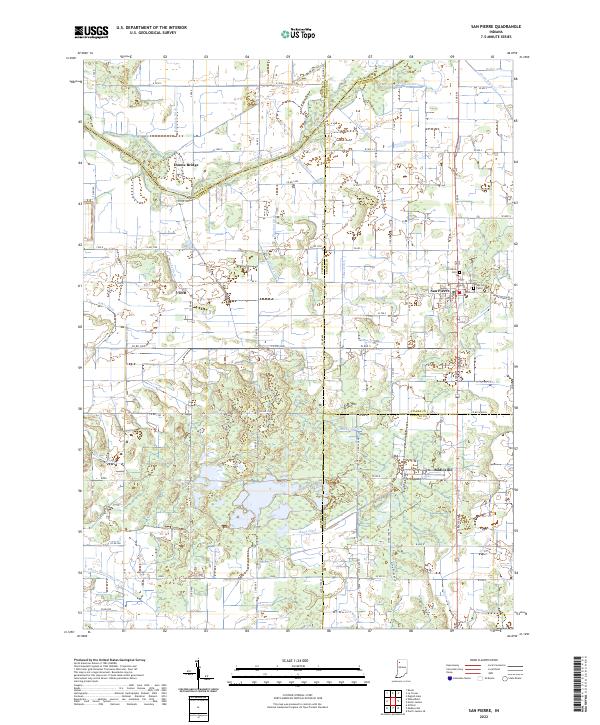 2022 San Pierre2022 Print · USGSNorthwest Indiana at the start of the 2020s shows a landscape deeply shaped by the drainage of the Kankakee Basin. Researchers can trace the heritage of local settlements like San Pierre and Tefft or locate family sites at the San Pierre Public Cem and All Saints Cem.
 - 2022 Map of Denham, 2022 Print
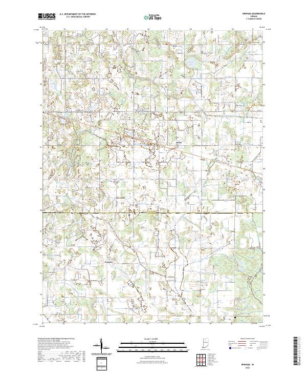 2022 Denham2022 Print · USGSIndiana's farm country comes into focus on the Starke and Pulaski county line, where drainage ditches have long reshaped the land. Researchers can trace the legacy of local families at Center Cem and follow the path of the North Judson To Monterey Trl past Denham and Aldine.
 - 2022 Map of North Judson, 2022 Print
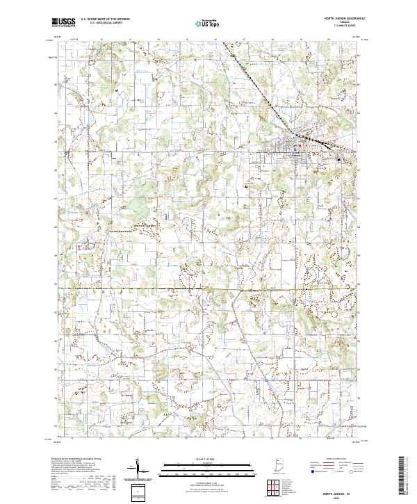 2022 North Judson2022 Print · USGSNorth Judson and the surrounding Kankakee Valley marshlands are captured here in the early 2020s, showing a landscape defined by century-old drainage systems. Researchers can trace family roots at Highland Cemetery or follow the paths of the Rensselaer Trail and North Judson to Monterey Trail.
 - 2022 Map of North Judson SE, 2022 Print
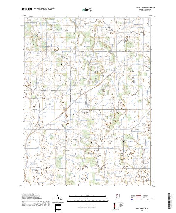 2022 North Judson SE2022 Print · USGSPulaski County, Indiana, is captured here in the early twenty-first century, showcasing a landscape transformed by extensive drainage engineering. Genealogists and local historians can locate several family-named landmarks, including Sutton Cemetery, Big Monon Ditch, and Bowman Cemetery.
 - 2022 Map of Medaryville, 2022 Print
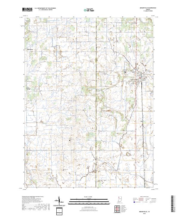 2022 Medaryville2022 Print · USGSThe rural agricultural lands of Pulaski County are shown here in the 2020s, defined by the town of Medaryville and a complex drainage network. Researchers can trace local lineage at Saint Marks Lutheran Cem or locate the small landing strips at Tatertown Airport and Alley Oop Airport.
 - 2022 Map of Ripley, 2022 Print
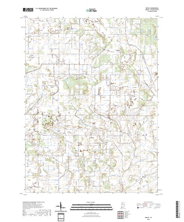 2022 Ripley2022 Print · USGSAgricultural Pulaski County is mapped here in the early twenty-first century, showing a landscape defined by drainage and rural roads. Researchers can locate Ripley and the Burroughs Cem, or trace waterways like Thompson Ditch and Agnew Br.
 - 2022 Map of Buffalo, 2022 Print
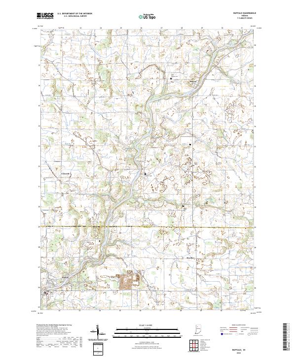 2022 Buffalo2022 Print · USGSIndiana's Tippecanoe River valley is seen here in recent years, where drainage ditches and rural townships define the local landscape. Researchers can locate family heritage sites at Saint Josephs Cem or trace the early settlement footprints of Pulaski and Buffalo.
 - 2022 Map of Francesville, 2022 Print
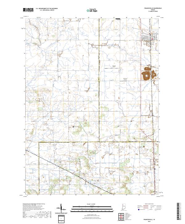 2022 Francesville2022 Print · USGSNorthwest Indiana's prairie farmlands are revealed in this detailed look at the rural landscape where Jasper, Pulaski, and White counties meet. Local researchers can trace family plots at Osborne Cem or explore the drainage history of Slough Creek and Jordan Ditch.
 - 2022 Map of Grass Creek, 2022 Print
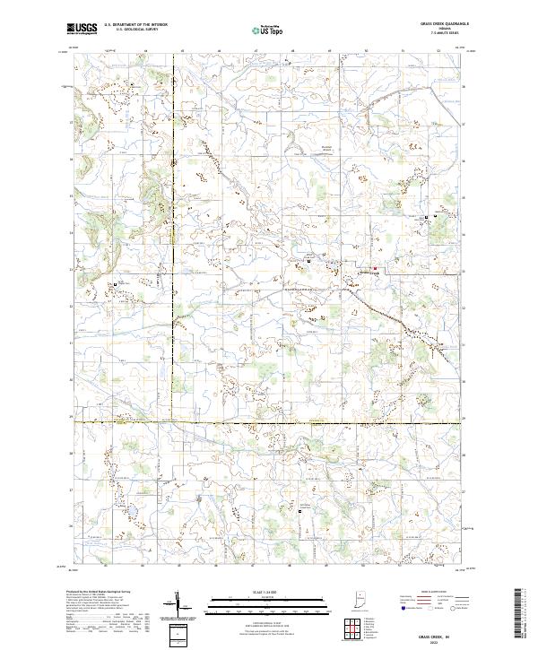 2022 Grass Creek2022 Print · USGSThe tri-county borderlands of Fulton, Pulaski, and Cass counties are documented here in the early twenty-first century. Genealogists and local historians can locate several family and community burial sites like Victor Chapel Cemetery and Bauman Cemetery.
 - 2022 Map of Monon NE, 2022 Print
 2022 Monon NE2022 Print · USGSThe drainage of the Indiana wetlands is on full display in this modern survey of the Pulaski and White County border. Researchers can trace the agricultural grid and find local landmarks such as Roseland Cem, Big Monon Cr, and Beaver-Ditch.
 - 2022 Map of Star City, 2022 Print
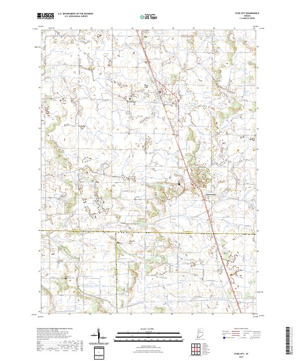 2022 Star City2022 Print · USGSIndiana's agricultural heartland is documented here in the early 2020s at the junction of three counties. Local historians can trace family roots through Star City West Cem and Mount Pleasant Cem, or follow the drainage history of Indian Creek and Stout Gise Ditch.
 - 2022 Map of Culver, 2022 Print
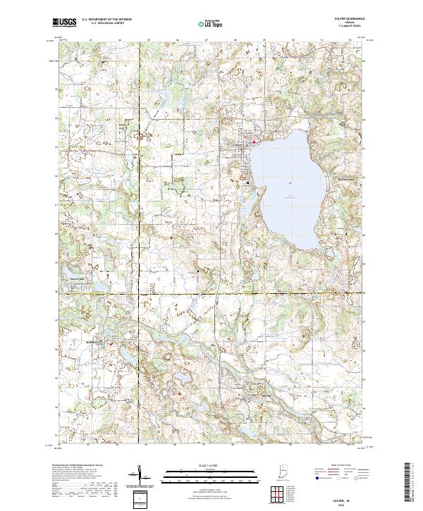 2022 Culver2022 Print · USGSThe northern Indiana lake country is captured here in the early twenty-first century, centered on the shores of the deep Lake Maxinkuckee. Researchers can locate family sites across several county lines, from the town of Culver to rural landmarks like Zion Cem and the banks of the Tippecanoe River.
 - 2022 Map of Kewanna, 2022 Print
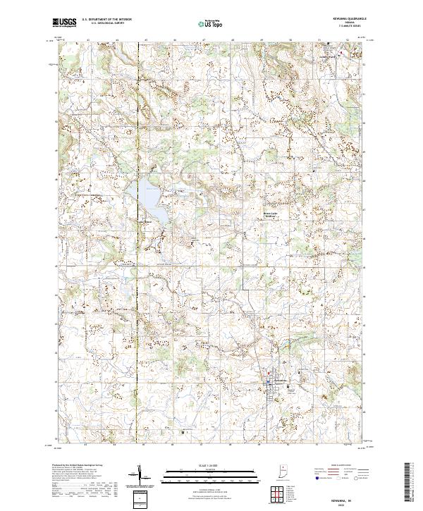 2022 Kewanna2022 Print · USGSThe western edge of Fulton County is captured here in the early 2020s, showing a landscape of managed waterways and small rural hubs. Researchers can trace family history at the Kewanna Citizens IOOF Cem or explore the shoreline developments around Lake Bruce and Leiters Ford.
End of results
Showing maps 1-15 of 15
Top cities of Pulaski County
- Winamac historical maps
- Francesville historical maps
- Medaryville historical maps
- Monterey historical maps
Frequently asked questions
- What are the different types of historical maps available for Pulaski County?
- What is the oldest map of Pulaski County?
- Where can I purchase historical maps of Pulaski County for my home or office?
- Where can I download high-res historical maps of Pulaski County?
- Are there historical topographic maps available for Pulaski County?
- Is there historical aerial imagery available for Pulaski County?
- Where are historical maps of Pulaski County sourced from?