Old Maps of Pulaski County, Indiana for Metal Detecting
Plan your next treasure hunt with 97 historic maps of Pulaski County. Find old homesites, ghost towns, trails, and gathering spots that may be lost to time — perfect for identifying promising metal detecting locations.
- Locate forgotten sites: Uncover places like long-lost settlements, abandoned rail lines, or gathering spots.
- Plan better hunts: Use map overlays combined with LiDAR or satellite views to narrow in on historically rich areas.
- Made for detectorists: Thousands of hobbyists use these maps to discover relics, coins, and hidden history.
Use these historic maps to boost your research and find new opportunities beneath the surface of Pulaski County.
Pulaski County, IN maps
(97)- 1953 Map of Chicago, 1964 Print
 1953 Chicago1964 Print · USGSThe southern Lake Michigan shoreline was rapidly modernizing in the mid-fifties, balancing heavy industry with its famous academic centers. Researchers can trace the footprints of Notre Dame University or locate vanished sites like the Kingsbury Ordnance Plant and Meigs Field.5 unique versions available
 - 1953 Map of Danville, 1965 Print
 1953 Danville1965 Print · USGSIndiana and Illinois crossroads come to life in this mid-century survey as the interstate era begins to reshape the river-and-rail landscape. Genealogists and collectors can trace the historic paths of the Nickel Plate railroad or locate smaller communities like Veedersburg, Goodland, and Bismarck.3 unique versions available
 - 1955 Map of Danville
 1955 Danville1955 Print · USGSThe Indiana-Illinois borderlands during the mid-fifties reveal a landscape of thriving rail hubs and university towns. Researchers can trace the legacy of Purdue University, the Tippecanoe Battlefield, and the path of the Pennsylvania RR.
 - 1956 Map of Danville
 1956 Danville1956 Print · USGSMid-century Indiana and Illinois are captured here as the river-and-rail economy evolved into the modern highway era. Researchers can trace ancestral roots and old transport lines through Logansport, Battle Ground, and the dams at Lake Shafer.
 - 1957 Map of Chicago
 1957 Chicago1957 Print · USGSThe industrial heartland and southern Great Lakes shoreline are captured here during the peak of mid-century growth. Researchers can trace the massive Gary Steel Works, the grounds of the University of Notre Dame, and the early paths of the Tri-State Tollway.
 - 1959 Map of North Judson, 1961 Print
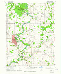
 1959 North Judson1961 Print · USGSNorth Judson was a powerhouse railroad junction in the late 1950s, where four major lines met amidst a heavily ditched agricultural landscape. Genealogists and rail historians can trace the Pennsylvania RR corridor, locate the Blue Sea Community Building, or find family ties at St Thomas Cem and Highland Cem.2 unique versions available
 - 1959 Map of San Pierre, 1961 Print
 1959 San Pierre1961 Print · USGSNorthwest Indiana in the late fifties is defined by managed wetlands and the intersection of major rail lines. Genealogists and historians can trace the rural communities of San Pierre and Tefft, locating the All Saints Cem & Cem and the Township Sch.2 unique versions available
 - 1960 Map of Grass Creek, 1964 Print
 1960 Grass Creek1964 Print · USGSIndiana farm country in the early sixties is defined here by the iron rails of the Pennsylvania and a complex web of drainage ditches. Genealogists can locate family-named sites like Bowman Cem, O'Brien Lake, and the rural West Union Ch.3 unique versions available
 - 1962 Map of Buffalo, 1963 Print
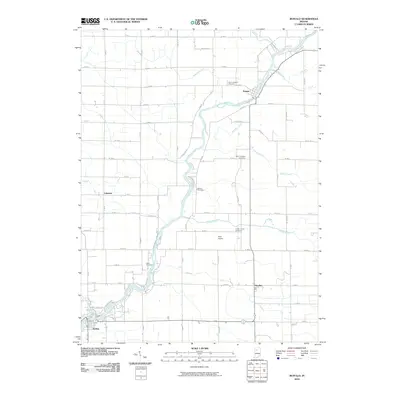
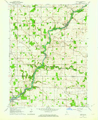 1962 Buffalo1963 Print · USGSNorthern White County and southern Pulaski County are defined here by the winding Tippecanoe River in the early sixties. Genealogists can trace family roots through sites like Hoover Cem, White Oak Ch, and the rural community of Headlee.2 unique versions available
 - 1962 Map of Monon NE, 1963 Print
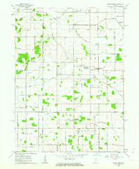
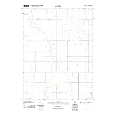
 1962 Monon NE1963 Print · USGSThe rural borderlands of Pulaski and White Counties are captured here in the early 1960s, showing a landscape defined by an extensive drainage system. Local historians can trace family ties at Roseland Cem, the St James Ch, and the old Beaver Center Sch.
 - 1962 Map of Winamac, 1964 Print
 1962 Winamac1964 Print · USGSIndiana's Tippecanoe River valley at the start of the 1960s shows a landscape of conservation and local industry. Researchers can trace the Pennsylvania RR through Winamac or locate family roots at St Peters Cem and Fairview Sch.2 unique versions available
 - 1962 Map of Star City, 1964 Print
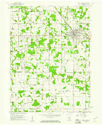
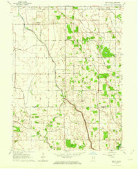
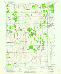
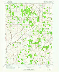
 1962 Star City1964 Print · USGSPulaski County agricultural life is captured here in the early 1960s, showing the intersection of rail transport and rural community centers. Researchers can trace the lineage of Star City and Thornhope, locating the I O O F Cem and the local Twp Sch.
 - 1962 Map of Kewanna, 1964 Print
 1962 Kewanna1964 Print · USGSFulton County and its agricultural landscape are shown here in the early sixties, centered on the crossroads of Kewanna. Local historians can trace the Indian Treaty Boundary and locate family burial grounds like Shaffer Cem and Moon Cem.2 unique versions available
 - 1962 Map of Medaryville, 1964 Print
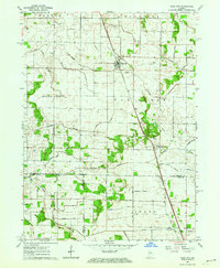
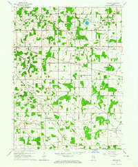
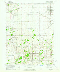
 1962 Medaryville1964 Print · USGSMedaryville and the surrounding Pulaski County plains are captured in the early sixties, showing a landscape defined by industrial drainage and rail transport. Genealogists can trace family roots through numerous local sites like St Marks Cem, Mason Cem, and the rural Independence Ch.
 - 1962 Map of Denham, 1964 Print
 1962 Denham1964 Print · USGSStarke and Pulaski counties are shown in the early sixties as a bustling crossroads for four major railroads. Genealogists and rail historians can trace the Erie-Lackawanna and Pennsylvania lines near Denham and the Center Cem.
 - 1962 Map of Ripley, 1964 Print
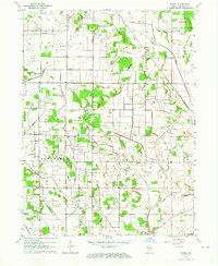 1962 Ripley1964 Print · USGSPulaski County during the early sixties shows a landscape defined by industrial agriculture and rail transit. Researchers can trace family roots at Burroughs Cem or locate the old Aurora Sch and the PENNSYLVANIA railroad stop at Ripley.
 - 1962 Map of Bass Lake, 1964 Print
 1962 Bass Lake1964 Print · USGSStarke and Pulaski Counties are shown in the early sixties as the region balanced lakeside recreation with its rail-and-river economy. Researchers can locate family landmarks like the Township Sch, Hartz Cem, and the old rail siding at Bass Station.2 unique versions available
 - 1962 Map of North Judson SE, 1964 Print
 1962 North Judson SE1964 Print · USGSPulaski County’s rural townships are captured here in the early sixties, showing a landscape defined by an intricate drainage system and the Monon Railroad. Genealogists can trace family landmarks like Koster Cem, St Johns Ch, and homes along Tiede Road.
 - 1962 Map of Francesville, 1964 Print
 1962 Francesville1964 Print · USGSNorthwest Indiana's agricultural prairie is seen in the early sixties as a network of drainage ditches and rail lines. You can trace the MONON railroad through Francesville or locate rural landmarks like Osborne Cem and the settlement of Lee.2 unique versions available
 - 1962 Map of Culver, 1964 Print
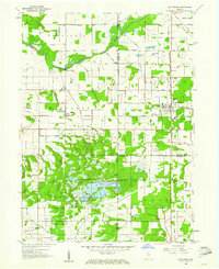
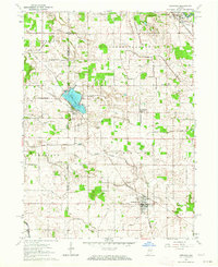
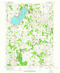
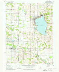 1962 Culver1964 Print · USGSThe Lake Maxinkuckee region in the early sixties is dominated by the prestigious Culver Military Academy and the busy riverfront village of Monterey. Researchers can trace the Old Indian Treaty Boundary and locate family names at North Union Cem and Masonic Cem.3 unique versions available
 - 1984 Map of Knox, 1985 Print
 1984 Knox1985 Print · USGSNorthern Indiana's glacial lake country is captured in the mid-eighties, showing a landscape defined by the Kankakee River and major rail lines. Genealogists and historians can trace family ties through lakefront settlements like Lake Maxinkuckee and Bass Lake or the Old Indian Treaty Boundary.2 unique versions available
 - 1985 Map of Logansport
 1985 Logansport1985 Print · USGSNorth-central Indiana in the mid-eighties shows a landscape of river-fed towns and significant military aviation hubs. Genealogists and local historians can trace the rail corridors of the Conrail or locate sites like River View Cem and the crossroads at Twelve Mile.2 unique versions available
 - 2010 Map of Grass Creek, 2010 Print
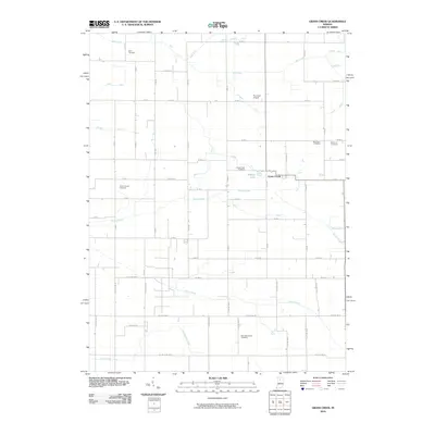 2010 Grass Creek2010 Print · USGSCovers Pulaski County, including Grass Creek, Cass County, and other nearby areas
 - 2010 Map of Buffalo, 2010 Print
 2010 Buffalo2010 Print · USGSCovers Pulaski County, including Lakeside, Pulaski, and other nearby areas
 - 2010 Map of Monon NE, 2010 Print
 2010 Monon NE2010 Print · USGSCovers Pulaski County, including Buffalo, White County, and other nearby areas
Showing maps 1-25 of 97
Top cities of Pulaski County
- Winamac historical maps
- Francesville historical maps
- Medaryville historical maps
- Monterey historical maps
Frequently asked questions
- What are the different types of historical maps available for Pulaski County?
- What is the oldest map of Pulaski County?
- Where can I purchase historical maps of Pulaski County for my home or office?
- Where can I download high-res historical maps of Pulaski County?
- Are there historical topographic maps available for Pulaski County?
- Is there historical aerial imagery available for Pulaski County?
- Where are historical maps of Pulaski County sourced from?