2020s Maps of Mishawaka, Indiana
Explore 3 historic maps of Mishawaka from the 2020s. These maps offer a rare glimpse into what life looked like during the 2020s — showing old roads, neighborhoods, homes, and landmarks that have changed or disappeared over time.
Whether you're researching your family's past, planning a metal detecting trip, or studying how Mishawaka's landscape evolved across the 2020s, these high-resolution maps are a powerful tool for exploring the history of this region.
- Focus on a specific era: All maps on this page are from the 2020s, giving you a focused view of this time period.
- See what’s changed: Compare century-old streets, trails, and buildings to today's modern landscape using overlays and satellite layers.
- Research with precision: Use these maps for genealogy, historical research, land use analysis, or educational projects.
- View, download, or print: Maps are fully viewable online in high resolution, and can be downloaded or printed for your own records.
Start exploring Mishawaka's history through authentic maps from the 2020s. This is your window into the past.
Mishawaka, IN maps
(3)- 2022 Map of Wyatt, 2022 Print
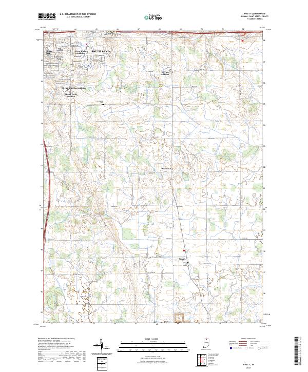 2022 Wyatt2022 Print · USGSThe southern outskirts of South Bend transition into the fertile farm country of St. Joseph County in the early 2020s. Researchers can trace family history at the Van Buskirk Cem or explore the rural layout of Woodland and Wyatt amidst a complex network of drainage ditches.
 - 2022 Map of Osceola, 2022 Print
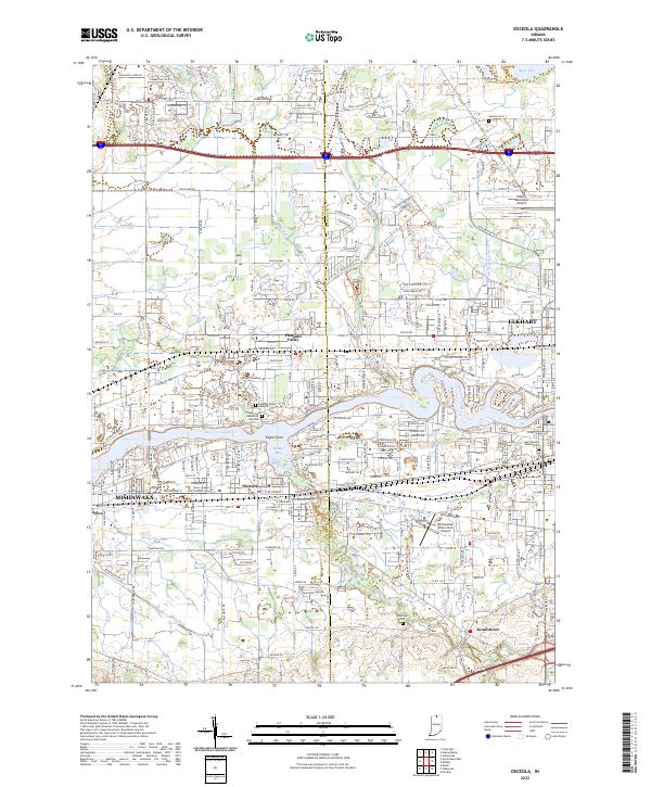 2022 Osceola2022 Print · USGSNorthern Indiana's urban corridor between Mishawaka and Elkhart is captured here in the early 2000s as residential growth fills the river valley. Trace local history at Carlton Cem, the winding Baugo Creek, or the small settlement of Osceola.
 - 2022 Map of South Bend East, 2022 Print
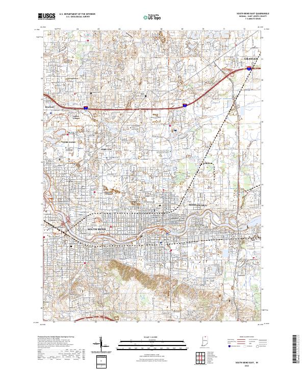 2022 South Bend East2022 Print · USGSSt. Joseph County's urban corridor is captured here at a modern peak of development along the Saint Joseph River. Genealogists and historians can trace local roots through numerous sites like Stuckey Cem, Cedar Grove Cem, and the neighborhoods of Indian Village and Maple Lane.
End of results
Showing maps 1-3 of 3
Top cities near Mishawaka
- South Bend historical maps
- Elkhart historical maps
- Granger historical maps
- Niles historical maps
- Nappanee historical maps
- Notre Dame historical maps
See more
Frequently asked questions
- What are the different types of historical maps available for Mishawaka?
- What is the oldest map of Mishawaka?
- Where can I purchase historical maps of Mishawaka for my home or office?
- Where can I download high-res historical maps of Mishawaka?
- Are there historical topographic maps available for Mishawaka?
- Is there historical aerial imagery available for Mishawaka?
- Where are historical maps of Mishawaka sourced from?