2020s Maps of Scott County, Indiana
Explore 10 historic maps of Scott County from the 2020s. These maps offer a rare glimpse into what life looked like during the 2020s — showing old roads, neighborhoods, homes, and landmarks that have changed or disappeared over time.
Whether you're researching your family's past, planning a metal detecting trip, or studying how Scott County's landscape evolved across the 2020s, these high-resolution maps are a powerful tool for exploring the history of this region.
- Focus on a specific era: All maps on this page are from the 2020s, giving you a focused view of this time period.
- See what’s changed: Compare century-old streets, trails, and buildings to today's modern landscape using overlays and satellite layers.
- Research with precision: Use these maps for genealogy, historical research, land use analysis, or educational projects.
- View, download, or print: Maps are fully viewable online in high resolution, and can be downloaded or printed for your own records.
Start exploring Scott County's history through authentic maps from the 2020s. This is your window into the past.
Scott County, IN maps
(10)- 2022 Map of Little York, 2022 Print
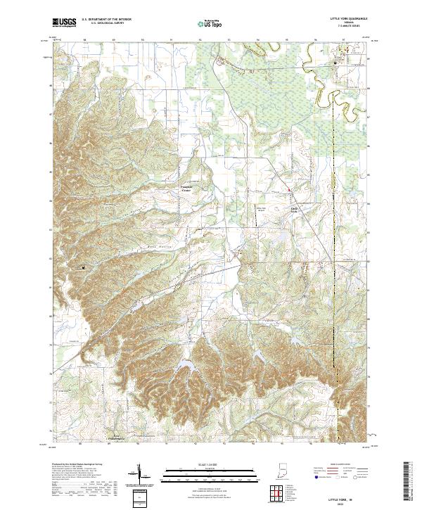 2022 Little York2022 Print · USGSLittle York and New Philadelphia are shown in this modern survey of the Indiana countryside as it appeared recently. Genealogists and hikers can trace the Knobstone Trail across the ridges or locate family burial sites at Ridlen Cemetery and Steep Hollow Cemetery.
 - 2022 Map of Crothersville, 2022 Print
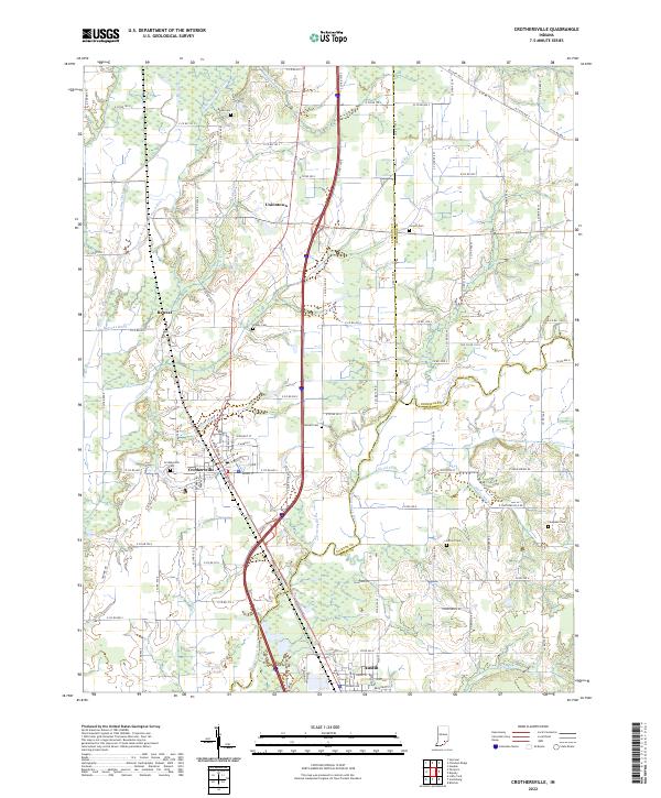 2022 Crothersville2022 Print · USGSSouthern Indiana's agricultural heartland is documented here as it appeared in the early 2020s, centered on the communities of Crothersville and Austin. Genealogists and local historians can trace family locations near Gorrell Cem, Uniontown, and Grassy Cem.
 - 2022 Map of South Boston, 2022 Print
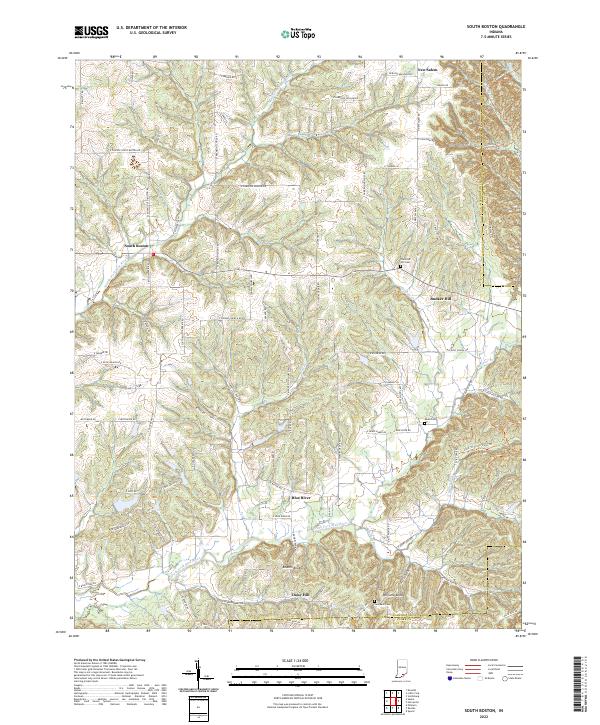 2022 South Boston2022 Print · USGSSouthern Indiana's rural landscape is mapped here at the start of the 2020s, showing the small communities and waterways north of the Clark County line. Researchers can trace family history through sites like Swayback Cem, Daisy Hill, and South Boston.
 - 2022 Map of Blocher, 2022 Print
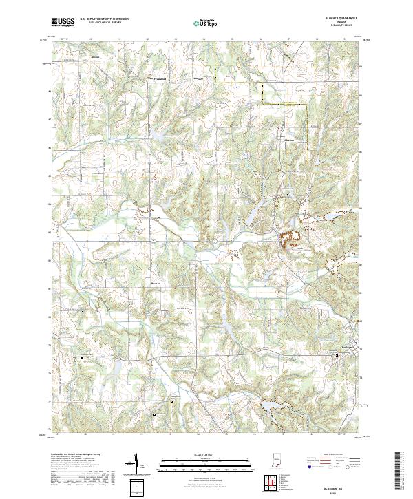 2022 Blocher2022 Print · USGSScott County, Indiana, is captured here in the early 2020s, showcasing a landscape of small agricultural settlements and winding creek drainages. Researchers can trace family history through numerous rural burial sites like Estil Cem and Bridgewater Cem or locate the old crossroads of New Frankfort and Goshen.
 - 2022 Map of Henryville, 2022 Print
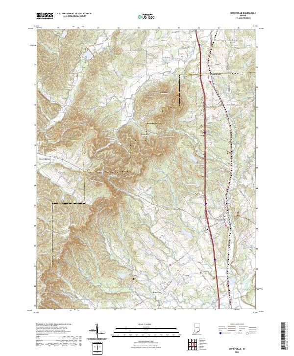 2022 Henryville2022 Print · USGSSouthern Indiana's high ridges and creek valleys are documented here in the early twenty-first century as the area balances its rural roots with new development. Genealogists and hikers can trace the Clark Sf Horse Trails Trl or locate family sites at Mountain Grove Cem and Mount Zion Cem.
 - 2022 Map of Scottsburg, 2022 Print
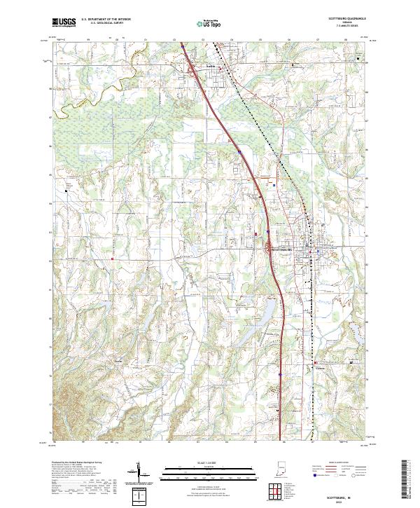 2022 Scottsburg2022 Print · USGSScott County enters the 2020s as a vital crossroads of rail and river in southern Indiana. Genealogists and researchers can locate family landmarks like the Scott County Courthouse or several community burial sites, including Everitt Cem and Spurgeon Cem.
 - 2022 Map of Otisco, 2022 Print
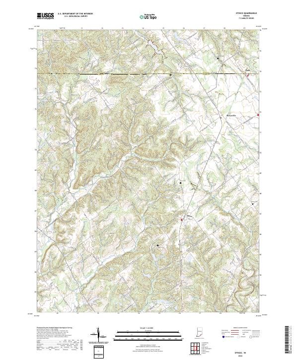 2022 Otisco2022 Print · USGSSouthern Indiana's rural landscape at the Scott and Clark County line is documented here in the early twenty-first century. Genealogists and historians can trace family locations near Otisco, Marysville, and several local burial grounds like Seatick Cem and States Cem.
 - 2022 Map of Kent, 2022 Print
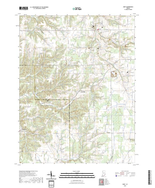 2022 Kent2022 Print · USGSSouthern Indiana's rural character is preserved in this recent survey of the Jefferson and Scott county line. Genealogists and historians can locate several local burial sites like Blankenship Cemetery and White River Cemetery near the communities of Lexington and Swanville.
 - 2022 Map of New Washington, 2022 Print
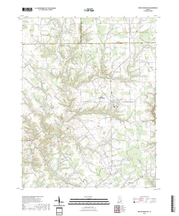 2022 New Washington2022 Print · USGSThe crossroads community of New Washington and the surrounding Clark County farm country are captured here in the early twenty-first century. Genealogists can trace family names at Crown Hill Cem or locate the small settlements of Hibernia and New Market.
 - 2022 Map of Deputy, 2022 Print
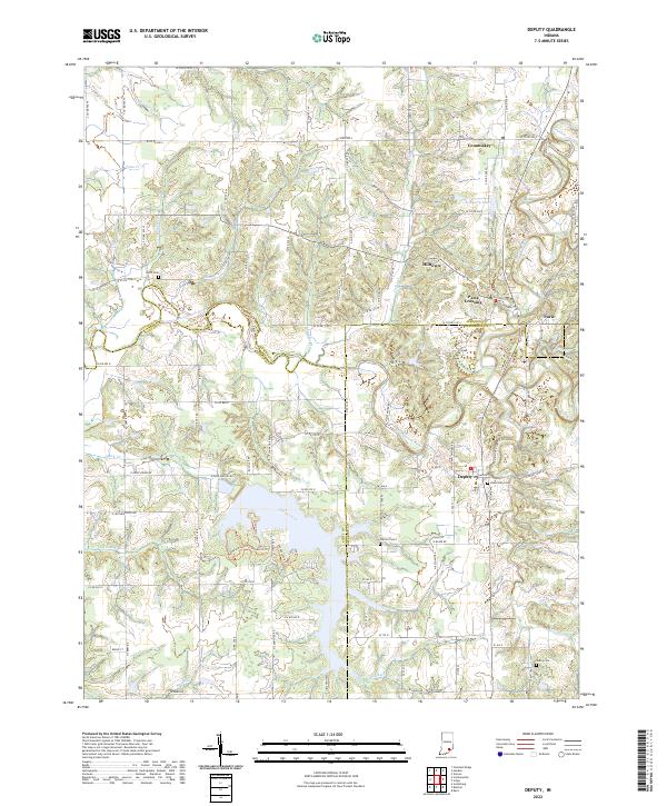 2022 Deputy2022 Print · USGSIn the early 2020s, this Southern Indiana region at the intersection of Jennings and Jefferson counties remains defined by the winding Muscatatuck River. Genealogists can trace family roots through Robertson Cem, Carmel Cem, and the rural community at Deputy.
End of results
Showing maps 1-10 of 10
Top cities of Scott County
Frequently asked questions
- What are the different types of historical maps available for Scott County?
- What is the oldest map of Scott County?
- Where can I purchase historical maps of Scott County for my home or office?
- Where can I download high-res historical maps of Scott County?
- Are there historical topographic maps available for Scott County?
- Is there historical aerial imagery available for Scott County?
- Where are historical maps of Scott County sourced from?