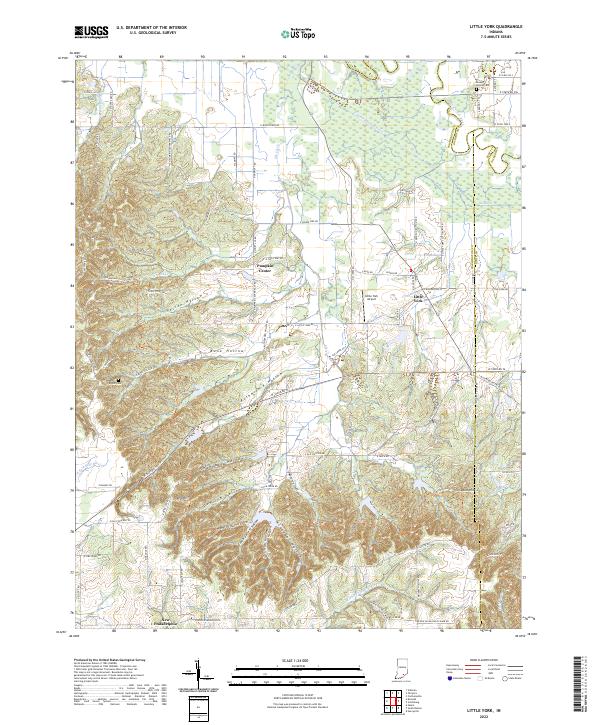
2022 Map of Little York
USGS Topo · Published 2022About this map
Little York and the nearby hamlet of Pumpkin Center sit at a crossroads of agriculture and aviation in Washington County. The terrain transitions from the low-lying wetlands of the Muscatatuck River and Cammie-Thomas Ditch in the north to the deeply incised valleys of the south. This rugged southern portion is defined by a dense network of family-named features, including Herron Hollow, Rutherford Hollow, and Dowling Hollow, which carve into the ridges around Vic Swaim Hill.
Find a feature on this map
88 named features on this map. Tap any name to fly to it.
Don’t see what you’re looking for? This feature index may not catch every label — zoom into the map to look around manually.
Map Details
Editions of this 2022 Little York Map
This is the sole edition of this map. No revisions or reprints were ever made.
Other maps of this area

1947 · Scottsburg
USGS Topo · 1:24,000

1949 · Henryville
USGS Topo · 1:24,000

1950 · Salem
USGS Topo · 1:24,000

1953 · Kossuth
USGS Topo · 1:24,000

1955 · South Boston
USGS Topo · 1:24,000

1956 · Vincennes
USGS Topo · 1:250,000

1956 · Louisville
USGS Topo · 1:250,000

1957 · Vincennes
USGS Topo · 1:250,000

1958 · Vincennes
USGS Topo · 1:250,000

1958 · Little York
USGS Topo · 1:24,000