
1955 Map of South Boston
USGS Topo · Published 1956About this map
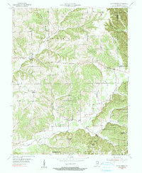
Clark State Forest dominates the eastern and central ridges of this mid-century landscape, framing a network of rural settlements and agricultural valleys. In the mid-1950s, the area around South Boston and New Salem was defined by small, community-centered landmarks like Franklin Sch and Polk Sch, which served as local anchors alongside numerous country churches. The rugged topography is etched by the Middle Fork Blue River and South Fork Blue River, with prominent elevations such as Bowers Knob and Williams Knob rising above the timberline.
Find a feature on this map
30 named features on this map. Tap any name to fly to it.
Don’t see what you’re looking for? This feature index may not catch every label — zoom into the map to look around manually.
Map Details
Editions of this 1955 South Boston Map
4 editions found

Other maps of this area

1938 · Speed
USGS Topo · 1:24,000

1941 · Borden
USGS Topo · 1:24,000

1947 · Speed
USGS Topo · 1:24,000

1947 · Scottsburg
USGS Topo · 1:24,000

1949 · Henryville
USGS Topo · 1:24,000

1950 · Salem
USGS Topo · 1:24,000

1950 · Palmyra
USGS Topo · 1:24,000

1953 · Kossuth
USGS Topo · 1:24,000

1956 · Vincennes
USGS Topo · 1:250,000

1956 · Louisville
USGS Topo · 1:250,000