2020s Maps of Starke County, Indiana
Explore 13 historic maps of Starke County from the 2020s. These maps offer a rare glimpse into what life looked like during the 2020s — showing old roads, neighborhoods, homes, and landmarks that have changed or disappeared over time.
Whether you're researching your family's past, planning a metal detecting trip, or studying how Starke County's landscape evolved across the 2020s, these high-resolution maps are a powerful tool for exploring the history of this region.
- Focus on a specific era: All maps on this page are from the 2020s, giving you a focused view of this time period.
- See what’s changed: Compare century-old streets, trails, and buildings to today's modern landscape using overlays and satellite layers.
- Research with precision: Use these maps for genealogy, historical research, land use analysis, or educational projects.
- View, download, or print: Maps are fully viewable online in high resolution, and can be downloaded or printed for your own records.
Start exploring Starke County's history through authentic maps from the 2020s. This is your window into the past.
Starke County, IN maps
(13)- 2022 Map of Bass Lake, 2022 Print
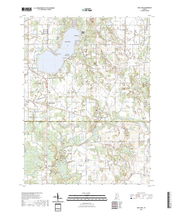 2022 Bass Lake2022 Print · USGSStarke and Pulaski Counties are shown in the early 2020s, centered on the recreational and agricultural landscape surrounding Bass Lake. Researchers can trace old property boundaries near Beardstown, find the North Bend Cem, or locate regional aviation sites like Wheeler Airport.
 - 2022 Map of Donaldson, 2022 Print
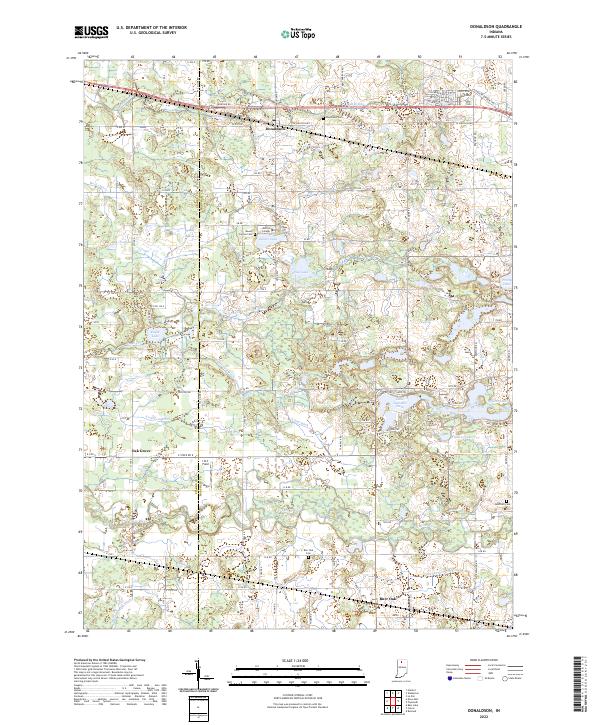 2022 Donaldson2022 Print · USGSThe rural marshlands and prairie of Marshall County appear in fine detail during the early 2020s. Genealogists and local historians can trace family roots at Donaldson Cem, Ancilla College, or along the winding banks of the Yellow River.
 - 2022 Map of Hamlet, 2022 Print
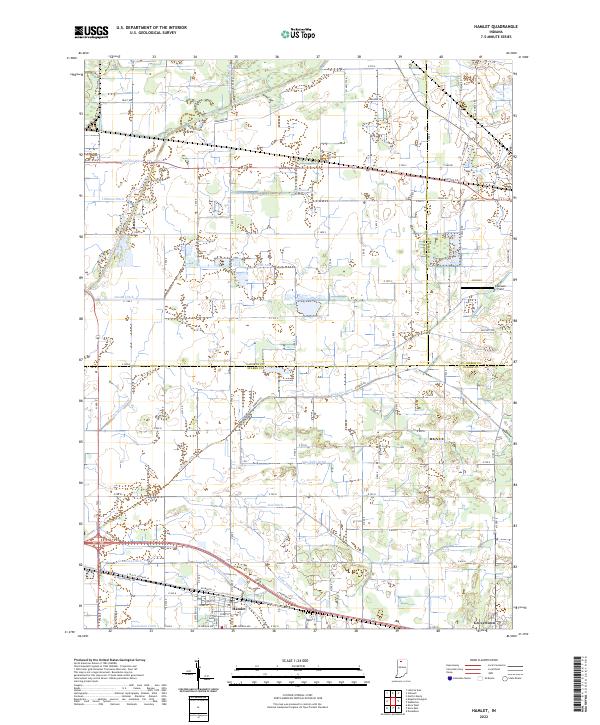 2022 Hamlet2022 Print · USGSThe rail-and-canal landscape of Starke County comes into focus as it appeared in the early twenty-first century. Genealogists and researchers can trace the drainage of the Kankakee marsh through Robbins Ditch and locate family landmarks near Hamlet and Grovertown.
 - 2022 Map of San Pierre, 2022 Print
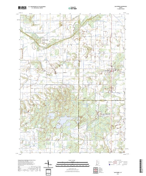 2022 San Pierre2022 Print · USGSNorthwest Indiana at the start of the 2020s shows a landscape deeply shaped by the drainage of the Kankakee Basin. Researchers can trace the heritage of local settlements like San Pierre and Tefft or locate family sites at the San Pierre Public Cem and All Saints Cem.
 - 2022 Map of Knox West, 2022 Print
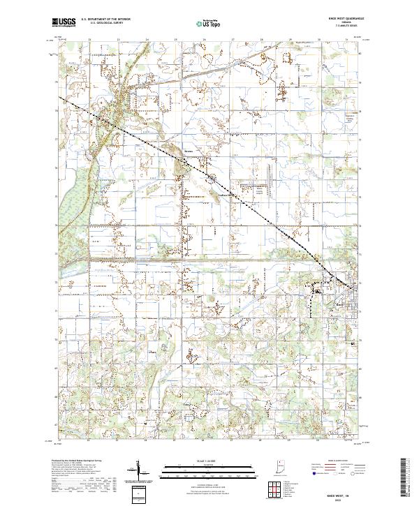 2022 Knox West2022 Print · USGSStarke County's engineered agricultural landscape is on full display here in the early 2020s, showing a complex web of drainage and irrigation. Researchers can locate family sites near Toto, Brems, and Indian Hill, or trace the paths of the Yellow River and Oak Park Cem.
 - 2022 Map of La Crosse, 2022 Print
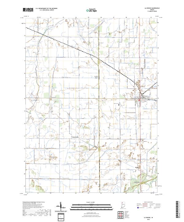 2022 La Crosse2022 Print · USGSLa Crosse and the Kankakee River valley are captured in this modern survey of the LaPorte and Porter county lines. Trace family roots at Oak Grove Cem or locate old rail-stop settlements like Clanricarde, Wilders, and Riverside.
 - 2022 Map of Walkerton, 2022 Print
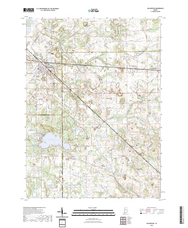 2022 Walkerton2022 Print · USGSThe crossroads of St. Joseph and Marshall Counties come alive in this contemporary look at the area's agricultural and township layout. Researchers can trace family history through Tyner Cem and Barber Cem or locate old property lines near Walkerton and Koontz Lake.
 - 2022 Map of Denham, 2022 Print
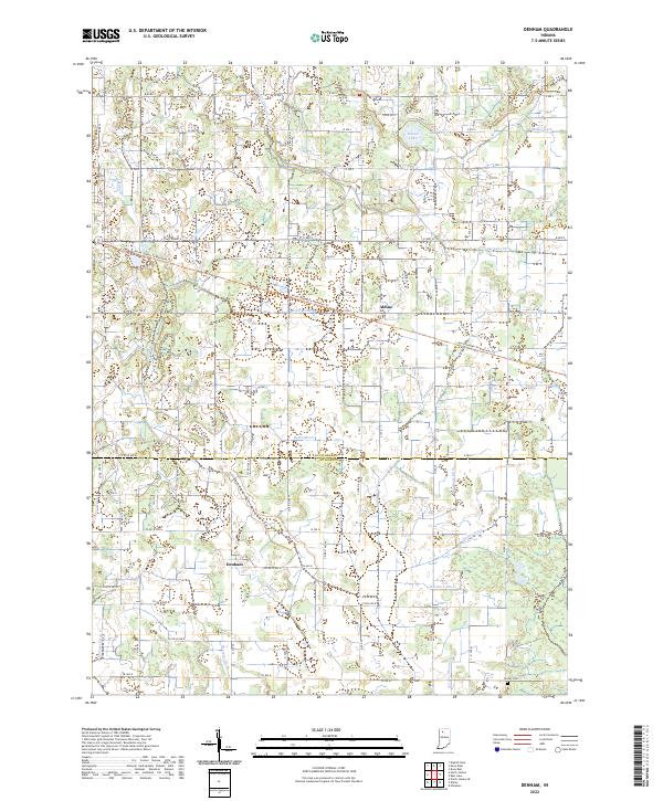 2022 Denham2022 Print · USGSIndiana's farm country comes into focus on the Starke and Pulaski county line, where drainage ditches have long reshaped the land. Researchers can trace the legacy of local families at Center Cem and follow the path of the North Judson To Monterey Trl past Denham and Aldine.
 - 2022 Map of North Judson, 2022 Print
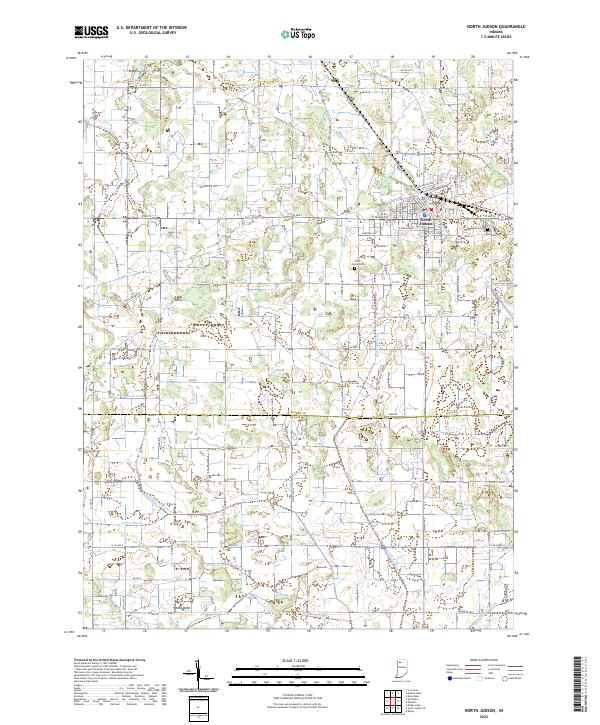 2022 North Judson2022 Print · USGSNorth Judson and the surrounding Kankakee Valley marshlands are captured here in the early 2020s, showing a landscape defined by century-old drainage systems. Researchers can trace family roots at Highland Cemetery or follow the paths of the Rensselaer Trail and North Judson to Monterey Trail.
 - 2022 Map of Kingsford Heights, 2022 Print
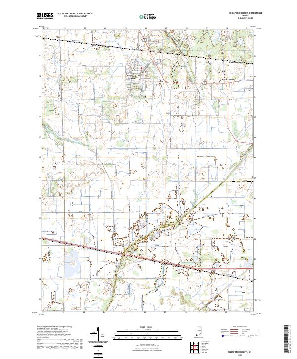 2022 Kingsford Heights2022 Print · USGSKingsford Heights and the Kankakee River valley appear here in the early twenty-first century, showcasing a landscape of precision drainage and rural crossroads. Genealogists and historians can trace the residential blocks of Kingsford Heights or locate local landmarks like Union Center and Salisbury Ditch.
 - 2022 Map of English Lake, 2022 Print
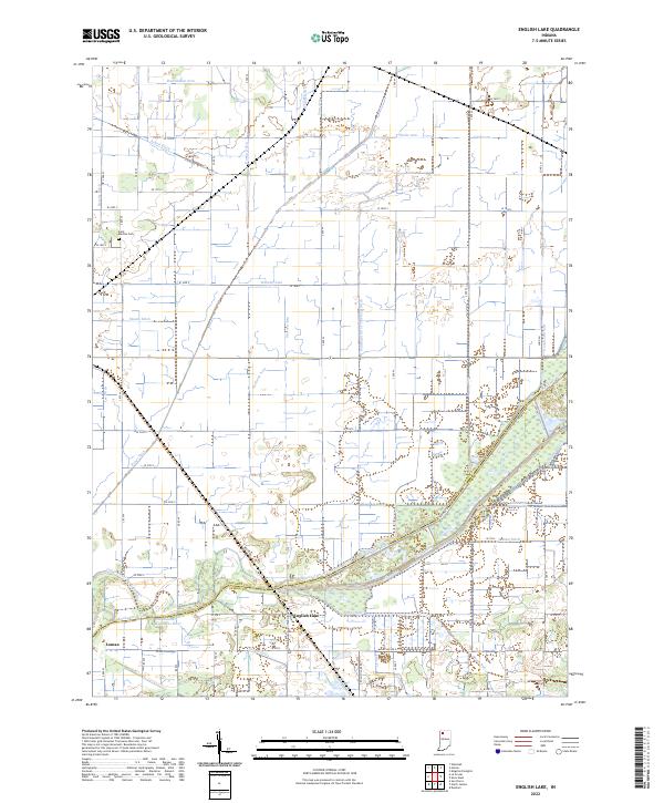 2022 English Lake2022 Print · USGSLaPorte and Starke counties appear here at the confluence of the Kankakee River and Yellow River in the modern era. Researchers can trace land management through an extensive network of drainage features like the William Arm of Tuesburg Ditch and find local history at English Lake or Saint Martins Cem.
 - 2022 Map of Culver, 2022 Print
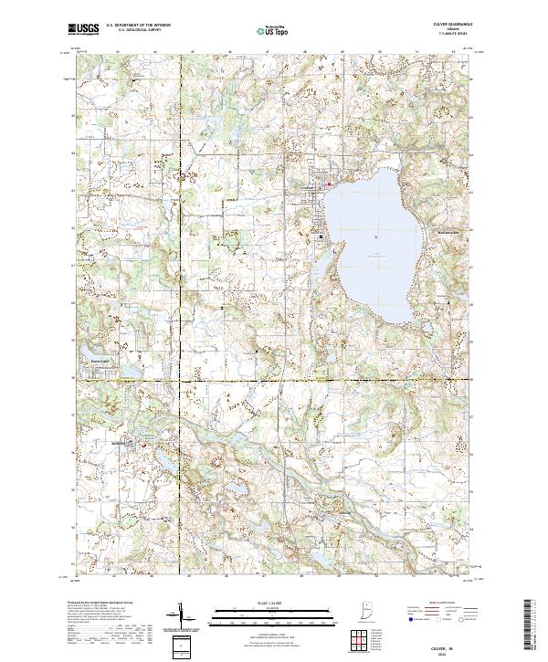 2022 Culver2022 Print · USGSThe northern Indiana lake country is captured here in the early twenty-first century, centered on the shores of the deep Lake Maxinkuckee. Researchers can locate family sites across several county lines, from the town of Culver to rural landmarks like Zion Cem and the banks of the Tippecanoe River.
 - 2022 Map of Knox East, 2022 Print
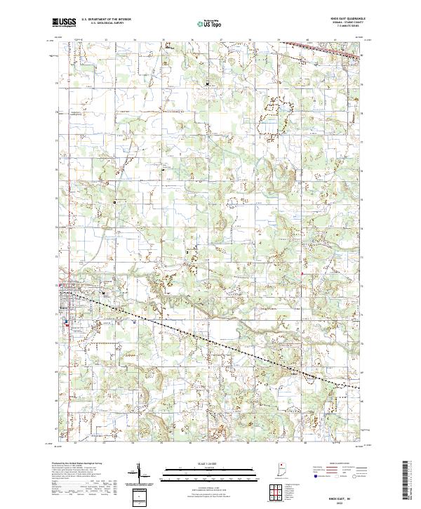 2022 Knox East2022 Print · USGSEastern Starke County is mapped here in the early 2020s, showing the developed street grid of Knox and the agricultural lands surrounding it. Genealogists can locate family landmarks like Crown Hill Cem and Swartzell Cem, or trace the extensive drainage network of Gearhart Ditch and the Yellow River.
End of results
Showing maps 1-13 of 13
Top cities of Starke County
Frequently asked questions
- What are the different types of historical maps available for Starke County?
- What is the oldest map of Starke County?
- Where can I purchase historical maps of Starke County for my home or office?
- Where can I download high-res historical maps of Starke County?
- Are there historical topographic maps available for Starke County?
- Is there historical aerial imagery available for Starke County?
- Where are historical maps of Starke County sourced from?