Old Maps of Vevay, Indiana for Genealogy
Trace your family roots with 20 historic maps of Vevay. These high-res maps reveal old neighborhoods, homesites, landmarks, and streets — helping you uncover where your ancestors lived and how the area evolved over time.
- Explore historic neighborhoods: Identify where your relatives may have lived in the 1800s or 1900s.
- Compare maps over time: Trace the changes in streets, buildings, and landmarks for multi-generational research.
- Perfect for genealogy & ancestry research: Used by family historians and researchers to map out lineage and migration.
These maps are an incredible resource for exploring your personal connection to Vevay's past.
Vevay, IN maps
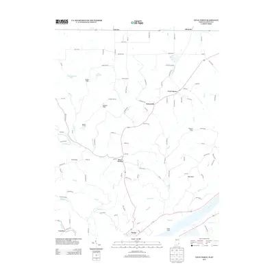
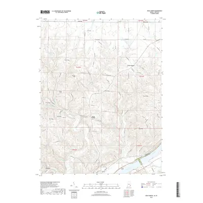
(20)- 1943 Map of Vevay North
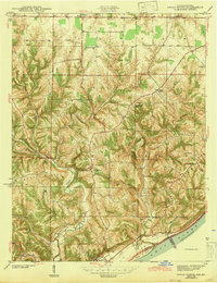 1943 Vevay North1943 Print · USGSSoutheast Indiana during the early years of the war shows a landscape of ridge-top farms and river valley settlements. Genealogists can trace family footprints through numerous rural landmarks like Mt Sterling, Stow Cem, and Jacksonville Sch.2 unique versions available
 - 1943 Map of Vevay South
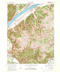
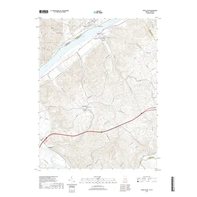
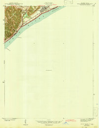 1943 Vevay South1943 Print · USGSThe Indiana side of the Ohio River is captured in the early 1940s, showing the riverside town of Vevay and its surrounding hills. Genealogists can trace family landmarks like Potato Bug Hill, the Bridge Sch, and the County Infirmary.
 - 1952 Map of Vevay South, 1954 Print
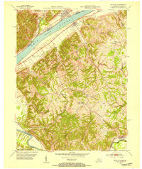 1952 Vevay South1954 Print · USGSThe Ohio River valley at the Indiana-Kentucky border was a landscape of riverfront hubs and isolated hill settlements in the early fifties. Genealogists and historians can trace family plots at O'Neal Cem or Stafford Cem and locate rural landmarks like Marvin Chapel and the Easterday settlement.2 unique versions available
 - 1956 Map of Louisville, 1971 Print
 1956 Louisville1971 Print · USGSThe Ohio River valley and the Kentucky Bluegrass are captured here during a period of rapid mid-century growth and industrial activity. Genealogists and historians can trace rail-centered towns and military land use at Fort Knox and the Jefferson Proving Ground.2 unique versions available
 - 1957 Map of Vevay North, 1958 Print
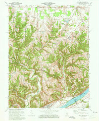
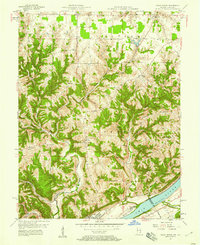 1957 Vevay North1958 Print · USGSThe Ohio River hills of Switzerland County come alive in the late 1950s, showing the intricate landscape of ridges and creek beds. Researchers can find old rural landmarks like Plum Creek Ch, the river town of Vevay, and the aptly named Popcorn Ridge.2 unique versions available
 - 1964 Map of Louisville
 1964 Louisville1964 Print · USGSThe Ohio River valley and Kentucky Bluegrass are captured in the mid-1960s, showing a region balanced between industrial growth and its agrarian roots. Genealogists and historians can trace the development of county seats like Shelbyville and Paris, or locate established institutions such as Georgetown College and Bernheim Forest.
 - 1967 Map of Vevay South, 1969 Print
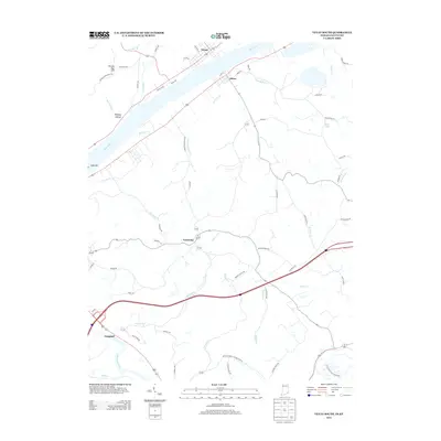
 1967 Vevay South1969 Print · USGSThe Ohio River borderlands between Kentucky and Indiana are captured here in the late sixties, showcasing a landscape of riverside industry and steep ridges. Genealogists can trace family names and landmarks from the riverfronts of Vevay and Ghent to inland sites like Sharon Ch and Eagle Station.3 unique versions available
 - 1971 Map of Vevay North, 1973 Print
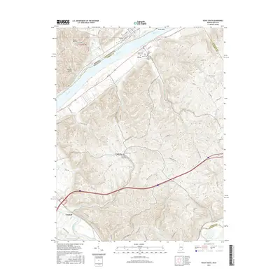
 1971 Vevay North1973 Print · USGSThe river town of Vevay and its rural hinterlands are captured in the early 1970s, showcasing a landscape of ridge-top roads and winding creek valleys. Genealogists can trace family landmarks like Fredonia Ch, Popcorn Ridge, and the early layout of Mt Sterling.3 unique versions available
 - 1986 Map of Madison
 1986 Madison1986 Print · USGSSouthern Indiana and Northern Kentucky are shown here in the mid-eighties, centered on the river corridor and the sprawling Jefferson Proving Ground. Genealogists and historians can trace rail lines like the Seaboard System and locate river towns from Madison to Bethlehem.
 - 1990 Map of Madison, 1991 Print
 1990 Madison1991 Print · USGSThe Ohio River valley and the southern Indiana plains are documented here in the final decade of the twentieth century. Genealogists and historians can trace family-named crossroads and established rail towns like Dudleytown, Austin, and Crothersville along the P C RR line.
 - 2010 Map of Vevay South, 2010 Print
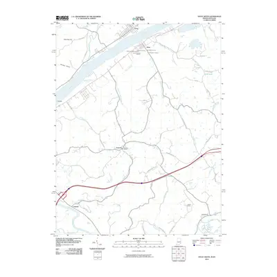 2010 Vevay South2010 Print · USGSCovers Vevay, including Ghent, Easterday, and other nearby areas
 - 2010 Map of Vevay North, 2010 Print
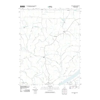 2010 Vevay North2010 Print · USGSCovers Vevay, including Fairview, Jacksonville, and other nearby areas
 - 2013 Map of Vevay North, 2013 Print
 2013 Vevay North2013 Print · USGSCovers Vevay, including Fairview, Jacksonville, and other nearby areas
 - 2013 Map of Vevay South, 2013 Print
 2013 Vevay South2013 Print · USGSCovers Vevay, including Ghent, Easterday, and other nearby areas
 - 2016 Map of Vevay South, 2016 Print
 2016 Vevay South2016 Print · USGSCovers Vevay, including Ghent, Easterday, and other nearby areas
 - 2016 Map of Vevay North, 2016 Print
 2016 Vevay North2016 Print · USGSCovers Vevay, including Fairview, Jacksonville, and other nearby areas
 - 2019 Map of Vevay South, 2019 Print
 2019 Vevay South2019 Print · USGSCovers Vevay, including Ghent, Easterday, and other nearby areas
 - 2019 Map of Vevay North, 2019 Print
 2019 Vevay North2019 Print · USGSCovers Vevay, including Fairview, Jacksonville, and other nearby areas
 - 2022 Map of Vevay North, 2022 Print
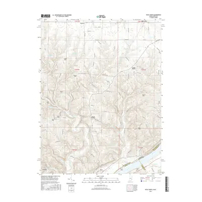
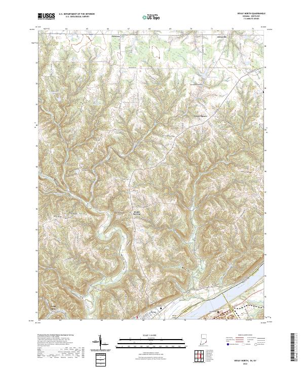 2022 Vevay North2022 Print · USGSSwitzerland County's ridge-and-hollow landscape is captured here just north of the Ohio River, showing the traditional upland settlements of the Indiana-Kentucky borderlands. Researchers can trace family sites near Vevay Cem, explore the rural crossroads of Center Square, or follow the winding Indian Creek.
 - 2022 Map of Vevay South, 2022 Print
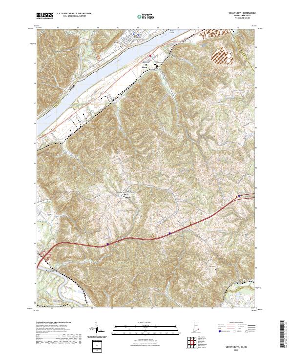 2022 Vevay South2022 Print · USGSThe riverfront communities of Vevay and Ghent sit at a historic crossing of the Ohio River in this recent survey. Genealogists and local researchers can trace numerous rural landmarks, from the Switzerland County Courthouse to the Colored Oddfellows Cem and Whitehead Cem.
End of results
Showing maps 1-20 of 20
Top cities near Vevay
- Carrollton historical maps
- Rising Sun historical maps
- Warsaw historical maps
- Pleasant historical maps
- Owenton historical maps
- Campbellsburg historical maps
See more
Frequently asked questions
- What are the different types of historical maps available for Vevay?
- What is the oldest map of Vevay?
- Where can I purchase historical maps of Vevay for my home or office?
- Where can I download high-res historical maps of Vevay?
- Are there historical topographic maps available for Vevay?
- Is there historical aerial imagery available for Vevay?
- Where are historical maps of Vevay sourced from?