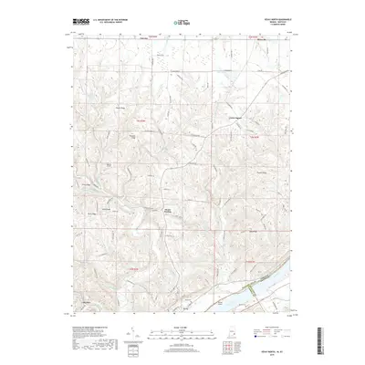
2019 Map of Vevay North
USGS Topo · Published 2019About this map
Vevay sits prominently along the northern bend of the Ohio River in Switzerland County, Indiana, serving as the southern anchor for a landscape of deep ridges and creek valleys. This 2019 survey illustrates the rugged interior topography of the region, where family-named landmarks like Popcorn Ridge, Tapps Ridge, and Drakes Ridge dictate the winding paths of rural roads. The mapping reveals a network of small, scattered settlements including Mount Sterling, Allensville, and Fairview in the north, and Long Run to the west. Water defines the township boundaries, with Plum Creek and Indian Creek carving through the hills toward the river. Notable local landmarks include Roberts Airport and Lake Geneva, along with historical resting places such as Vevay Cem and Blanton Cem. The map provides a clear picture of the modern rural infrastructure, from the small airfield to the state roads that connect these historic river-valley communities.
Find a feature on this map
104 named features on this map. Tap any name to fly to it.
Don’t see what you’re looking for? This feature index may not catch every label — zoom into the map to look around manually.
Map Details
Editions of this 2019 Vevay North Map
This is the sole edition of this map. No revisions or reprints were ever made.
Other maps of this area

1943 · Florence
USGS Topo · 1:24,000

1943 · Aberdeen
USGS Topo · 1:24,000

1943 · Vevay North
USGS Topo · 1:24,000

1943 · Brooksburg
USGS Topo · 1:24,000

1943 · Vevay South
USGS Topo · 1:24,000

1951 · Florence
USGS Topo · 1:24,000

1951 · Sanders
USGS Topo · 1:24,000

1952 · Vevay South
USGS Topo · 1:24,000

1953 · Carrollton
USGS Topo · 1:24,000

1953 · Aberdeen
USGS Topo · 1:24,000