2020s Maps of Lincolnville, Indiana
Explore 1 historic maps of Lincolnville from the 2020s. These maps offer a rare glimpse into what life looked like during the 2020s — showing old roads, neighborhoods, homes, and landmarks that have changed or disappeared over time.
Whether you're researching your family's past, planning a metal detecting trip, or studying how Lincolnville's landscape evolved across the 2020s, these high-resolution maps are a powerful tool for exploring the history of this region.
- Focus on a specific era: All maps on this page are from the 2020s, giving you a focused view of this time period.
- See what’s changed: Compare century-old streets, trails, and buildings to today's modern landscape using overlays and satellite layers.
- Research with precision: Use these maps for genealogy, historical research, land use analysis, or educational projects.
- View, download, or print: Maps are fully viewable online in high resolution, and can be downloaded or printed for your own records.
Start exploring Lincolnville's history through authentic maps from the 2020s. This is your window into the past.
Lincolnville, IN maps
(1)- 2022 Map of Lagro, 2022 Print
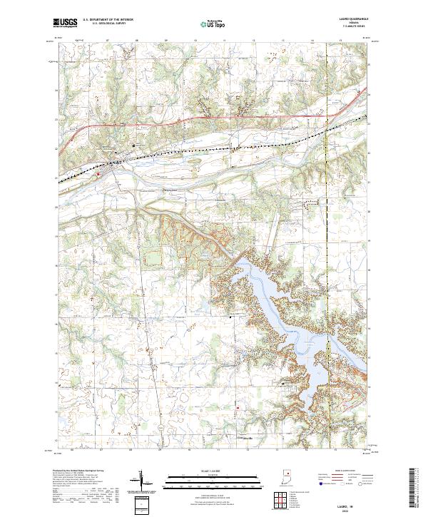 2022 Lagro2022 Print · USGSWabash County's river-bottom lands and the Salamonie reservoir are documented here in the early twenty-first century. Genealogists can locate family sites at the Lagro Independent Order of Odd Fellows Cemetery, Leedy Cem, and the historic settlement of Lincolnville.
End of results
Showing maps 1-1 of 1
Top cities near Lincolnville
- Marion historical maps
- Huntington historical maps
- Wabash historical maps
- Lancaster historical maps
- Andrews historical maps
- Van Buren historical maps
See more
Frequently asked questions
- What are the different types of historical maps available for Lincolnville?
- What is the oldest map of Lincolnville?
- Where can I purchase historical maps of Lincolnville for my home or office?
- Where can I download high-res historical maps of Lincolnville?
- Are there historical topographic maps available for Lincolnville?
- Is there historical aerial imagery available for Lincolnville?
- Where are historical maps of Lincolnville sourced from?