1900s (20th Century) Maps of Newburgh, Indiana
Explore 10 historic maps of Newburgh from the 1900s (20th Century). These maps offer a rare glimpse into what life looked like during the 1900s — showing old roads, neighborhoods, homes, and landmarks that have changed or disappeared over time.
Whether you're researching your family's past, planning a metal detecting trip, or studying how Newburgh's landscape evolved across the 1900s, these high-resolution maps are a powerful tool for exploring the history of this region.
- Focus on a specific era: All maps on this page are from the 1900s, giving you a focused view of this time period.
- See what’s changed: Compare century-old streets, trails, and buildings to today's modern landscape using overlays and satellite layers.
- Research with precision: Use these maps for genealogy, historical research, land use analysis, or educational projects.
- View, download, or print: Maps are fully viewable online in high resolution, and can be downloaded or printed for your own records.
Start exploring Newburgh's history through authentic maps from the 1900s. This is your window into the past.
Newburgh, IN maps
(10)- 1905 Map of Newburg
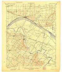 1905 Newburg1905 Print · USGSThe Ohio River bottomlands of Indiana and Kentucky are captured here in the early twentieth century, showing a world defined by river transit and rail. Genealogists can locate river-town homesteads near Newburg or trace family river crossings at MASON FERRY and HAMILTON FERRY.3 unique versions available
 - 1951 Map of Yankeetown, 1952 Print
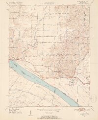 1951 Yankeetown1952 Print · USGSThe banks of the Ohio River in the early fifties reveal a landscape of river-bottom settlements and upland farms. Researchers can trace the layout of Scuffletown and Carlinburg, find early Oil Wells, and locate rural landmarks like St Rupert Ch and Vanada Cem.2 unique versions available
 - 1952 Map of Newburgh, 1953 Print
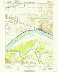 1952 Newburgh1953 Print · USGSThe Indiana-Kentucky borderlands along the Ohio River come to life in the early fifties, showing the transition from agricultural bottomlands to riverfront settlements. Researchers can trace family roots at Rose Hill Cem or locate the historic Angel Mounds State Memorial and Lock No 47.2 unique versions available
 - 1954 Map of Evansville
 1954 Evansville1954 Print · USGSThe Ohio River borderlands between Indiana and Kentucky appear here during a period of robust industrial and military growth. Genealogists and researchers can trace the rail corridors of the Illinois Central and find landmarks like US Lock and Dam No 48 or Camp Breckinridge.
 - 1957 Map of Evansville, 1969 Print
 1957 Evansville1969 Print · USGSIndiana and Kentucky meet along the Ohio River in this mid-century survey of a vital industrial and transport corridor. Genealogists and historians can trace the development of river towns like Owensboro and Newburgh or locate old rail lines like the Southern Ry.3 unique versions available
 - 1961 Map of Evansville
 1961 Evansville1961 Print · USGSThe Ohio River valley and its surrounding coalfields are captured here during the late fifties and early sixties. Trace the industrial rail networks of the Illinois Central RR and explore regional landmarks like Mammoth Cave National Park and Angel Mounds State Memorial.2 unique versions available
 - 1964 Map of Newburgh, 1966 Print
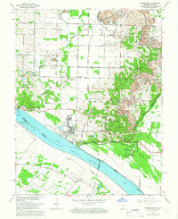
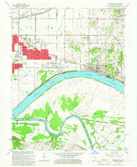 1964 Newburgh1966 Print · USGSThe Indiana-Kentucky borderlands at the bend of the Ohio River come into focus in the mid-1960s as Evansville's suburbs meet older river towns. Researchers can locate the historic Angel Mounds State Memorial, trace the Louisville and Nashville rail line, and find family markers at Rose Hill Cem.3 unique versions available
 - 1964 Map of Yankeetown, 1966 Print
 1964 Yankeetown1966 Print · USGSThe Indiana-Kentucky borderlands along the Ohio River appear here in the mid-1960s, showing a landscape of riverfront hamlets and industrial change. Genealogists and local historians can locate Yankeetown Cem, trace the Old Railroad Grade, and find rural landmarks like St Ruperts Ch.4 unique versions available
 - 1986 Map of Evansville
 1986 Evansville1986 Print · USGSThe Ohio River valley thrives in the mid-1980s as a hub of river commerce, industry, and natural preservation spanning the Indiana-Kentucky border. Genealogists and historians can locate remote landmarks like Dead Mans Cem, Lippe Church, and the riverside community of Scuffletown.
 - 1991 Map of Evansville
 1991 Evansville1991 Print · USGSThe tri-state region of Indiana and Kentucky was a hub of river commerce and rail transport in the early nineties. Researchers can trace the industrial corridor between Evansville and Owensboro, locating landmarks like Angel Mounds State Memorial and the Seaboard System railroad.
End of results
Showing maps 1-10 of 10
Top cities near Newburgh
- Evansville historical maps
- Owensboro historical maps
- Henderson historical maps
- Boonville historical maps
- Chandler historical maps
- Darmstadt historical maps
See more
Frequently asked questions
- What are the different types of historical maps available for Newburgh?
- What is the oldest map of Newburgh?
- Where can I purchase historical maps of Newburgh for my home or office?
- Where can I download high-res historical maps of Newburgh?
- Are there historical topographic maps available for Newburgh?
- Is there historical aerial imagery available for Newburgh?
- Where are historical maps of Newburgh sourced from?