Old Maps of Owensboro, Kentucky
Explore 39 old maps of Owensboro, spanning from 1901 to today. These high-resolution historic maps reveal how streets, neighborhoods, landmarks, and natural features evolved over time — perfect for genealogy, metal detecting, research, and local history exploration.
What you can do with these maps:
- See how Owensboro changed over time: Compare historical maps to modern-day views to trace roads, homesites, rail lines & more.
- View detailed metadata: Each map includes creators, publishers, year, scale, and archive source.
- Overlay maps with satellite & LiDAR: Visualize the past alongside modern tools to explore terrain & human change.
- Trusted historical sources: Maps sourced from the USGS, Library of Congress, and other archives.
- Access maps your way: View online, download high-res files, or order prints for personal or research use.
Start exploring old maps of Owensboro to uncover forgotten places, hidden landmarks, and the deep history beneath your feet.
Owensboro, KY maps
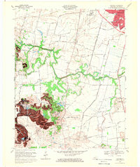
(39)- 1901 Map of Owensboro
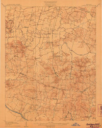
 1901 Owensboro1901 Print · USGSThe Ohio River bend at the turn of the century shows a bustling corridor of rail and river commerce between Kentucky and Indiana. Trace the early footprints of Owensboro and Rockport alongside vanished landmarks like Lake Mills and the Willow Pond Bed.5 unique versions available
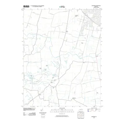
 - 1906 Map of Sutherland
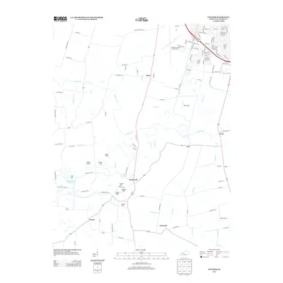
 1906 Sutherland1906 Print · USGSDaviess and McLean counties come into focus at the start of the twentieth century, when the rail lines and river forks dictated the pace of rural life. Genealogists and local historians can trace early homes and landmarks near Utica, St Martins Church, and the distinctive Backbone Ridge.3 unique versions available
 - 1952 Map of Owensboro East, 1953 Print
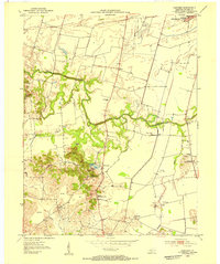
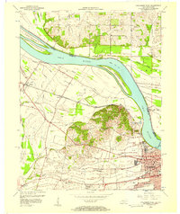
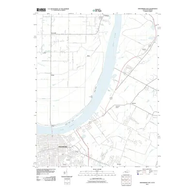
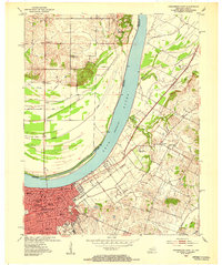 1952 Owensboro East1953 Print · USGSOwensboro's riverfront and growing residential core are captured here at the start of the 1950s. Genealogists and historians can locate specific neighborhood schools like Lincoln Sch, the sprawling Rose Hill Cem, and rural Indiana outposts like Patronville.
 - 1952 Map of Owensboro West, 1953 Print
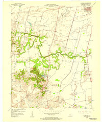
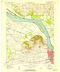 1952 Owensboro West1953 Print · USGSDaviess County in the early fifties shows a growing riverfront city transitioning into a landscape of oil production and bottomland farming. Genealogists and historians can trace family landmarks like Lancaster Cem, Alexander Ch, and the many Oil Wells scattered through Stanley.
 - 1953 Map of Sutherland, 1954 Print
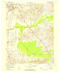
 1953 Sutherland1954 Print · USGSDaviess County in the early fifties shows the expansion of Owensboro alongside established rural settlements. Genealogists and historians can trace family locations near Sutherland, Browns Valley, and the campus of Kentucky Wesleyan College.
 - 1953 Map of Panther, 1954 Print
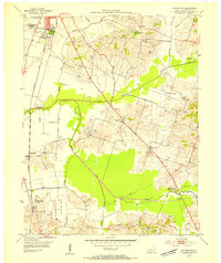
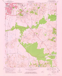
 1953 Panther1954 Print · USGSSouth of Owensboro in the early fifties, this area shows a landscape defined by meandering creeks and emerging industry. Genealogists and historians can trace family-named landmarks and rural centers like St Raphael Ch, Mosleyville, and the extensive strip mines near Zion Hill.
 - 1954 Map of Evansville
 1954 Evansville1954 Print · USGSThe Ohio River borderlands between Indiana and Kentucky appear here during a period of robust industrial and military growth. Genealogists and researchers can trace the rail corridors of the Illinois Central and find landmarks like US Lock and Dam No 48 or Camp Breckinridge.
 - 1956 Map of Panther, 1957 Print
 1956 Panther1957 Print · USGSDaviess County in the mid-1950s reveals a landscape of growing industry and deep-rooted rural communities south of the Ohio River. Researchers can trace early energy production and family centers through the numerous Oil Wells, Strip Mines, and local landmarks like St Raphael Ch or Sutherland Consolidated Sch.
 - 1956 Map of Sutherland, 1957 Print
 1956 Sutherland1957 Print · USGSDaviess County in the mid-fifties shows the southern growth of Owensboro toward rural farming communities. Genealogists and historians can trace local landmarks like Kentucky Wesleyan College, Masonville, and the Illinois Central rail lines.2 unique versions available
 - 1956 Map of Owensboro East, 1957 Print
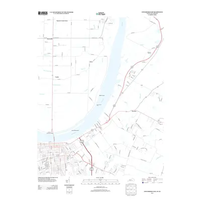
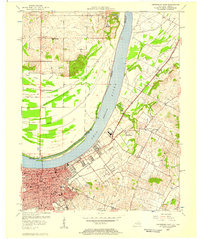 1956 Owensboro East1957 Print · USGSOwensboro and the Ohio River shoreline are captured here in the mid-fifties, showing the city's transition from a river port to a modern educational and industrial center. Researchers can trace historic institutions like Brescia College or locate vanished rural landmarks such as Larkin Ch and the settlement of Africa.
 - 1956 Map of Owensboro West, 1957 Print
 1956 Owensboro West1957 Print · USGSThe riverfront and rail corridors of Daviess County come alive in this mid-century survey of the Ohio River valley. Genealogists and historians can trace the foundations of Owensboro and rural outposts like Stanley, Sorgho, and the Lancaster Cem.2 unique versions available
 - 1957 Map of Evansville, 1969 Print
 1957 Evansville1969 Print · USGSIndiana and Kentucky meet along the Ohio River in this mid-century survey of a vital industrial and transport corridor. Genealogists and historians can trace the development of river towns like Owensboro and Newburgh or locate old rail lines like the Southern Ry.3 unique versions available
 - 1961 Map of Evansville
 1961 Evansville1961 Print · USGSThe Ohio River valley and its surrounding coalfields are captured here during the late fifties and early sixties. Trace the industrial rail networks of the Illinois Central RR and explore regional landmarks like Mammoth Cave National Park and Angel Mounds State Memorial.2 unique versions available
 - 1967 Map of Owensboro East, 1970 Print
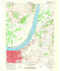 1967 Owensboro East1970 Print · USGSDaviess County and the Indiana shoreline appear here during a period of significant urban growth in the late sixties. Researchers can trace the city’s expansion through landmarks like Brescia College, the Louisville and Nashville rail lines, and Elmwood Cemetery.3 unique versions available
 - 1968 Map of Owensboro West, 1969 Print
 1968 Owensboro West1969 Print · USGSDaviess County during the late sixties shows the western expansion of Owensboro toward the Bon Harbor Hills. Genealogists and historians can locate family landmarks like Lancaster Cem, the Louisville and Nashville rail line, and the riverside Lock and Dam No 46.3 unique versions available
 - 1968 Map of Sutherland, 1969 Print
 1968 Sutherland1969 Print · USGSOwensboro and the surrounding Daviess County countryside are captured here in the late sixties during a period of steady southward growth. Genealogists and researchers can trace the historic Louisville and Nashville line past Sutherland to find rural landmarks like St Anthonys Cem and the schools of Masonville.3 unique versions available
 - 1968 Map of Panther, 1970 Print
 1968 Panther1970 Print · USGSDaviess County in the late 1960s shows a landscape of traditional farmsteads and rural parishes meeting modern aviation and industry. Researchers can find many family landmarks, from Windy Hollow to consolidated country schools like Snyder Consolidated Sch and Sutherland Consolidated Sch.2 unique versions available
 - 1986 Map of Evansville
 1986 Evansville1986 Print · USGSThe Ohio River valley thrives in the mid-1980s as a hub of river commerce, industry, and natural preservation spanning the Indiana-Kentucky border. Genealogists and historians can locate remote landmarks like Dead Mans Cem, Lippe Church, and the riverside community of Scuffletown.
 - 1991 Map of Evansville
 1991 Evansville1991 Print · USGSThe tri-state region of Indiana and Kentucky was a hub of river commerce and rail transport in the early nineties. Researchers can trace the industrial corridor between Evansville and Owensboro, locating landmarks like Angel Mounds State Memorial and the Seaboard System railroad.
 - 2010 Map of Panther, 2010 Print
 2010 Panther2010 Print · USGSCovers Owensboro, including Moseleyville, Tuck, and other nearby areas
 - 2010 Map of Sutherland, 2010 Print
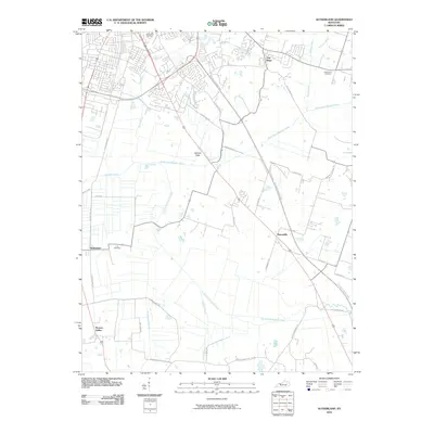 2010 Sutherland2010 Print · USGSCovers Owensboro, including Oak Ridge, Browns Valley, and other nearby areas
 - 2010 Map of Owensboro West, 2010 Print
 2010 Owensboro West2010 Print · USGSCovers Owensboro, including Griffith, Stanley, and other nearby areas
 - 2010 Map of Owensboro East, 2010 Print
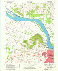
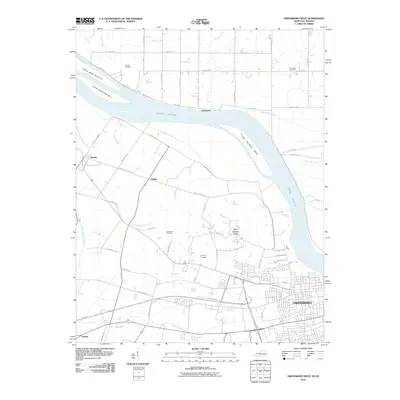
 2010 Owensboro East2010 Print · USGSCovers Owensboro, including Patronville, Africa, and other nearby areas
 - 2013 Map of Panther, 2013 Print
 2013 Panther2013 Print · USGSCovers Owensboro, including Moseleyville, Tuck, and other nearby areas
 - 2013 Map of Owensboro East, 2013 Print
 2013 Owensboro East2013 Print · USGSCovers Owensboro, including Patronville, Africa, and other nearby areas
Showing maps 1-25 of 39
Top cities near Owensboro
- Newburgh historical maps
- Rockport historical maps
- Lewisport historical maps
- Calhoun historical maps
- Grandview historical maps
Top neighborhoods of Owensboro
Frequently asked questions
- What are the different types of historical maps available for Owensboro?
- What is the oldest map of Owensboro?
- Where can I purchase historical maps of Owensboro for my home or office?
- Where can I download high-res historical maps of Owensboro?
- Are there historical topographic maps available for Owensboro?
- Is there historical aerial imagery available for Owensboro?
- Where are historical maps of Owensboro sourced from?