
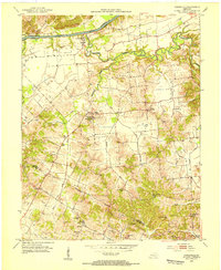
1952 Map of Owensboro West
USGS Topo · Published 1953About this map
The Ohio River dominates this early 1950s landscape, serving as the border between Kentucky and Indiana. On the southern bank, the city of Owensboro expands westward toward the Bon Harbor Hills, a prominent topographic feature rising above the river bottomlands. This era captures the city's educational and civic infrastructure, including the Catholic High Sch, Jefferson Jr High Sch, and the Municipal Sport Center.
Find a feature on this map
43 named features on this map. Tap any name to fly to it.
Don’t see what you’re looking for? This feature index may not catch every label — zoom into the map to look around manually.
Map Details
Editions of this 1952 Owensboro West Map
This is the sole edition of this map. No revisions or reprints were ever made.
Other maps of this area

1901 · Owensboro
USGS Topo · 1:62,500

1905 · Newburg
USGS Topo · 1:62,500

1906 · Sutherland
USGS Topo · 1:62,500

1908 · Calhoun
USGS Topo · 1:62,500

1951 · Yankeetown
USGS Topo · 1:24,000

1952 · Owensboro East
USGS Topo · 1:24,000

1952 · Rockport
USGS Topo · 1:24,000

1952 · Reed
USGS Topo · 1:24,000

1953 · Sutherland
USGS Topo · 1:24,000
1953 · Curdsville
USGS Topo · 1:24,000