
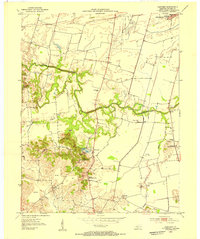
1952 Map of Owensboro East
USGS Topo · Published 1953About this map
The city of Owensboro dominates the southern bank of the Ohio River in the early 1950s, serving as a dense educational and civic hub. This survey detail includes the campuses of Wesleyan College and Western High Sch, alongside numerous other institutions like Central Jr High Sch and the County Hospital. The urban grid transitions into the industrial and transport corridor of the Louisville and Nashville railroad, which parallels the river. Across the water on the Indiana side, the landscape is distinctly rural and agricultural. Small settlements such as Patronville and Pueblo sit among a network of drainage features like the Forked Pond Ditch and Isaac Wright Drain, illustrating the engineering required to manage the fertile floodplains of Yellow Bank Island. To the east, the community of Thruston serves as a local crossroads near the Yellow Creek Ch and White Chapel Memorial Gardens.
Find a feature on this map
43 named features on this map. Tap any name to fly to it.
Don’t see what you’re looking for? This feature index may not catch every label — zoom into the map to look around manually.
Map Details
Editions of this 1952 Owensboro East Map
This is the sole edition of this map. No revisions or reprints were ever made.
Other maps of this area

1901 · Owensboro
USGS Topo · 1:62,500

1903 · Tell City
USGS Topo · 1:62,500

1906 · Sutherland
USGS Topo · 1:62,500

1907 · Whitesville
USGS Topo · 1:62,500

1909 · Whitesville
USGS Topo · 1:62,500

1952 · Rockport
USGS Topo · 1:24,000

1952 · Owensboro West
USGS Topo · 1:24,000

1953 · Philpot
USGS Topo · 1:24,000

1953 · Sutherland
USGS Topo · 1:24,000
1953 · Panther
USGS Topo · 1:24,000