Old Maps of Daviess County, Kentucky
Explore 137 old maps of Daviess County, spanning from 1901 to today. These high-resolution historic maps reveal how streets, neighborhoods, landmarks, and natural features evolved over time — perfect for genealogy, metal detecting, research, and local history exploration.
What you can do with these maps:
- See how Daviess County changed over time: Compare historical maps to modern-day views to trace roads, homesites, rail lines & more.
- View detailed metadata: Each map includes creators, publishers, year, scale, and archive source.
- Overlay maps with satellite & LiDAR: Visualize the past alongside modern tools to explore terrain & human change.
- Trusted historical sources: Maps sourced from the USGS, Library of Congress, and other archives.
- Access maps your way: View online, download high-res files, or order prints for personal or research use.
Start exploring old maps of Daviess County to uncover forgotten places, hidden landmarks, and the deep history beneath your feet.
Daviess County, KY maps
(137)- 1901 Map of Owensboro
 1901 Owensboro1901 Print · USGSThe Ohio River bend at the turn of the century shows a bustling corridor of rail and river commerce between Kentucky and Indiana. Trace the early footprints of Owensboro and Rockport alongside vanished landmarks like Lake Mills and the Willow Pond Bed.5 unique versions available
 - 1903 Map of Tell City
 1903 Tell City1903 Print · USGSThe Ohio River valley at the turn of the century is captured here as a vital corridor for both river and rail trade. Researchers can trace the early layouts of Tell City and Hawesville or locate smaller settlements like Knottsville and Waitman.7 unique versions available
 - 1905 Map of Newburg
 1905 Newburg1905 Print · USGSThe Ohio River bottomlands of Indiana and Kentucky are captured here in the early twentieth century, showing a world defined by river transit and rail. Genealogists can locate river-town homesteads near Newburg or trace family river crossings at MASON FERRY and HAMILTON FERRY.3 unique versions available
 - 1906 Map of Sutherland
 1906 Sutherland1906 Print · USGSDaviess and McLean counties come into focus at the start of the twentieth century, when the rail lines and river forks dictated the pace of rural life. Genealogists and local historians can trace early homes and landmarks near Utica, St Martins Church, and the distinctive Backbone Ridge.3 unique versions available
 - 1907 Map of Whitesville, 1962 Print
 1907 Whitesville1962 Print · USGSDaviess and Ohio counties are captured here in the early 1900s, showcasing a rural landscape of crossroads settlements and river fords. Genealogists can locate specific family-named landmarks and community hubs like Hewlett's Store, Tanglewood School, and Little Zion Church.
 - 1908 Map of Calhoun
 1908 Calhoun1908 Print · USGSWestern Kentucky's river-driven economy is on full display in the first decade of the twentieth century, centered on the winding Green River. Researchers can trace ancestral locations in Beechgrove, Ashbyburg, and Calhoun, or locate vanished river crossings like Steamboat Ferry.2 unique versions available
 - 1909 Map of Whitesville
 1909 Whitesville1909 Print · USGSKentucky's rural interior comes into focus here during the early 1900s, showing a landscape of small farming communities and river crossings. Genealogists can trace family roots through dozens of local landmarks like Whalen PO, St Thomas Church, and Berry School.2 unique versions available
 - 1951 Map of Yankeetown, 1952 Print
 1951 Yankeetown1952 Print · USGSThe banks of the Ohio River in the early fifties reveal a landscape of river-bottom settlements and upland farms. Researchers can trace the layout of Scuffletown and Carlinburg, find early Oil Wells, and locate rural landmarks like St Rupert Ch and Vanada Cem.2 unique versions available
 - 1952 Map of Owensboro East, 1953 Print
 1952 Owensboro East1953 Print · USGSOwensboro's riverfront and growing residential core are captured here at the start of the 1950s. Genealogists and historians can locate specific neighborhood schools like Lincoln Sch, the sprawling Rose Hill Cem, and rural Indiana outposts like Patronville.
 - 1952 Map of Rockport, 1953 Print
 1952 Rockport1953 Print · USGSSpencer County sits on the bank of the Ohio River during the early 1950s, showing a well-established river-and-rail hub. Genealogists can locate family landmarks such as the County Infirmary, Silverdale Sch, and the Lincoln Pioneer Village.2 unique versions available
 - 1952 Map of Owensboro West, 1953 Print
 1952 Owensboro West1953 Print · USGSDaviess County in the early fifties shows a growing riverfront city transitioning into a landscape of oil production and bottomland farming. Genealogists and historians can trace family landmarks like Lancaster Cem, Alexander Ch, and the many Oil Wells scattered through Stanley.
 - 1952 Map of Reed, 1953 Print
 1952 Reed1953 Print · USGSThe Henderson and Daviess County line follows the serpentine Green River in the early fifties, revealing a landscape of river-bottom farms and active oil extraction. Genealogists and local historians can trace family roots through sites like Birk City, Mt Zion Ch, and Hamilton Ferry.
 - 1952 Map of Calhoun, 1954 Print
 1952 Calhoun1954 Print · USGSMcLean County thrived along the banks of the winding Green River in the early fifties, where river commerce and rural agriculture met. Genealogists can trace family landmarks and community hubs like Shutts Chapel, Jewel City, and the St Sebastian Sch.3 unique versions available
 - 1953 Map of Philpot, 1954 Print
 1953 Philpot1954 Print · USGSDaviess and Ohio counties in the early fifties show a landscape of oil production and rural community life. Trace family roots at Karns Grove Ch or follow the Illinois Central Line past Philpot and Whitesville.
 - 1953 Map of Sutherland, 1954 Print
 1953 Sutherland1954 Print · USGSDaviess County in the early fifties shows the expansion of Owensboro alongside established rural settlements. Genealogists and historians can trace family locations near Sutherland, Browns Valley, and the campus of Kentucky Wesleyan College.
 - 1953 Map of Utica, 1954 Print
 1953 Utica1954 Print · USGSDaviess and McLean counties come alive in the early fifties, showing a rural landscape defined by crossroad communities and oil exploration. Genealogists can trace family footprints at Atherton Cem or through local congregations like Bethlehem Ch and New Bethel Ch.3 unique versions available
 - 1953 Map of Glenville, 1954 Print
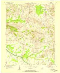 1953 Glenville1954 Print · USGSMcLean County farming and energy extraction coincide during the early fifties near the Green River. Researchers can locate family landmarks such as Glenville Ch, Pleasant Hope Ch, and the numerous oil wells dotting the hills near Buel.2 unique versions available
 - 1953 Map of Delaware, 1954 Print
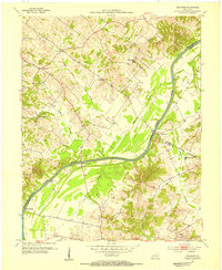 1953 Delaware1954 Print · USGSThe Green River valley comes to life in the early fifties, showing a rural Kentucky landscape of active oil wells and riverfront landings. Genealogists can trace family names at Boston Cem and Mackey Cem or locate the old Delaware and Euterpe settlements.3 unique versions available
 - 1953 Map of Curdsville, 1954 Print
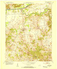 1953 Curdsville1954 Print · USGSDaviess and McLean counties come into focus in the early 1950s, revealing a landscape defined by the winding Green River and rural industry. Researchers can trace family roots through sites like Mt St Joseph Academy, McCain Cem, and the active Oil Wells of the era.3 unique versions available
 - 1953 Map of Panther, 1954 Print
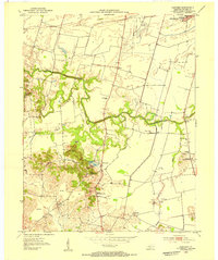 1953 Panther1954 Print · USGSSouth of Owensboro in the early fifties, this area shows a landscape defined by meandering creeks and emerging industry. Genealogists and historians can trace family-named landmarks and rural centers like St Raphael Ch, Mosleyville, and the extensive strip mines near Zion Hill.
 - 1953 Map of Lewisport, 1955 Print
 1953 Lewisport1955 Print · USGSThe riverfront and rail corridor of Hancock County come to life in the early 1950s, centered on the historic town of Lewisport. Genealogists and historians can trace family locations through landmarks like Sand Hill Cem, Waitman Ch, and the many Oil Wells dotting the valley.
 - 1953 Map of Whitesville, 1955 Print
 1953 Whitesville1955 Print · USGSDaviess and Ohio counties in the early fifties reveal a landscape of active energy production and rail-dependent commerce. Local historians can trace the Illinois Central line through Reynolds Sta or locate family sites at St Thomas Cem and Old Panther Ch.
 - 1953 Map of Pleasant Ridge, 1955 Print
 1953 Pleasant Ridge1955 Print · USGSDaviess and Ohio Counties are shown here in the early fifties, a time when small rural settlements and active oil fields shared the landscape. Researchers can trace old family sites and country landmarks like Shinkle Chapel, Clear Run Sch, and French Cem.
 - 1953 Map of Maceo, 1955 Print
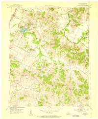 1953 Maceo1955 Print · USGSDaviess and Hancock counties in the mid-1950s reveal a landscape of deep rural roots and early industrial change. Genealogists and historians can locate family landmarks like Hawes and Taylor Cem, the community at Knottsville, and South Hampton Ch.
 - 1953 Map of Pellville, 1955 Print
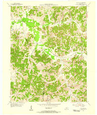 1953 Pellville1955 Print · USGSThe rural border of Hancock and Daviess counties is shown in the early fifties, documenting a landscape of small farming communities and country schools. Genealogists can locate family landmarks like Lamar Cem, St Lawrence Sch, and Weberstown.2 unique versions available
Showing maps 1-25 of 137
Top cities of Daviess County
Frequently asked questions
- What are the different types of historical maps available for Daviess County?
- What is the oldest map of Daviess County?
- Where can I purchase historical maps of Daviess County for my home or office?
- Where can I download high-res historical maps of Daviess County?
- Are there historical topographic maps available for Daviess County?
- Is there historical aerial imagery available for Daviess County?
- Where are historical maps of Daviess County sourced from?