1950s Maps of Daviess County, Kentucky
Explore 24 historic maps of Daviess County from the 1950s. These maps offer a rare glimpse into what life looked like during the 1950s — showing old roads, neighborhoods, homes, and landmarks that have changed or disappeared over time.
Whether you're researching your family's past, planning a metal detecting trip, or studying how Daviess County's landscape evolved across the 1950s, these high-resolution maps are a powerful tool for exploring the history of this region.
- Focus on a specific era: All maps on this page are from the 1950s, giving you a focused view of this time period.
- See what’s changed: Compare century-old streets, trails, and buildings to today's modern landscape using overlays and satellite layers.
- Research with precision: Use these maps for genealogy, historical research, land use analysis, or educational projects.
- View, download, or print: Maps are fully viewable online in high resolution, and can be downloaded or printed for your own records.
Start exploring Daviess County's history through authentic maps from the 1950s. This is your window into the past.
Daviess County, KY maps
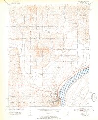
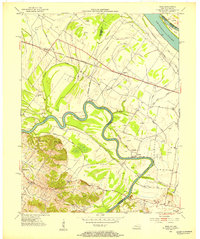
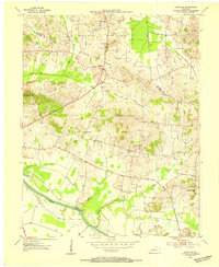
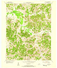
(24)- 1951 Map of Yankeetown, 1952 Print
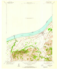
 1951 Yankeetown1952 Print · USGSThe banks of the Ohio River in the early fifties reveal a landscape of river-bottom settlements and upland farms. Researchers can trace the layout of Scuffletown and Carlinburg, find early Oil Wells, and locate rural landmarks like St Rupert Ch and Vanada Cem.2 unique versions available
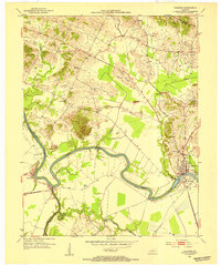
 - 1952 Map of Owensboro East, 1953 Print
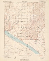
 1952 Owensboro East1953 Print · USGSOwensboro's riverfront and growing residential core are captured here at the start of the 1950s. Genealogists and historians can locate specific neighborhood schools like Lincoln Sch, the sprawling Rose Hill Cem, and rural Indiana outposts like Patronville.
 - 1952 Map of Rockport, 1953 Print
 1952 Rockport1953 Print · USGSSpencer County sits on the bank of the Ohio River during the early 1950s, showing a well-established river-and-rail hub. Genealogists can locate family landmarks such as the County Infirmary, Silverdale Sch, and the Lincoln Pioneer Village.2 unique versions available
 - 1952 Map of Owensboro West, 1953 Print
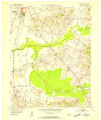
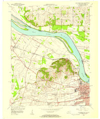
 1952 Owensboro West1953 Print · USGSDaviess County in the early fifties shows a growing riverfront city transitioning into a landscape of oil production and bottomland farming. Genealogists and historians can trace family landmarks like Lancaster Cem, Alexander Ch, and the many Oil Wells scattered through Stanley.
 - 1952 Map of Reed, 1953 Print
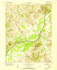
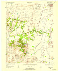
 1952 Reed1953 Print · USGSThe Henderson and Daviess County line follows the serpentine Green River in the early fifties, revealing a landscape of river-bottom farms and active oil extraction. Genealogists and local historians can trace family roots through sites like Birk City, Mt Zion Ch, and Hamilton Ferry.
 - 1952 Map of Calhoun, 1954 Print
 1952 Calhoun1954 Print · USGSMcLean County thrived along the banks of the winding Green River in the early fifties, where river commerce and rural agriculture met. Genealogists can trace family landmarks and community hubs like Shutts Chapel, Jewel City, and the St Sebastian Sch.3 unique versions available
 - 1953 Map of Philpot, 1954 Print
 1953 Philpot1954 Print · USGSDaviess and Ohio counties in the early fifties show a landscape of oil production and rural community life. Trace family roots at Karns Grove Ch or follow the Illinois Central Line past Philpot and Whitesville.
 - 1953 Map of Sutherland, 1954 Print
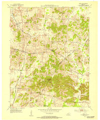
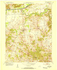
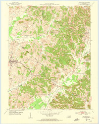
 1953 Sutherland1954 Print · USGSDaviess County in the early fifties shows the expansion of Owensboro alongside established rural settlements. Genealogists and historians can trace family locations near Sutherland, Browns Valley, and the campus of Kentucky Wesleyan College.
 - 1953 Map of Utica, 1954 Print
 1953 Utica1954 Print · USGSDaviess and McLean counties come alive in the early fifties, showing a rural landscape defined by crossroad communities and oil exploration. Genealogists can trace family footprints at Atherton Cem or through local congregations like Bethlehem Ch and New Bethel Ch.3 unique versions available
 - 1953 Map of Glenville, 1954 Print
 1953 Glenville1954 Print · USGSMcLean County farming and energy extraction coincide during the early fifties near the Green River. Researchers can locate family landmarks such as Glenville Ch, Pleasant Hope Ch, and the numerous oil wells dotting the hills near Buel.2 unique versions available
 - 1953 Map of Delaware, 1954 Print
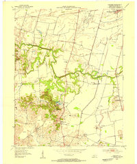
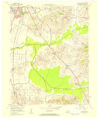
 1953 Delaware1954 Print · USGSThe Green River valley comes to life in the early fifties, showing a rural Kentucky landscape of active oil wells and riverfront landings. Genealogists can trace family names at Boston Cem and Mackey Cem or locate the old Delaware and Euterpe settlements.3 unique versions available
 - 1953 Map of Curdsville, 1954 Print
 1953 Curdsville1954 Print · USGSDaviess and McLean counties come into focus in the early 1950s, revealing a landscape defined by the winding Green River and rural industry. Researchers can trace family roots through sites like Mt St Joseph Academy, McCain Cem, and the active Oil Wells of the era.3 unique versions available
 - 1953 Map of Panther, 1954 Print
 1953 Panther1954 Print · USGSSouth of Owensboro in the early fifties, this area shows a landscape defined by meandering creeks and emerging industry. Genealogists and historians can trace family-named landmarks and rural centers like St Raphael Ch, Mosleyville, and the extensive strip mines near Zion Hill.
 - 1953 Map of Lewisport, 1955 Print
 1953 Lewisport1955 Print · USGSThe riverfront and rail corridor of Hancock County come to life in the early 1950s, centered on the historic town of Lewisport. Genealogists and historians can trace family locations through landmarks like Sand Hill Cem, Waitman Ch, and the many Oil Wells dotting the valley.
 - 1953 Map of Whitesville, 1955 Print
 1953 Whitesville1955 Print · USGSDaviess and Ohio counties in the early fifties reveal a landscape of active energy production and rail-dependent commerce. Local historians can trace the Illinois Central line through Reynolds Sta or locate family sites at St Thomas Cem and Old Panther Ch.
 - 1953 Map of Pleasant Ridge, 1955 Print
 1953 Pleasant Ridge1955 Print · USGSDaviess and Ohio Counties are shown here in the early fifties, a time when small rural settlements and active oil fields shared the landscape. Researchers can trace old family sites and country landmarks like Shinkle Chapel, Clear Run Sch, and French Cem.
 - 1953 Map of Maceo, 1955 Print
 1953 Maceo1955 Print · USGSDaviess and Hancock counties in the mid-1950s reveal a landscape of deep rural roots and early industrial change. Genealogists and historians can locate family landmarks like Hawes and Taylor Cem, the community at Knottsville, and South Hampton Ch.
 - 1953 Map of Pellville, 1955 Print
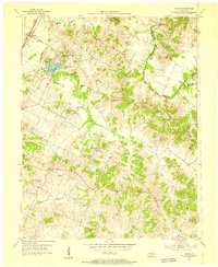
 1953 Pellville1955 Print · USGSThe rural border of Hancock and Daviess counties is shown in the early fifties, documenting a landscape of small farming communities and country schools. Genealogists can locate family landmarks like Lamar Cem, St Lawrence Sch, and Weberstown.2 unique versions available
 - 1954 Map of Evansville
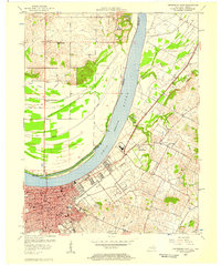
 1954 Evansville1954 Print · USGSThe Ohio River borderlands between Indiana and Kentucky appear here during a period of robust industrial and military growth. Genealogists and researchers can trace the rail corridors of the Illinois Central and find landmarks like US Lock and Dam No 48 or Camp Breckinridge.
 - 1956 Map of Panther, 1957 Print
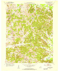
 1956 Panther1957 Print · USGSDaviess County in the mid-1950s reveals a landscape of growing industry and deep-rooted rural communities south of the Ohio River. Researchers can trace early energy production and family centers through the numerous Oil Wells, Strip Mines, and local landmarks like St Raphael Ch or Sutherland Consolidated Sch.
 - 1956 Map of Sutherland, 1957 Print
 1956 Sutherland1957 Print · USGSDaviess County in the mid-fifties shows the southern growth of Owensboro toward rural farming communities. Genealogists and historians can trace local landmarks like Kentucky Wesleyan College, Masonville, and the Illinois Central rail lines.2 unique versions available
 - 1956 Map of Owensboro East, 1957 Print
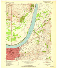
 1956 Owensboro East1957 Print · USGSOwensboro and the Ohio River shoreline are captured here in the mid-fifties, showing the city's transition from a river port to a modern educational and industrial center. Researchers can trace historic institutions like Brescia College or locate vanished rural landmarks such as Larkin Ch and the settlement of Africa.
 - 1956 Map of Owensboro West, 1957 Print
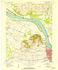
 1956 Owensboro West1957 Print · USGSThe riverfront and rail corridors of Daviess County come alive in this mid-century survey of the Ohio River valley. Genealogists and historians can trace the foundations of Owensboro and rural outposts like Stanley, Sorgho, and the Lancaster Cem.2 unique versions available
 - 1957 Map of Evansville, 1969 Print
 1957 Evansville1969 Print · USGSIndiana and Kentucky meet along the Ohio River in this mid-century survey of a vital industrial and transport corridor. Genealogists and historians can trace the development of river towns like Owensboro and Newburgh or locate old rail lines like the Southern Ry.3 unique versions available
End of results
Showing maps 1-24 of 24
Top cities of Daviess County
Frequently asked questions
- What are the different types of historical maps available for Daviess County?
- What is the oldest map of Daviess County?
- Where can I purchase historical maps of Daviess County for my home or office?
- Where can I download high-res historical maps of Daviess County?
- Are there historical topographic maps available for Daviess County?
- Is there historical aerial imagery available for Daviess County?
- Where are historical maps of Daviess County sourced from?