2020s Maps of Daviess County, Kentucky
Explore 18 historic maps of Daviess County from the 2020s. These maps offer a rare glimpse into what life looked like during the 2020s — showing old roads, neighborhoods, homes, and landmarks that have changed or disappeared over time.
Whether you're researching your family's past, planning a metal detecting trip, or studying how Daviess County's landscape evolved across the 2020s, these high-resolution maps are a powerful tool for exploring the history of this region.
- Focus on a specific era: All maps on this page are from the 2020s, giving you a focused view of this time period.
- See what’s changed: Compare century-old streets, trails, and buildings to today's modern landscape using overlays and satellite layers.
- Research with precision: Use these maps for genealogy, historical research, land use analysis, or educational projects.
- View, download, or print: Maps are fully viewable online in high resolution, and can be downloaded or printed for your own records.
Start exploring Daviess County's history through authentic maps from the 2020s. This is your window into the past.
Daviess County, KY maps
(18)- 2022 Map of Rockport, 2022 Print
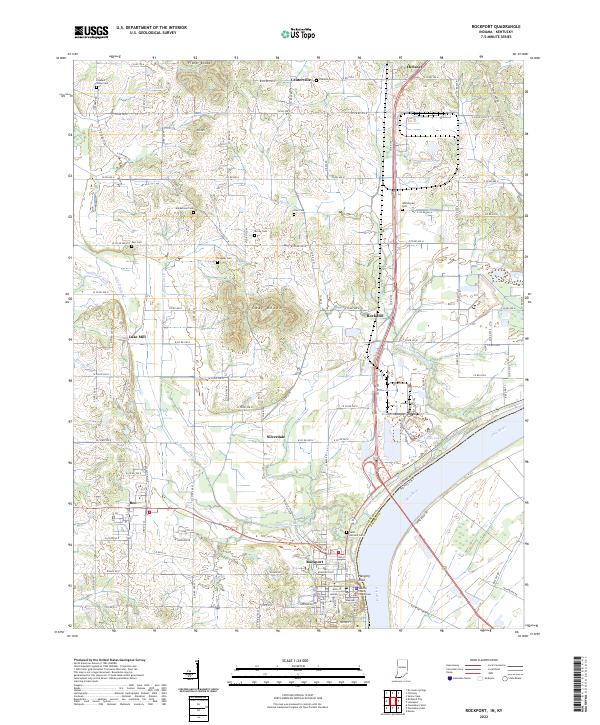 2022 Rockport2022 Print · USGSThe Ohio River waterfront at Rockport is captured here in the early 2020s, showcasing the county seat alongside its neighboring river-bottom farmlands. Researchers can trace local heritage through sites like the Spencer County Courthouse and numerous pioneer-era burial grounds including Hackleman Cem and Stateler Cem.
 - 2022 Map of Yankeetown, 2022 Print
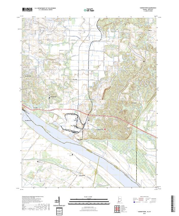 2022 Yankeetown2022 Print · USGSWarrick County river life and the evolving shoreline of the Ohio River are captured here in the early 2020s. Researchers can trace family history through several local burial sites like Bates Hill Cem and Vanada Cem or locate the landing at Scuffletown.
 - 2022 Map of Pellville, 2022 Print
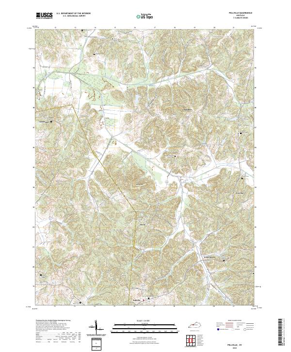 2022 Pellville2022 Print · USGSThe rural border of Hancock and Daviess counties is captured here in detail, showcasing a landscape of winding creeks and dispersed hill-country settlements. Researchers can trace historic family burial sites and rural church locations like Blackford Baptist Church Cem, Mount Eden Cem, and the crossroads at Floral.
 - 2022 Map of Calhoun, 2022 Print
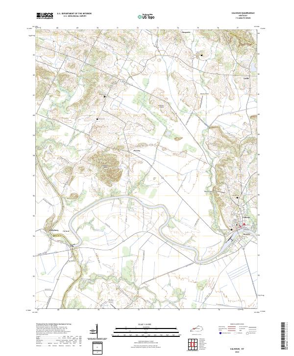 2022 Calhoun2022 Print · USGSMcLean County riverside life is centered on the winding Green River in this modern survey. Genealogists can trace family heritage through the McLean County Courthouse and numerous burial sites like the Camp Calhoun Cem and Antioch Cem.
 - 2022 Map of Owensboro East, 2022 Print
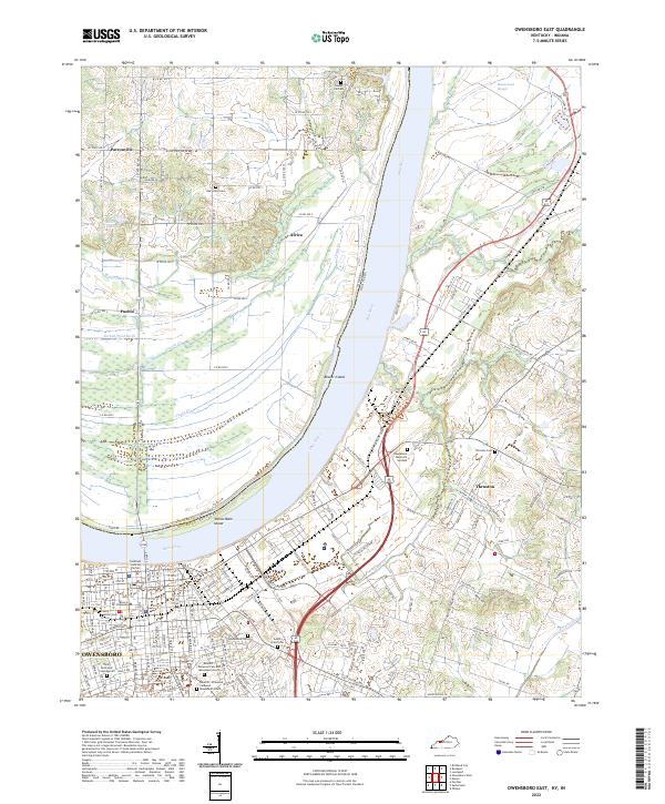 2022 Owensboro East2022 Print · USGSDaviess County and the Indiana borderlands appear here in the early twenty-first century as the river-port city of Owensboro expands. Researchers can locate several historic burial grounds like Settler Cem and trace the paths of rural settlements such as Patronville and Africa.
 - 2022 Map of Glenville, 2022 Print
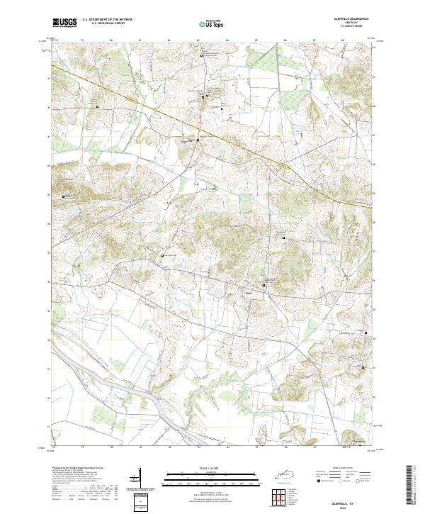 2022 Glenville2022 Print · USGSWestern Kentucky's riverfront and ridge country are documented here in the early 2020s, centered on the Glenville community. Genealogists can locate family landmarks like the Leet - Wilhite Family Cem and Oak Grove Cem near the Green River.
 - 2022 Map of Utica, 2022 Print
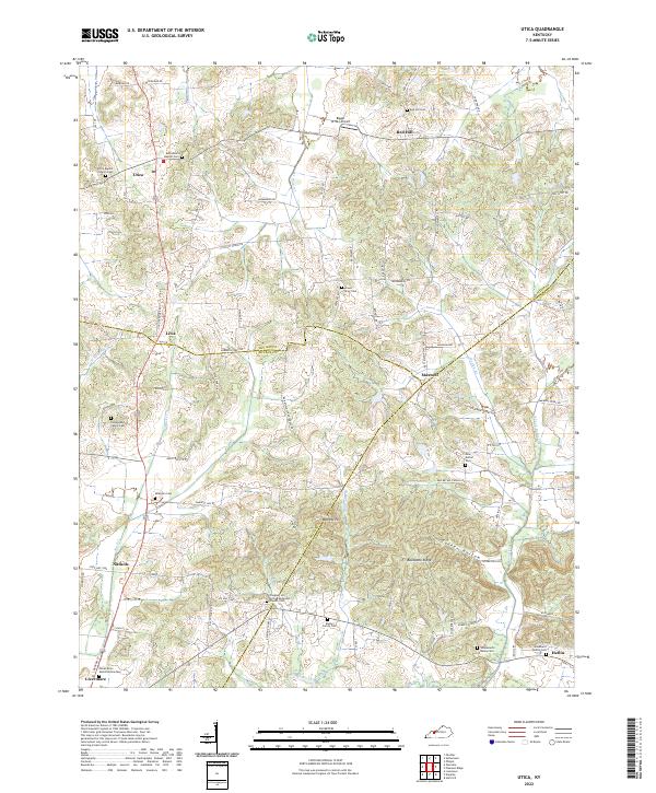 2022 Utica2022 Print · USGSWestern Kentucky country life is well-documented here as the modern era meets a landscape shaped by the Rough River and Buck Cr. Genealogists can trace deep local roots through family-named sites like Underwood Family Cem and the Rowan Family Cem.
 - 2022 Map of Delaware, 2022 Print
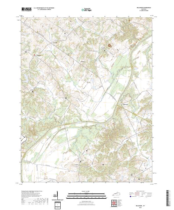 2022 Delaware2022 Print · USGSThe Green River bottomlands and rural crossroads of western Kentucky come alive in this recent survey. Genealogists can trace family lines through numerous burial sites like the Gish Family Cem Number 1, Nunn Cem, and Delaware Church Cem.
 - 2022 Map of Lewisport, 2022 Print
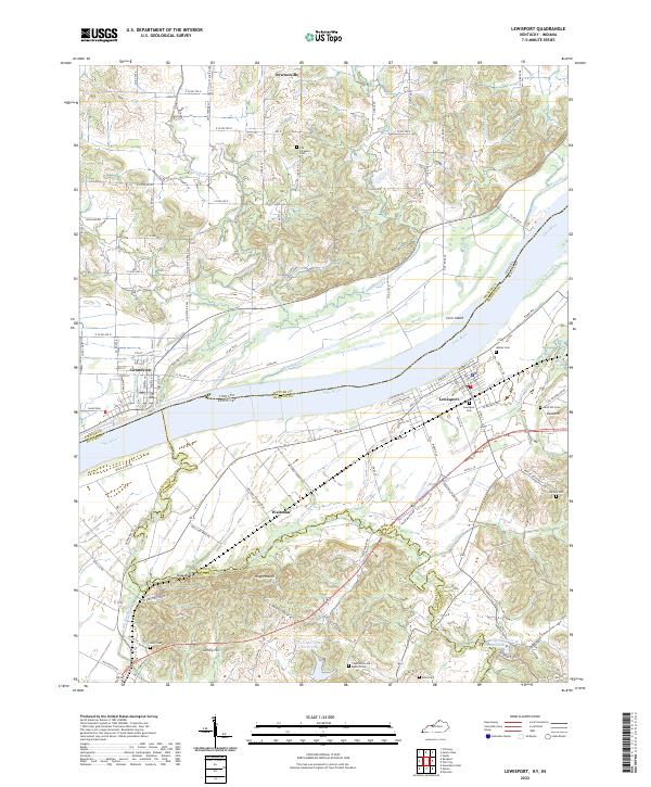 2022 Lewisport2022 Print · USGSThe Ohio River corridor between Indiana and Kentucky is captured here in the early twenty-first century, showing the established river towns of Lewisport and Grandview. Researchers can trace rural lineages through numerous local burial sites like Old Sargeant Cem and Holland Cem.
 - 2022 Map of Whitesville, 2022 Print
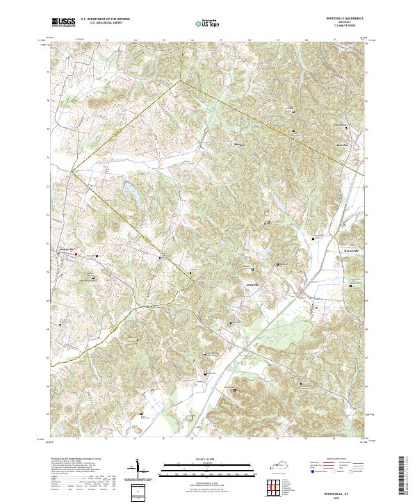 2022 Whitesville2022 Print · USGSThe tri-county border area of Daviess, Ohio, and Hancock counties is mapped here in the early twenty-first century. Genealogists can locate numerous small burial sites, including Saint Mary of the Woods Cem, Barnetts Knob Cem, and Friendship Community Cem.
 - 2022 Map of Maceo, 2022 Print
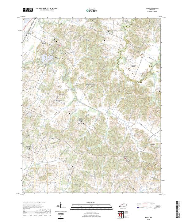 2022 Maceo2022 Print · USGSNortheastern Daviess County appears as a rich landscape of rural parishes and family-named landmarks in the early twenty-first century. Genealogists can trace decades of local history through sites like Yelvington Cem, Knottsville, and the Mount Zion Presbyterian Church Cem.
 - 2022 Map of Curdsville, 2022 Print
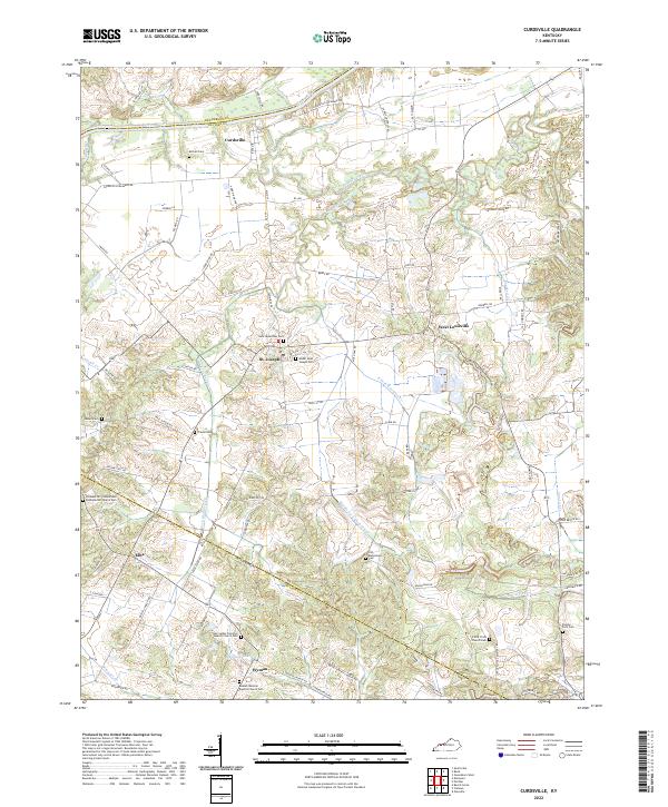 2022 Curdsville2022 Print · USGSDaviess County’s riverine landscape is captured here in the modern era, bounded by the Green River and the rural reaches of Curdsville. Genealogists can trace family names and local history through numerous sites like Saint Alphonsus Cem, West Louisville, and Wyman Lake.
 - 2022 Map of Reed, 2022 Print
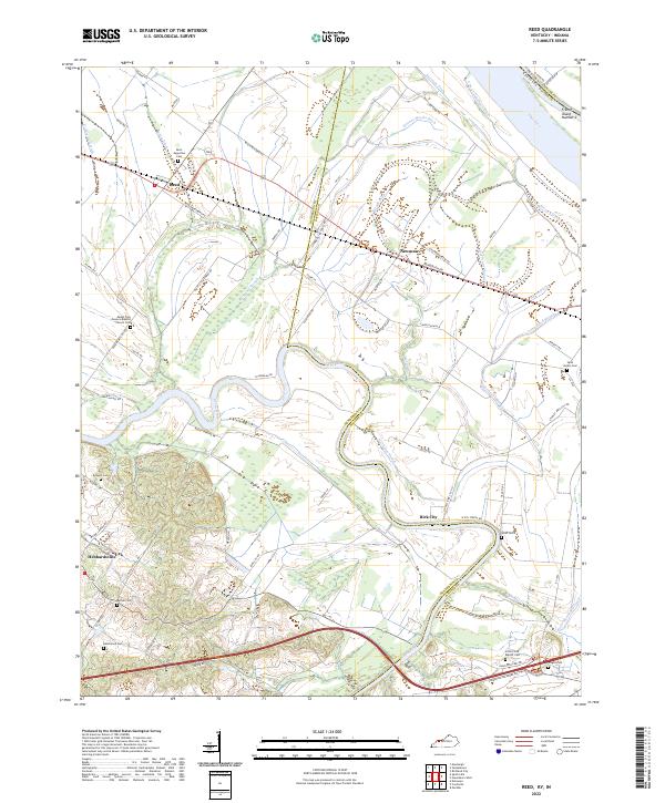 2022 Reed2022 Print · USGSThe Henderson and Daviess County border comes alive in the early 2020s, showing a landscape shaped by the Green River and the Ohio River. Family historians can trace rural roots through Saint Augustine Cem, Bethel Cem, and the river community of Birk City.
 - 2022 Map of Sutherland, 2022 Print
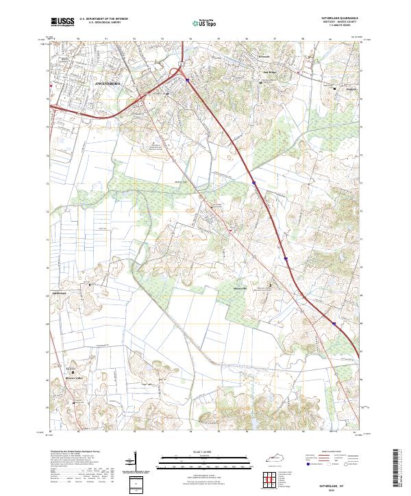 2022 Sutherland2022 Print · USGSDaviess County’s suburban growth and agricultural roots meet south of Owensboro in this modern survey of the Kentucky landscape. Researchers can trace family history through several local landmarks including Masonville, Hix Cem, and the Trunnell Family Cem.
 - 2022 Map of Owensboro West, 2022 Print
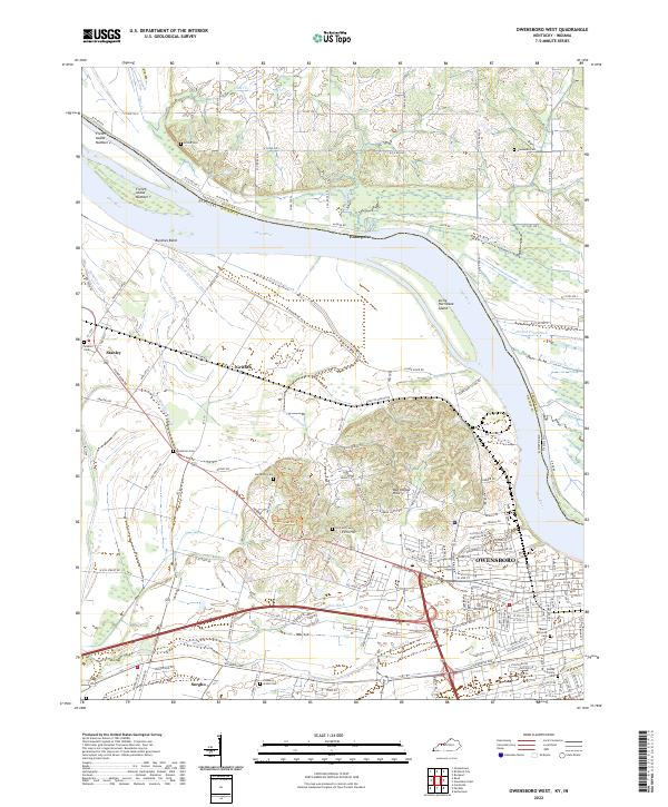 2022 Owensboro West2022 Print · USGSThe riverfront west of OWENSBORO and the fertile lowlands of the Kentucky-Indiana border are captured here in the early 2020s. Researchers can locate numerous local burial sites like Mater Dolorosa Cem and Bosley Family Cem or trace the winding Cowhide Slough.
 - 2022 Map of Panther, 2022 Print
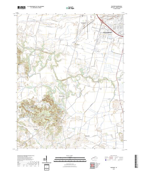 2022 Panther2022 Print · USGSThe southern outskirts of Owensboro meet rural Daviess County in the early twenty-first century, showing a landscape shaped by drainage engineering and aviation. Researchers can locate several burial grounds including Atheys Chapel Cemetery and trace local hamlets like Moseleyville and Handyville.
 - 2022 Map of Pleasant Ridge, 2022 Print
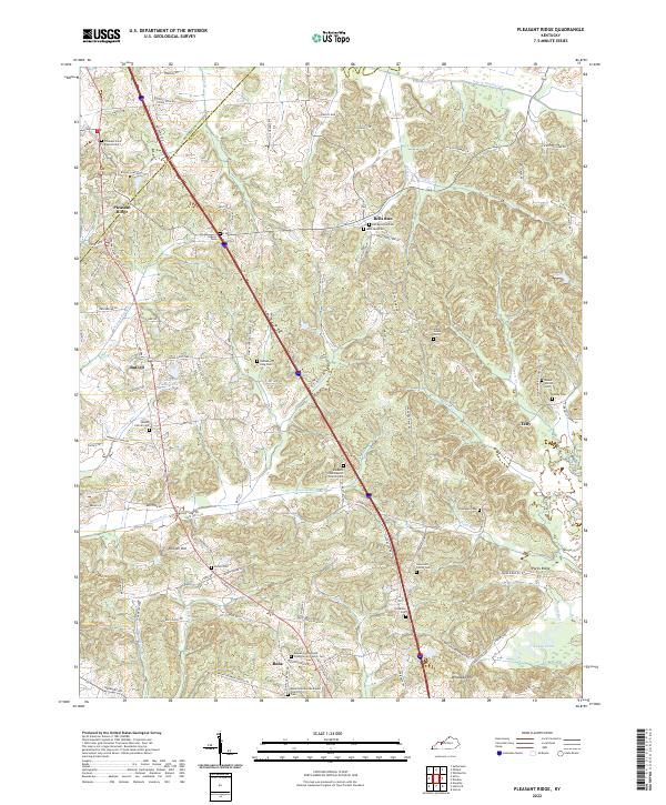 2022 Pleasant Ridge2022 Print · USGSThe Daviess and Ohio County borderlands come into focus in this contemporary survey of the rural Kentucky interior. Local historians can trace dozens of small family burial grounds and country churches, including Patterson Cem, Mount Carmel Cem, and Beulah Cumberland Presbyterian Church.
 - 2022 Map of Philpot, 2022 Print
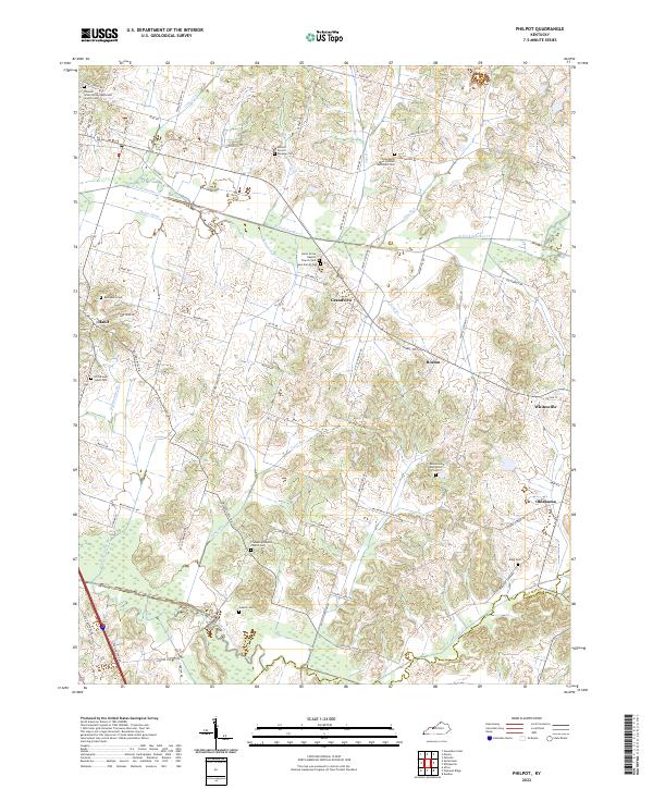 2022 Philpot2022 Print · USGSEastern Daviess County comes into focus in the early 2020s, showing a landscape of rural crossroads and family legacies. Researchers can locate many small burial sites like Richardson Jones Cem and trace the paths of N Fork Panther Cr through Grandview and Whitesville.
End of results
Showing maps 1-18 of 18
Top cities of Daviess County
Frequently asked questions
- What are the different types of historical maps available for Daviess County?
- What is the oldest map of Daviess County?
- Where can I purchase historical maps of Daviess County for my home or office?
- Where can I download high-res historical maps of Daviess County?
- Are there historical topographic maps available for Daviess County?
- Is there historical aerial imagery available for Daviess County?
- Where are historical maps of Daviess County sourced from?