
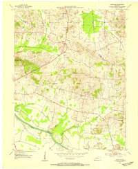
1953 Map of Sutherland
USGS Topo · Published 1954About this map
The southeastern edge of Owensboro transitions into a landscape defined by the branching waterways of Panther Creek during the early 1950s. This survey records a period of institutional growth, highlighted by the campus of Kentucky Wesleyan College and the Tri-State Fairgrounds on the city's periphery. To the south, rural life is anchored by small communities like Masonville and Sutherland, where the local social fabric is visible through landmarks such as St Anthony Sch and Sugar Grove Ch.
Find a feature on this map
31 named features on this map. Tap any name to fly to it.
Don’t see what you’re looking for? This feature index may not catch every label — zoom into the map to look around manually.
Map Details
Editions of this 1953 Sutherland Map
This is the sole edition of this map. No revisions or reprints were ever made.
Other maps of this area

1901 · Owensboro
USGS Topo · 1:62,500

1903 · Tell City
USGS Topo · 1:62,500

1906 · Sutherland
USGS Topo · 1:62,500

1907 · Whitesville
USGS Topo · 1:62,500

1909 · Whitesville
USGS Topo · 1:62,500

1952 · Owensboro East
USGS Topo · 1:24,000

1952 · Owensboro West
USGS Topo · 1:24,000

1953 · Philpot
USGS Topo · 1:24,000

1953 · Utica
USGS Topo · 1:24,000
1953 · Glenville
USGS Topo · 1:24,000