2020s Maps of Adair County, Iowa
Explore 20 historic maps of Adair County from the 2020s. These maps offer a rare glimpse into what life looked like during the 2020s — showing old roads, neighborhoods, homes, and landmarks that have changed or disappeared over time.
Whether you're researching your family's past, planning a metal detecting trip, or studying how Adair County's landscape evolved across the 2020s, these high-resolution maps are a powerful tool for exploring the history of this region.
- Focus on a specific era: All maps on this page are from the 2020s, giving you a focused view of this time period.
- See what’s changed: Compare century-old streets, trails, and buildings to today's modern landscape using overlays and satellite layers.
- Research with precision: Use these maps for genealogy, historical research, land use analysis, or educational projects.
- View, download, or print: Maps are fully viewable online in high resolution, and can be downloaded or printed for your own records.
Start exploring Adair County's history through authentic maps from the 2020s. This is your window into the past.
Adair County, IA maps
(20)- 2022 Map of Canby, 2022 Print
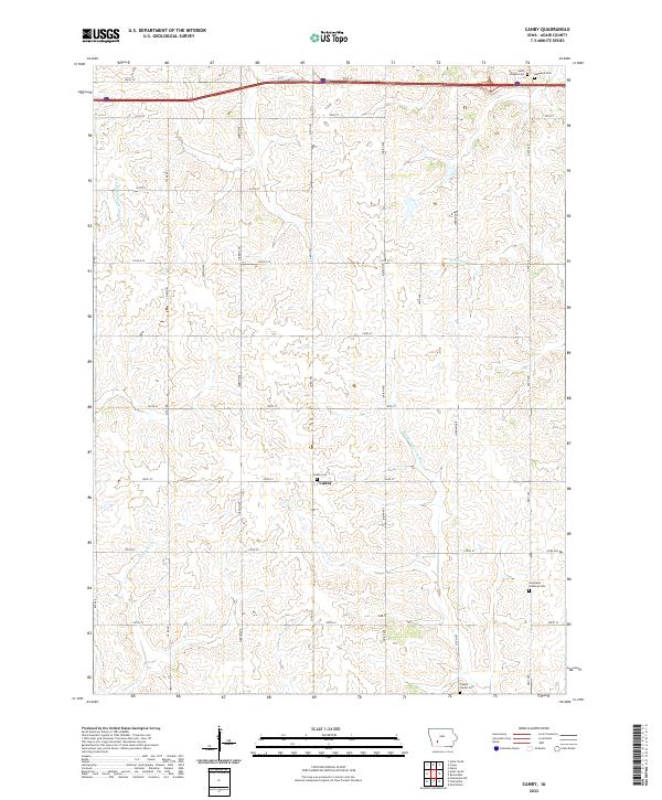 2022 Canby2022 Print · USGSAdair County agricultural lands are documented here in the early twenty-first century, centered on the historic crossroads of Canby. Researchers can locate several burial sites including Oakwood Cem and Prussia Center Cem along the Middle Nodaway River watershed.
 - 2022 Map of Adair North, 2022 Print
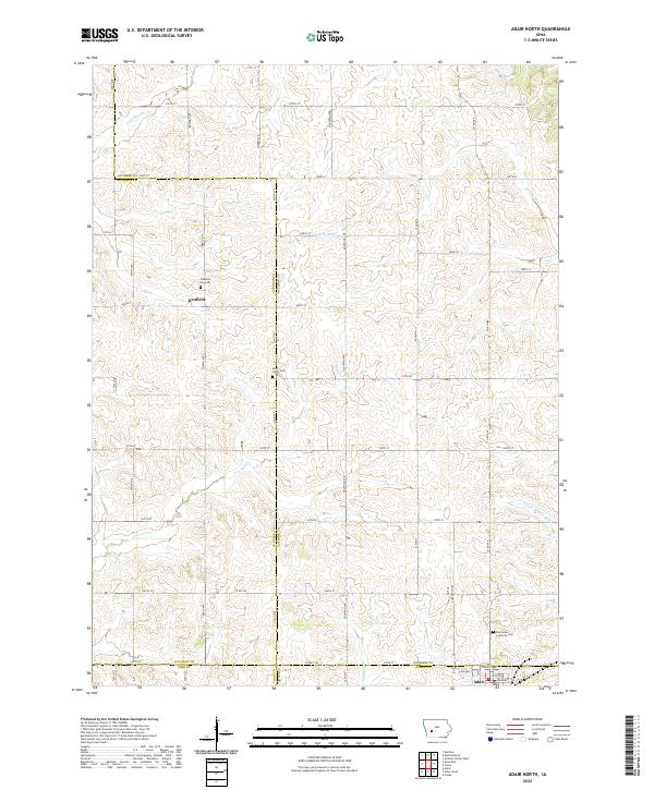 2022 Adair North2022 Print · USGSThe rural borders of Guthrie, Audubon, Adair, and Cass counties are captured here in the early twenty-first century. Researchers can locate family farm sites and historical burial grounds like Pleasant Hill Cem and Saint Johns Cem near Kenfield.
 - 2022 Map of Earlham West, 2022 Print
 2022 Earlham West2022 Print · USGSMadison County's agricultural heartland is captured here in the early twenty-first century as modern roads trace historic section lines. Genealogists can locate specific family burial sites at Penn Center Cem, Old Penn Center Cem, and Eppard Cem along the North River.
 - 2022 Map of Fontanelle, 2022 Print
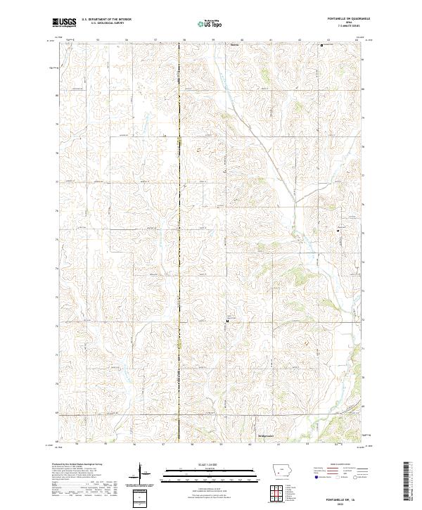
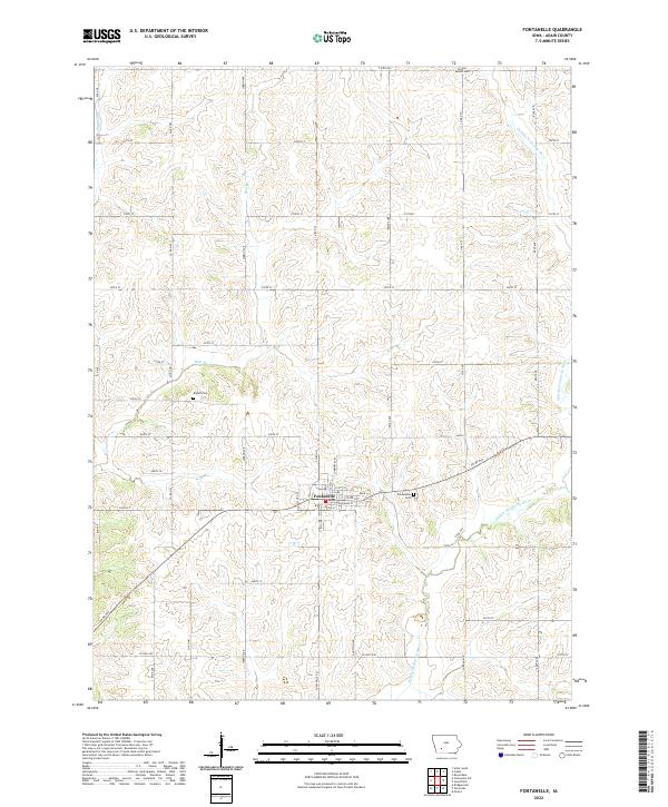 2022 Fontanelle2022 Print · USGSAdair County farm country is captured here in the early twenty-first century, centered on the historic town of Fontanelle. Genealogists and local historians can trace burial sites at Prussia Center Cem and Bryant Cem or follow the banks of the Middle Nodaway River.
 - 2022 Map of Nevinville, 2022 Print
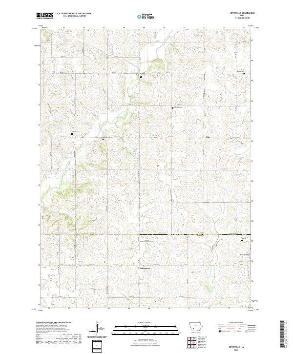 2022 Nevinville2022 Print · USGSSouthwestern Iowa farmland is mapped here in detail during the early twenty-first century, spanning the border of Adair and Adams counties. Genealogists can trace family roots at Rose Hill Cem, Mormon Cem, or the rural crossroads of Nevinville.
 - 2022 Map of Macksburg, 2022 Print
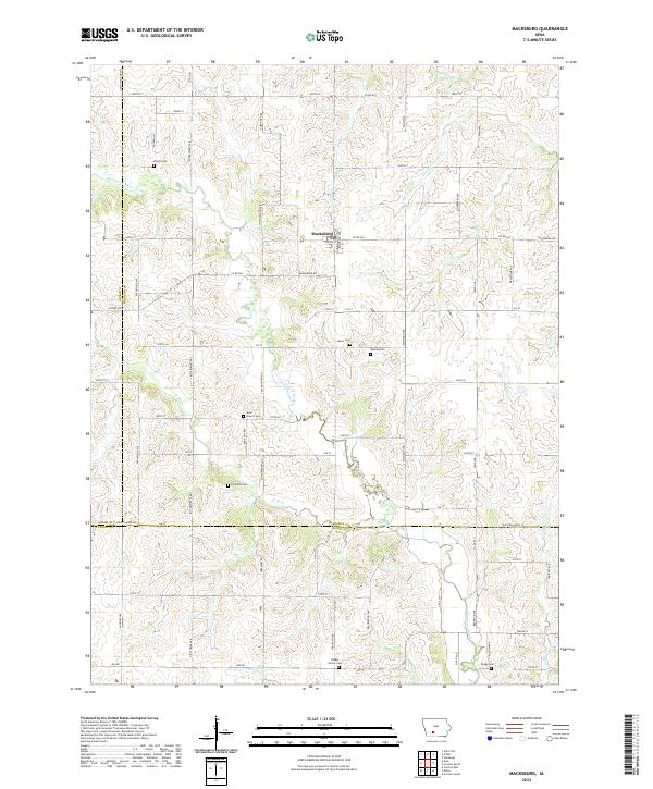 2022 Macksburg2022 Print · USGSMacksburg and the surrounding Madison County farm country are captured here in the early twenty-first century. Researchers can locate numerous local burial sites including West Branch Cem, Kivett Cem, and Dodge Center Cem.
 - 2022 Map of Menlo, 2022 Print
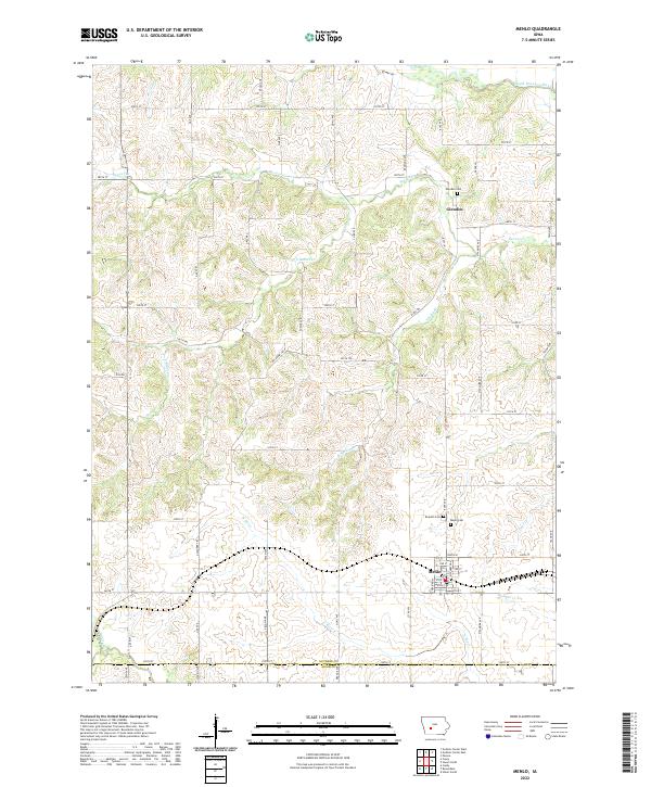 2022 Menlo2022 Print · USGSThe Guthrie County prairie unfolds across this recent survey, showcasing the enduring agricultural grid and river valleys of central Iowa. Genealogists and local historians can pinpoint family sites near Menlo, Glendon, and the historic Rosehill Cem.
 - 2022 Map of Fontanelle SW, 2022 Print
 2022 Fontanelle SW2022 Print · USGSIn the early twenty-first century, this corner of Adair County remains a landscape of river-fed farmland and quiet rural crossroads. Researchers can trace family ties at Saint Marys Cem or Sears Cem near the banks of the W Fork Middle Nodaway River.
 - 2022 Map of Casey, 2022 Print
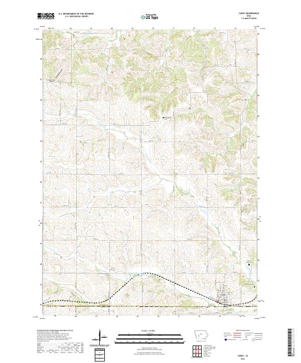 2022 Casey2022 Print · USGSThe community of Casey straddles the county line in this contemporary landscape. Researchers can trace rural lineages through local landmarks like Dalmanutha Cem, Spring Valley Cem, and the Stagecoach Airport.
 - 2022 Map of Arbor Hill, 2022 Print
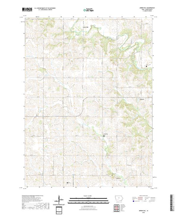 2022 Arbor Hill2022 Print · USGSAdair County's rural townships are documented here during the early 2020s, showcasing a landscape of family farms and quiet prairie settlements. Genealogists can locate several historic burial sites, including Hebron Cem and Boley Farm Cem near the banks of the Thompson River.
 - 2022 Map of Greenfield, 2022 Print
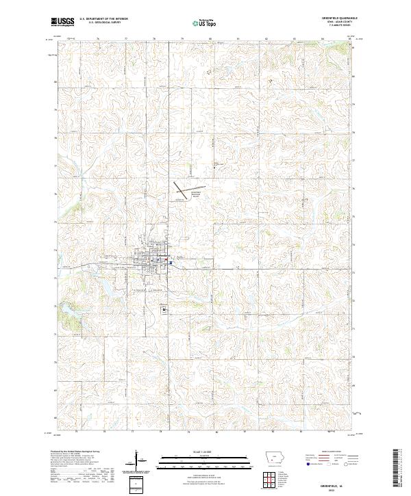 2022 Greenfield2022 Print · USGSGreenfield and its surrounding Adair County farmsteads are documented here in the early twenty-first century. Genealogists and local researchers can locate the Adair County Courthouse, the Adair County Cem, and trace the paths of the Middle Nodaway River and Thompson River.
 - 2022 Map of Orient, 2022 Print
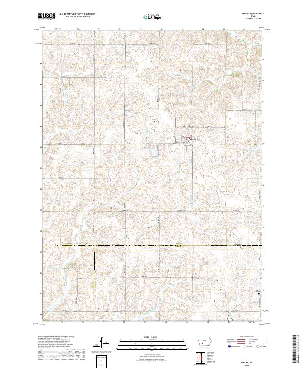 2022 Orient2022 Print · USGSAdair County and its neighbors are captured in the early twenty-first century, showing a landscape defined by the E Nodaway River. Genealogists and local historians can trace family locations near Orient Cem, Lake Orient, and the Prairie Lawn Cem.
 - 2022 Map of Rosserdale, 2022 Print
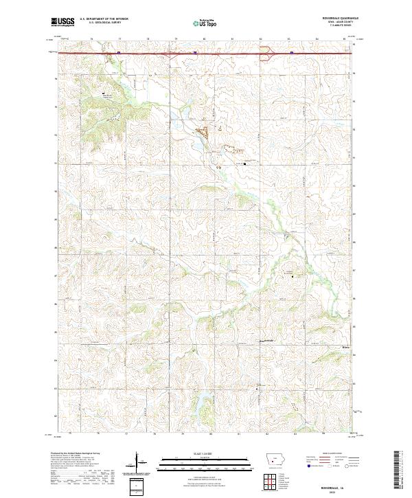 2022 Rosserdale2022 Print · USGSAdair County's agricultural heartland is documented here in the early 2020s, revealing a landscape of rolling drainage and quiet settlements. Genealogists can locate several family-named burial sites like Loucks Grove Cem and the Abandoned Timber Cem near Rosserdale.
 - 2022 Map of Zion, 2022 Print
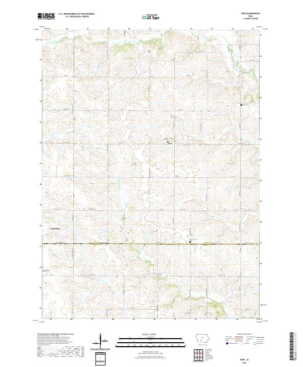 2022 Zion2022 Print · USGSAdair and Union Counties are captured here in the early twenty-first century, showing a landscape of high-prairie agriculture and winding creek beds. Researchers can trace family history at Hill of Zion Cem or follow the paths of Threemile Cr and the Thompson River.
 - 2022 Map of Bridgewater, 2022 Print
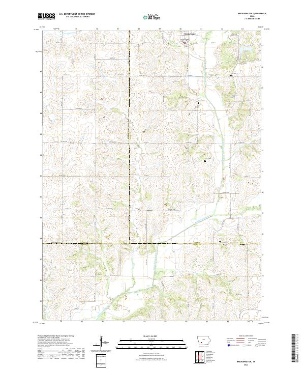 2022 Bridgewater2022 Print · USGSBridgewater and the surrounding farm country of Southwest Iowa are shown here at the start of the 2020s. Genealogists and local historians can trace family roots through rural landmarks like Witt Cem, Campbell Cem, and the banks of the Middle Nodaway River.
 - 2022 Map of Redfield, 2022 Print
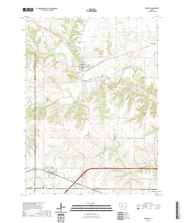 2022 Redfield2022 Print · USGSDallas County river towns and rural cemeteries are preserved in this recent survey of the Raccoon River valley. Genealogists can locate family burial sites at Spillers Cem or Bear Creek Cem and trace the legacy of Wiscotta and Redfield.
 - 2022 Map of Stuart South, 2022 Print
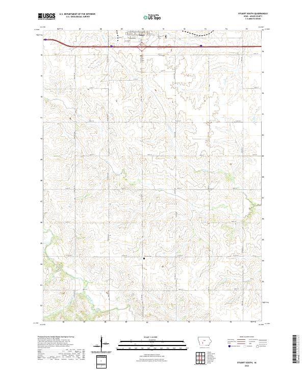 2022 Stuart South2022 Print · USGSAdair County's rolling farmland and river valleys are captured here in the early twenty-first century, just south of Stuart. Researchers can locate family sites near Calvary Cem or trace the winding paths of the Middle River and N River through the sections.
 - 2022 Map of Pitzer, 2022 Print
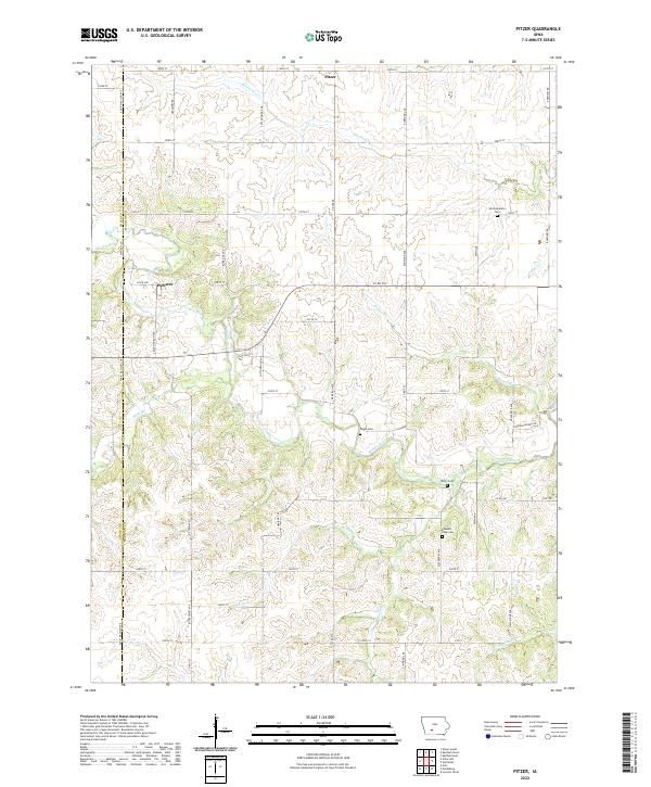 2022 Pitzer2022 Print · USGSMadison County farmland remains a network of quiet country roads and historic river crossings in the early twenty-first century. Genealogists can trace local legacies at Wintermantle Cem, Pleasant View Cem, and the small settlement of Pitzer.
 - 2022 Map of Adair South, 2022 Print
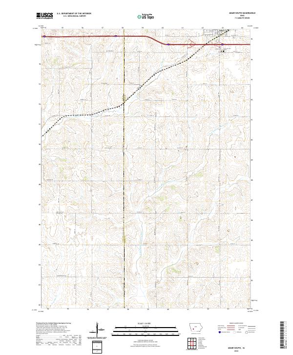 2022 Adair South2022 Print · USGSThe southern outskirts of Adair are shown here as they appeared in the early 2020s, dominated by a network of rural section roads and winding river forks. Genealogists can locate Saint Johns Cem and Sunnyhill Cem or trace family lands along Baltimore Rd and Dallas Rd.
 - 2022 Map of Stuart North, 2022 Print
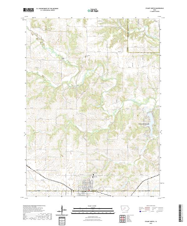 2022 Stuart North2022 Print · USGSGuthrie County and the northern outskirts of Stuart are captured here in the early 2020s, showing the intersection of river valleys and rural Iowa life. Researchers can locate local landmarks like Morrisburg Cem and the residential area around Diamondhead Lake.
End of results
Showing maps 1-20 of 20
Top cities of Adair County
- Greenfield historical maps
- Fontanelle historical maps
- Orient historical maps
- Bridgewater historical maps
Frequently asked questions
- What are the different types of historical maps available for Adair County?
- What is the oldest map of Adair County?
- Where can I purchase historical maps of Adair County for my home or office?
- Where can I download high-res historical maps of Adair County?
- Are there historical topographic maps available for Adair County?
- Is there historical aerial imagery available for Adair County?
- Where are historical maps of Adair County sourced from?