1970s Maps of Adair County, Iowa
Explore 6 historic maps of Adair County from the 1970s. These maps offer a rare glimpse into what life looked like during the 1970s — showing old roads, neighborhoods, homes, and landmarks that have changed or disappeared over time.
Whether you're researching your family's past, planning a metal detecting trip, or studying how Adair County's landscape evolved across the 1970s, these high-resolution maps are a powerful tool for exploring the history of this region.
- Focus on a specific era: All maps on this page are from the 1970s, giving you a focused view of this time period.
- See what’s changed: Compare century-old streets, trails, and buildings to today's modern landscape using overlays and satellite layers.
- Research with precision: Use these maps for genealogy, historical research, land use analysis, or educational projects.
- View, download, or print: Maps are fully viewable online in high resolution, and can be downloaded or printed for your own records.
Start exploring Adair County's history through authentic maps from the 1970s. This is your window into the past.
Adair County, IA maps
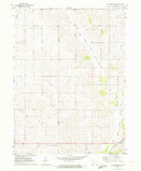
(6)- 1971 Map of Adair South, 1973 Print
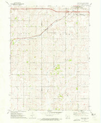 1971 Adair South1973 Print · USGSThe agricultural landscape between Adair and Cass counties is captured here in the early 1970s. Genealogists and local historians can trace the town’s footprint near St Johns Cem or follow the path of the Chicago Rock Island and Pacific rail line.
 - 1971 Map of Fontanelle, 1973 Print
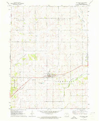 1971 Fontanelle1973 Print · USGSFontanelle and the surrounding Adair County townships are captured in the early seventies as the rail-and-river economy shaped the landscape. Researchers can trace family sites near Fontanelle Cem or follow the Burlington Northern line.
 - 1971 Map of Canby, 1973 Print
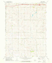 1971 Canby1973 Print · USGSAdair County farm country is captured here in the early seventies, centered on the small settlement of Canby. Family historians can trace local landmarks like Highland Ch and several burial sites including St Josephs Cem and Prussia Cem.2 unique versions available
 - 1971 Map of Casey, 1973 Print
 1971 Casey1973 Print · USGSThe town of Casey and the surrounding Guthrie County farmland are shown here in the early seventies, caught between the river valleys and the rails. Genealogists and local historians can trace the Rock Island Railroad and find the Dalmanutha Cemetery.
 - 1971 Map of Fontanelle SW, 1973 Print
 1971 Fontanelle SW1973 Print · USGSAdair and Cass County farmland is mapped here in the early 1970s as the river valleys meet the rails. Researchers can trace rural life through landmarks like St Marys Ch, the Eureka Cem, and the tracks of the BURLINGTON NORTHERN.
 - 1971 Map of Adair North, 1973 Print
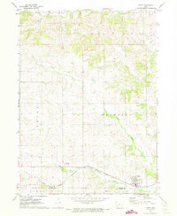
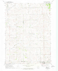 1971 Adair North1973 Print · USGSGuthrie, Audubon, and Adair counties converge in this early 1970s landscape of rolling prairie and winding creek beds. Researchers can locate specific rural landmarks like St Johns Church and Kenfield, or trace the path of the Old RR Grade.
End of results
Showing maps 1-6 of 6
Top cities of Adair County
- Greenfield historical maps
- Fontanelle historical maps
- Orient historical maps
- Bridgewater historical maps
Frequently asked questions
- What are the different types of historical maps available for Adair County?
- What is the oldest map of Adair County?
- Where can I purchase historical maps of Adair County for my home or office?
- Where can I download high-res historical maps of Adair County?
- Are there historical topographic maps available for Adair County?
- Is there historical aerial imagery available for Adair County?
- Where are historical maps of Adair County sourced from?