Old Maps of Adair County, Iowa for Metal Detecting
Plan your next treasure hunt with 133 historic maps of Adair County. Find old homesites, ghost towns, trails, and gathering spots that may be lost to time — perfect for identifying promising metal detecting locations.
- Locate forgotten sites: Uncover places like long-lost settlements, abandoned rail lines, or gathering spots.
- Plan better hunts: Use map overlays combined with LiDAR or satellite views to narrow in on historically rich areas.
- Made for detectorists: Thousands of hobbyists use these maps to discover relics, coins, and hidden history.
Use these historic maps to boost your research and find new opportunities beneath the surface of Adair County.
Adair County, IA maps
(133)- 1949 Map of Adel, 1955 Print
 1949 Adel1955 Print · USGSDallas County in the late 1940s is captured here at a moment when rural school districts and family-named corners still defined the Iowa countryside. Genealogists and historians can trace the foundations of Adel and Wiscotta, or locate landmarks like Blacks Corners and Oakland Cem.3 unique versions available
 - 1951 Map of Adel
 1951 Adel1951 Print · USGSMid-century Dallas County is defined by the convergence of the three Raccoon River forks and a robust network of rural rail towns. Genealogists can trace family roots at Oakland Cem or Pleasant Hill Cem and locate historic rural schools like Bear Creek Sch.2 unique versions available
 - 1951 Map of Afton, 1953 Print
 1951 Afton1953 Print · USGSSouthern Iowa's rural landscape is captured here in the early fifties, showing a region defined by its rail-and-river economy and dense network of country schools. Researchers can trace family history through dozens of landmarks like Mt Pisgah Cem, Macksburg, and Green Lawn Cem.2 unique versions available
 - 1952 Map of Panora, 1954 Print
 1952 Panora1954 Print · USGSGuthrie County and parts of Adair and Dallas counties are shown here in the early 1950s as a thriving rail and river corridor. Genealogists can trace family roots through several rural churches and schools like Victory Union Church, Pioneer Sch, and Rosehill Cem.2 unique versions available
 - 1952 Map of Winterset, 1954 Print
 1952 Winterset1954 Print · USGSThe heart of Madison County comes alive in the early fifties, showcasing the intricate network of country schools and churches surrounding Winterset. Genealogists can trace family names through Gordon Cem and locate the historic Harmon Tunnel near Pammel State Park.2 unique versions available
 - 1954 Map of Greenfield, 1956 Print
 1954 Greenfield1956 Print · USGSAdair County in the mid-1950s reveals a rural landscape in transition, where the rail lines through Greenfield still shaped local commerce. Genealogists can trace family footprints at Jefferson Cem, old rural schoolhouses like School No 6, and church sites like Loucks Grove Ch.
 - 1954 Map of Omaha, 1967 Print
 1954 Omaha1967 Print · USGSMid-century development radiates from the river bluffs into the agricultural heartland during this period of post-war growth. Genealogists and historians can trace rail-connected towns like Atlantic and Red Oak or locate the sprawling grounds of Offutt Air Force Base and Manawa Lake.3 unique versions available
 - 1957 Map of Omaha
 1957 Omaha1957 Print · USGSWestern Iowa and the Missouri River valley are seen here in the mid-fifties during the height of the rail-and-road era. Researchers can trace the sprawling rail lines of the Chicago And North Western or locate Cold War landmarks like Offutt Air Force Base.
 - 1958 Map of Omaha
 1958 Omaha1958 Print · USGSOmaha and Council Bluffs stand at the center of this mid-fifties landscape, where the Missouri River splits the urban plains of Nebraska from the rolling hills of western Iowa. Genealogists can trace the rail lines of the Wabash RR and Illinois Central RR to rural settlements like Missouri Valley and Red Oak.2 unique versions available
 - 1971 Map of Adair South, 1973 Print
 1971 Adair South1973 Print · USGSThe agricultural landscape between Adair and Cass counties is captured here in the early 1970s. Genealogists and local historians can trace the town’s footprint near St Johns Cem or follow the path of the Chicago Rock Island and Pacific rail line.
 - 1971 Map of Fontanelle, 1973 Print
 1971 Fontanelle1973 Print · USGSFontanelle and the surrounding Adair County townships are captured in the early seventies as the rail-and-river economy shaped the landscape. Researchers can trace family sites near Fontanelle Cem or follow the Burlington Northern line.
 - 1971 Map of Canby, 1973 Print
 1971 Canby1973 Print · USGSAdair County farm country is captured here in the early seventies, centered on the small settlement of Canby. Family historians can trace local landmarks like Highland Ch and several burial sites including St Josephs Cem and Prussia Cem.2 unique versions available
 - 1971 Map of Casey, 1973 Print
 1971 Casey1973 Print · USGSThe town of Casey and the surrounding Guthrie County farmland are shown here in the early seventies, caught between the river valleys and the rails. Genealogists and local historians can trace the Rock Island Railroad and find the Dalmanutha Cemetery.
 - 1971 Map of Fontanelle SW, 1973 Print
 1971 Fontanelle SW1973 Print · USGSAdair and Cass County farmland is mapped here in the early 1970s as the river valleys meet the rails. Researchers can trace rural life through landmarks like St Marys Ch, the Eureka Cem, and the tracks of the BURLINGTON NORTHERN.
 - 1971 Map of Adair North, 1973 Print
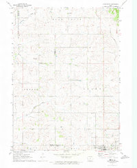 1971 Adair North1973 Print · USGSGuthrie, Audubon, and Adair counties converge in this early 1970s landscape of rolling prairie and winding creek beds. Researchers can locate specific rural landmarks like St Johns Church and Kenfield, or trace the path of the Old RR Grade.
 - 1980 Map of Nevinville, 1981 Print
 1980 Nevinville1981 Print · USGSAdair and Adams counties in the early eighties are defined by the winding Middle Nodaway River and scattered farmstead communities. Genealogists and local historians can locate Rose Hill Cem, Mormon Cem, and several rural country churches like Penn Avenue Ch.
 - 1980 Map of Bridgewater, 1981 Print
 1980 Bridgewater1981 Print · USGSBridgewater and its surrounding townships are shown here during the late seventies, a period of established rail lines and preserved pioneer history. Genealogists can locate family burial sites like Winn Cem or explore the area around Mormon Trail County Park.
 - 1981 Map of Zion
 1981 Zion1981 Print · USGSSouthern Iowa's rural landscape is captured here in the early eighties, showing a network of agricultural townships and family homesteads. Genealogists and historians can trace the local landmarks of Zion, find quiet burial grounds like Wilson Cem, and follow the Burlington Northern rail line.
 - 1981 Map of Orient
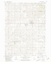 1981 Orient1981 Print · USGSAdair County farm country is captured here in the early eighties, centered on the railroad hub of Orient. Genealogists and local historians can trace legacy sites like the Prairie Lawn Cemetery or the rural settlements of Nevinville and Spaulding.
 - 1982 Map of Redfield, 1983 Print
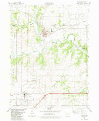 1982 Redfield1983 Print · USGSRedfield and Dexter flourished as rail and river towns in the early 1980s, serving as industrial and agricultural centers for Dallas County. Genealogists and historians can trace local family lineages through several rural burial grounds, including Harper Cem, Spillers Cem, and the historic Bear Creek Ch.
 - 1982 Map of Stuart North, 1983 Print
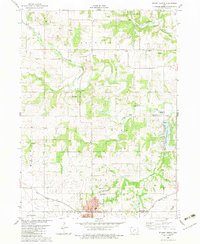 1982 Stuart North1983 Print · USGSGuthrie and Adair counties come into focus in the early eighties as the rail-and-river economy centers on the town of Stuart. Researchers can trace the path of the Iowa Railroad or locate family plots at Morrisburg Cem and North Oak Grove Cem.
 - 1982 Map of Menlo, 1983 Print
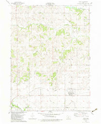 1982 Menlo1983 Print · USGSGuthrie and Adair counties appear in the early eighties as a landscape of established rail lines and agricultural watersheds. Genealogists and historians can trace the Iowa Railroad through Menlo, locate Rosehill Cem, and follow the Old Railroad Grade near Glendon.
 - 1983 Map of Rosserdale, 1984 Print
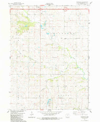 1983 Rosserdale1984 Print · USGSAdair County's rural townships are captured in the early 1980s, showcasing the transition between traditional farming communities and modern infrastructure. Genealogists and local historians can locate several family-centric landmarks including Rosserdale, Jefferson Center Ch, and Grove Center Cem.
 - 1983 Map of Earlham West, 1984 Print
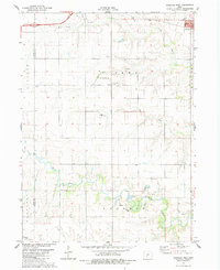 1983 Earlham West1984 Print · USGSMadison County's agricultural heartland is documented here in the early eighties, just as the modern interstate began to reshape rural travel. Trace family history and local landmarks through sites like Old Penn Center Cem, Early Chapel, and the riverfront quarries.
 - 1983 Map of Stuart South, 1984 Print
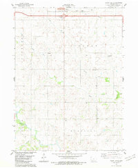 1983 Stuart South1984 Print · USGSAdair County farm country is captured here in the early 1980s, centered on the rural townships south of the Interstate. Genealogists and local historians can locate the Fairview Ch, Mt Vernon Ch, and the small settlement of Townhall.
Showing maps 1-25 of 133
Top cities of Adair County
- Greenfield historical maps
- Fontanelle historical maps
- Orient historical maps
- Bridgewater historical maps
Frequently asked questions
- What are the different types of historical maps available for Adair County?
- What is the oldest map of Adair County?
- Where can I purchase historical maps of Adair County for my home or office?
- Where can I download high-res historical maps of Adair County?
- Are there historical topographic maps available for Adair County?
- Is there historical aerial imagery available for Adair County?
- Where are historical maps of Adair County sourced from?