Old Maps of Raymond, Iowa for Genealogy
Trace your family roots with 15 historic maps of Raymond. These high-res maps reveal old neighborhoods, homesites, landmarks, and streets — helping you uncover where your ancestors lived and how the area evolved over time.
- Explore historic neighborhoods: Identify where your relatives may have lived in the 1800s or 1900s.
- Compare maps over time: Trace the changes in streets, buildings, and landmarks for multi-generational research.
- Perfect for genealogy & ancestry research: Used by family historians and researchers to map out lineage and migration.
These maps are an incredible resource for exploring your personal connection to Raymond's past.
Raymond, IA maps
(15)- 1954 Map of Waterloo, 1968 Print
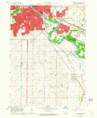
 1954 Waterloo1968 Print · USGSCentral Iowa at the height of its mid-century agricultural and rail boom features the growing hubs of Waterloo and Cedar Falls. Genealogists and researchers can trace the rail corridors of the Chicago Great Western and find local landmarks like Iowa State College and Brushy Ridge.4 unique versions available
 - 1955 Map of Waterloo
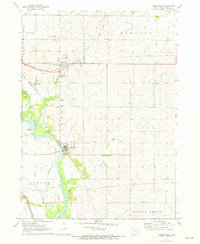
 1955 Waterloo1955 Print · USGSCentral Iowa in the mid-fifties presents a dense landscape of rail-connected farming towns and growing river cities. Researchers can trace ancestral roots and old transport routes through Waterloo, Marshalltown, and Ames, while locating rural Cemeteries and local Quarries.2 unique versions available
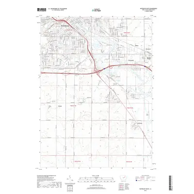
 - 1963 Map of Waterloo South, 1964 Print
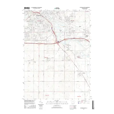
 1963 Waterloo South1964 Print · USGSMid-century Black Hawk County comes alive in this survey of the riverfront industrial and residential sprawl. Genealogists and local historians can trace family roots through numerous burial grounds like Elmwood Cemetery or locate vanished landmarks like the Flyers Airport and Drive-in Theater.3 unique versions available
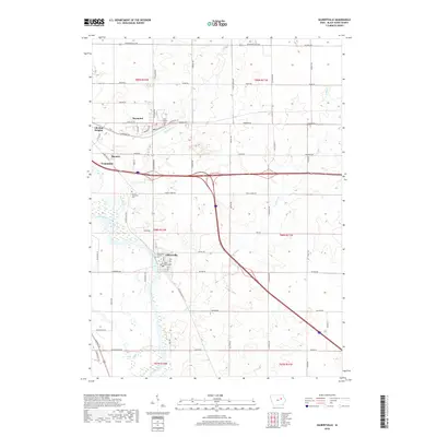
 - 1971 Map of Gilbertville, 1973 Print
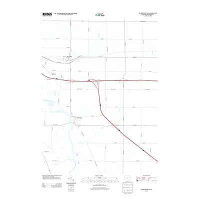
 1971 Gilbertville1973 Print · USGSBlack Hawk County comes into focus in the early seventies as the agricultural and industrial landscape around Gilbertville is meticulously recorded. Researchers can trace the paths of the Illinois Central railroad and locate local landmarks like the Township Cem and Raymar.
 - 1984 Map of Marshalltown, 1985 Print
 1984 Marshalltown1985 Print · USGSMid-Iowa's agricultural landscape and river corridors come alive in the mid-eighties as the Cedar River connects industrial hubs and small farm towns. Trace the tracks of the CHICAGO AND NORTHWESTERN or locate local landmarks like Union Grove State Park and Cedar Falls Junction.2 unique versions available
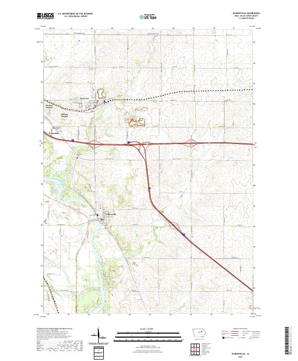
 - 2010 Map of Gilbertville, 2010 Print
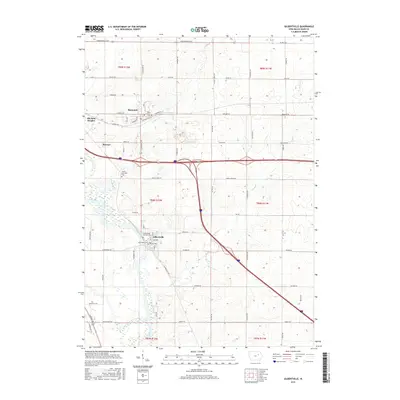
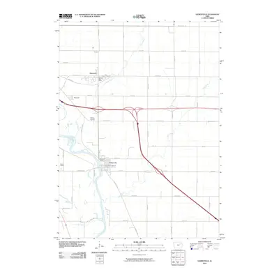 2010 Gilbertville2010 Print · USGSCovers Raymond, including Evansdale, Elk Run Heights, and other nearby areas
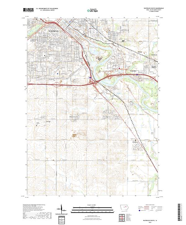
 - 2010 Map of Waterloo South, 2010 Print
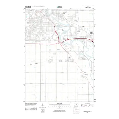 2010 Waterloo South2010 Print · USGSCovers Raymond, including Waterloo, Evansdale, and other nearby areas
 - 2013 Map of Gilbertville, 2013 Print
 2013 Gilbertville2013 Print · USGSCovers Raymond, including Evansdale, Elk Run Heights, and other nearby areas
 - 2013 Map of Waterloo South, 2013 Print
 2013 Waterloo South2013 Print · USGSCovers Raymond, including Waterloo, Evansdale, and other nearby areas
 - 2015 Map of Gilbertville, 2015 Print
 2015 Gilbertville2015 Print · USGSCovers Raymond, including Evansdale, Elk Run Heights, and other nearby areas
 - 2015 Map of Waterloo South, 2015 Print
 2015 Waterloo South2015 Print · USGSCovers Raymond, including Waterloo, Evansdale, and other nearby areas
 - 2018 Map of Waterloo South, 2018 Print
 2018 Waterloo South2018 Print · USGSCovers Raymond, including Waterloo, Evansdale, and other nearby areas
 - 2018 Map of Gilbertville, 2018 Print
 2018 Gilbertville2018 Print · USGSCovers Raymond, including Evansdale, Elk Run Heights, and other nearby areas
 - 2022 Map of Gilbertville, 2022 Print
 2022 Gilbertville2022 Print · USGSBlack Hawk County's river-fed landscapes and rural townships are captured here during a period of modern expansion. Researchers can trace family sites at Saint Mary's Cem, explore the riverside near Gilbertville, or follow the path of the Cedar Valley Nature Trl.
 - 2022 Map of Waterloo South, 2022 Print
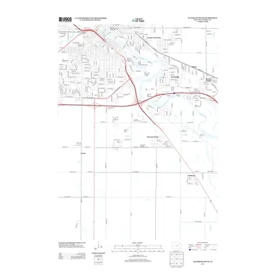
 2022 Waterloo South2022 Print · USGSBlack Hawk County's riverfront communities come into focus in this contemporary survey of the Cedar River valley. Genealogists and local historians can trace family ties through Sons of Jacob Cem, Elmwood Cem, and the Black Hawk County Courthouse.
End of results
Showing maps 1-15 of 15
Top cities near Raymond
- Waterloo historical maps
- Cedar Falls historical maps
- Evansdale historical maps
- Hudson historical maps
- Jesup historical maps
- La Porte City historical maps
See more
Frequently asked questions
- What are the different types of historical maps available for Raymond?
- What is the oldest map of Raymond?
- Where can I purchase historical maps of Raymond for my home or office?
- Where can I download high-res historical maps of Raymond?
- Are there historical topographic maps available for Raymond?
- Is there historical aerial imagery available for Raymond?
- Where are historical maps of Raymond sourced from?