1980s Maps of Marcy Township, Iowa
Explore 6 historic maps of Marcy Township from the 1980s. These maps offer a rare glimpse into what life looked like during the 1980s — showing old roads, neighborhoods, homes, and landmarks that have changed or disappeared over time.
Whether you're researching your family's past, planning a metal detecting trip, or studying how Marcy Township's landscape evolved across the 1980s, these high-resolution maps are a powerful tool for exploring the history of this region.
- Focus on a specific era: All maps on this page are from the 1980s, giving you a focused view of this time period.
- See what’s changed: Compare century-old streets, trails, and buildings to today's modern landscape using overlays and satellite layers.
- Research with precision: Use these maps for genealogy, historical research, land use analysis, or educational projects.
- View, download, or print: Maps are fully viewable online in high resolution, and can be downloaded or printed for your own records.
Start exploring Marcy Township's history through authentic maps from the 1980s. This is your window into the past.
Marcy Township, IA maps
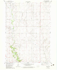
(6)- 1982 Map of Ogden, 1983 Print
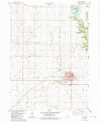 1982 Ogden1983 Print · USGSOgden and the surrounding Boone County farmland are captured in the early eighties as a hub of rail-and-road transport. Genealogists and researchers can locate several rural cemeteries like Maas Cem and family-named schools such as Howe Sch.
 - 1982 Map of Berkley, 1983 Print
 1982 Berkley1983 Print · USGSThe rural landscape around Berkley in the early eighties reveals a community organized by the drainage of Beaver Creek and its tributaries. Local researchers can trace family sites near Peoples Cem, Moore Cem, and historic pulpits like Swede Valley Ch.
 - 1984 Map of Des Moines, 1985 Print
 1984 Des Moines1985 Print · USGSCentral Iowa's heartland is captured in the mid-1980s as suburban growth met long-standing farm and rail infrastructure. Genealogists and researchers can trace the reaches of the Chicago and North Western through Maxwell or locate Laurel Hill Cem and Camp Dodge Military Reservation.2 unique versions available
 - 1984 Map of Guthrie Center, 1985 Print
 1984 Guthrie Center1985 Print · USGSWest-central Iowa's river valleys and farming townships are shown here in the mid-1980s, highlighting a network of conservation areas and historic rail towns. Genealogists and local historians can locate Violet Hill Cem, trace the Chicago and North Western railroad, or explore the grounds of Springbrook State Park.
 - 1985 Map of Carroll
 1985 Carroll1985 Print · USGSWest-Central Iowa in the mid-eighties shows a landscape of highly engineered farmland and river-valley conservation. Researchers can trace the drainage patterns of Purgatory Creek or locate local landmarks like Dolliver Memorial State Park and the rail-junction town of Gowrie.
 - 1985 Map of Ames
 1985 Ames1985 Print · USGSCentral Iowa's prairie landscape in the mid-eighties shows a well-established network of rail towns and conservation areas. Genealogists and historians can trace the paths of the Lincoln Highway and the Chicago and North Western line connecting Ames, Boone, and Webster City.
End of results
Showing maps 1-6 of 6
Top cities near Marcy Township
- Boone historical maps
- Perry historical maps
- Polk City historical maps
- Madrid historical maps
- Ogden historical maps
- Granger historical maps
See more
Top neighborhoods of Marcy Township
Frequently asked questions
- What are the different types of historical maps available for Marcy Township?
- What is the oldest map of Marcy Township?
- Where can I purchase historical maps of Marcy Township for my home or office?
- Where can I download high-res historical maps of Marcy Township?
- Are there historical topographic maps available for Marcy Township?
- Is there historical aerial imagery available for Marcy Township?
- Where are historical maps of Marcy Township sourced from?