1900s (20th Century) Maps of Marcy Township, Iowa
Explore 29 historic maps of Marcy Township from the 1900s (20th Century). These maps offer a rare glimpse into what life looked like during the 1900s — showing old roads, neighborhoods, homes, and landmarks that have changed or disappeared over time.
Whether you're researching your family's past, planning a metal detecting trip, or studying how Marcy Township's landscape evolved across the 1900s, these high-resolution maps are a powerful tool for exploring the history of this region.
- Focus on a specific era: All maps on this page are from the 1900s, giving you a focused view of this time period.
- See what’s changed: Compare century-old streets, trails, and buildings to today's modern landscape using overlays and satellite layers.
- Research with precision: Use these maps for genealogy, historical research, land use analysis, or educational projects.
- View, download, or print: Maps are fully viewable online in high resolution, and can be downloaded or printed for your own records.
Start exploring Marcy Township's history through authentic maps from the 1900s. This is your window into the past.
Marcy Township, IA maps
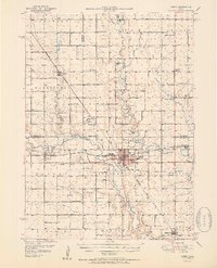
(29)- 1911 Map of Madrid, 1958 Print
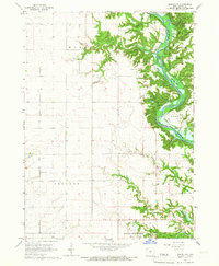
 1911 Madrid1958 Print · USGSBoone and Dallas counties appear here in the early twentieth century as a busy corridor of river-valley agriculture and rail transit. Researchers can trace dozens of early rural school sites like Hull School and Gildea School alongside the path of the Inter-Urban Railway.
 - 1914 Map of Madrid
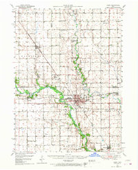
 1914 Madrid1914 Print · USGSCentral Iowa's river valleys and prairie townships come alive in the decade before the Great War, showing a landscape defined by rail lines and rural schoolhouses. Genealogists and historians can trace family roots through specific landmarks like Madrid, Woodward, and the Marcy Center School.3 unique versions available
 - 1916 Map of Boone
 1916 Boone1916 Print · USGSBoone and the Des Moines River valley appear here in the decade before the Great War, showing a landscape defined by deep river bluffs and heavy rail traffic. Genealogists can locate dozens of named rural schools such as Incline School and Coal Valley School, or trace the riverside streets of Moingona and Fraser.3 unique versions available
 - 1950 Map of Perry, 1968 Print
 1950 Perry1968 Print · USGSMid-century Dallas and Boone Counties are captured here at a peak of rural development, showing a landscape defined by prairie agriculture and heavy rail. Genealogists can trace family footprints across dozens of country schools like Garfield Sch and churches including Swede Valley Ch.
 - 1951 Map of Perry
 1951 Perry1951 Print · USGSMid-century central Iowa comes into focus in this detailed study of the rail and river corridors surrounding Perry. Genealogists and historians can trace the locations of dozens of country schools and cemeteries, from Prairie View Sch to the Violet Hill Cem.2 unique versions available
 - 1951 Map of Ogden
 1951 Ogden1951 Print · USGSCentral Iowa's farming heartland is captured here in the early fifties, showing a landscape defined by the intersection of the Chicago North Western and the Fort Dodge Des Moines and Southern. Researchers can trace vanished rural schoolhouses like Kelly Sch and the family history tied to Union Cem or Boxholm.3 unique versions available
 - 1954 Map of Omaha, 1967 Print
 1954 Omaha1967 Print · USGSMid-century development radiates from the river bluffs into the agricultural heartland during this period of post-war growth. Genealogists and historians can trace rail-connected towns like Atlantic and Red Oak or locate the sprawling grounds of Offutt Air Force Base and Manawa Lake.3 unique versions available
 - 1954 Map of Waterloo, 1968 Print
 1954 Waterloo1968 Print · USGSCentral Iowa at the height of its mid-century agricultural and rail boom features the growing hubs of Waterloo and Cedar Falls. Genealogists and researchers can trace the rail corridors of the Chicago Great Western and find local landmarks like Iowa State College and Brushy Ridge.4 unique versions available
 - 1954 Map of Fort Dodge, 1968 Print
 1954 Fort Dodge1968 Print · USGSNorthwest Iowa is shown here during a period of steady industrial and rail activity in the mid-fifties. Researchers can trace the extensive rail lines connecting Fort Dodge to mining and manufacturing sites like Gypsum and Industry Station.3 unique versions available
 - 1954 Map of Des Moines, 1973 Print
 1954 Des Moines1973 Print · USGSCentral Iowa's evolving landscape is captured here in the early seventies, just as major reservoirs were reshaping the river valleys. Genealogists and historians can trace the rail corridors of the Burlington Northern or locate family roots near Pella, Indianola, and Knoxville.2 unique versions available
 - 1955 Map of Waterloo
 1955 Waterloo1955 Print · USGSCentral Iowa in the mid-fifties presents a dense landscape of rail-connected farming towns and growing river cities. Researchers can trace ancestral roots and old transport routes through Waterloo, Marshalltown, and Ames, while locating rural Cemeteries and local Quarries.2 unique versions available
 - 1956 Map of Des Moines
 1956 Des Moines1956 Print · USGSCentral Iowa in the mid-fifties shows a landscape defined by bustling rail hubs and deep-rooted agricultural research. Genealogists and researchers can trace the growth of Des Moines and Ames, locate the Sac and Fox Indian Reservation, or study the paths of the Skunk River and South Skunk River.
 - 1957 Map of Des Moines
 1957 Des Moines1957 Print · USGSCentral Iowa's post-war landscape is defined here by the converging rail lines and river valleys that shaped its earliest settlements. Genealogists and historians can trace the paths of the Rock Island Railroad and locate community landmarks in Des Moines, Ames, and Newton.
 - 1957 Map of Omaha
 1957 Omaha1957 Print · USGSWestern Iowa and the Missouri River valley are seen here in the mid-fifties during the height of the rail-and-road era. Researchers can trace the sprawling rail lines of the Chicago And North Western or locate Cold War landmarks like Offutt Air Force Base.
 - 1957 Map of Fort Dodge
 1957 Fort Dodge1957 Print · USGSWest-central Iowa thrived as a network of rail-linked agricultural hubs and river towns during the mid-fifties. Researchers can trace the development of the Des Moines River valley and locate historic landmarks in Fort Dodge, Storm Lake, and Lehigh.
 - 1958 Map of Omaha
 1958 Omaha1958 Print · USGSOmaha and Council Bluffs stand at the center of this mid-fifties landscape, where the Missouri River splits the urban plains of Nebraska from the rolling hills of western Iowa. Genealogists can trace the rail lines of the Wabash RR and Illinois Central RR to rural settlements like Missouri Valley and Red Oak.2 unique versions available
 - 1958 Map of Fort Dodge
 1958 Fort Dodge1958 Print · USGSWestern Iowa in the mid-1950s reveals a productive landscape of river-valley industry and prairie agricultural hubs. Researchers can trace the development of the Des Moines River corridor through Fort Dodge and locate vanished local landmarks near Coalville or Storm Lake.
 - 1965 Map of Boone West, 1966 Print
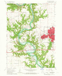 1965 Boone West1966 Print · USGSThe Des Moines River valley in the mid-1960s shows a landscape of deep ravines, active mining, and new water management. Trace local history through Moingona, Battin Chapel, and the vanished Mine Dump sites near Logansport.2 unique versions available
 - 1965 Map of Madrid NW, 1967 Print
 1965 Madrid NW1967 Print · USGSBoone County river life is captured here in the mid-sixties, just as the valley prepared for the waters of the Saylorville Reservoir. Genealogists and hikers can trace old landmarks like Peoples Cem, the Hubby Bridge, and the ridges of Ledges State Park.2 unique versions available
 - 1969 Map of Des Moines
 1969 Des Moines1969 Print · USGSCentral Iowa's fertile plains and growing capital are captured here during the late sixties, a time of major highway expansion and reservoir construction. Genealogists and researchers can trace rural township boundaries, local cemeteries, and rail lines serving towns like Pella, Grinnell, and Oskaloosa.
 - 1982 Map of Ogden, 1983 Print
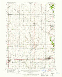
 1982 Ogden1983 Print · USGSOgden and the surrounding Boone County farmland are captured in the early eighties as a hub of rail-and-road transport. Genealogists and researchers can locate several rural cemeteries like Maas Cem and family-named schools such as Howe Sch.
 - 1982 Map of Berkley, 1983 Print
 1982 Berkley1983 Print · USGSThe rural landscape around Berkley in the early eighties reveals a community organized by the drainage of Beaver Creek and its tributaries. Local researchers can trace family sites near Peoples Cem, Moore Cem, and historic pulpits like Swede Valley Ch.
 - 1984 Map of Des Moines, 1985 Print
 1984 Des Moines1985 Print · USGSCentral Iowa's heartland is captured in the mid-1980s as suburban growth met long-standing farm and rail infrastructure. Genealogists and researchers can trace the reaches of the Chicago and North Western through Maxwell or locate Laurel Hill Cem and Camp Dodge Military Reservation.2 unique versions available
 - 1984 Map of Guthrie Center, 1985 Print
 1984 Guthrie Center1985 Print · USGSWest-central Iowa's river valleys and farming townships are shown here in the mid-1980s, highlighting a network of conservation areas and historic rail towns. Genealogists and local historians can locate Violet Hill Cem, trace the Chicago and North Western railroad, or explore the grounds of Springbrook State Park.
 - 1985 Map of Carroll
 1985 Carroll1985 Print · USGSWest-Central Iowa in the mid-eighties shows a landscape of highly engineered farmland and river-valley conservation. Researchers can trace the drainage patterns of Purgatory Creek or locate local landmarks like Dolliver Memorial State Park and the rail-junction town of Gowrie.
Showing maps 1-25 of 29
Top cities near Marcy Township
- Boone historical maps
- Perry historical maps
- Polk City historical maps
- Madrid historical maps
- Ogden historical maps
- Granger historical maps
See more
Top neighborhoods of Marcy Township
Frequently asked questions
- What are the different types of historical maps available for Marcy Township?
- What is the oldest map of Marcy Township?
- Where can I purchase historical maps of Marcy Township for my home or office?
- Where can I download high-res historical maps of Marcy Township?
- Are there historical topographic maps available for Marcy Township?
- Is there historical aerial imagery available for Marcy Township?
- Where are historical maps of Marcy Township sourced from?