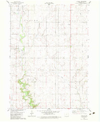
1982 Map of Berkley
USGS Topo · Published 1983About this map
Berkley serves as the primary settlement on this central Iowa landscape, positioned near the winding course of Jim Creek. The topography is defined by the convergence of the Beaver Creek drainage system, including Middle Beaver Cr and Little Beaver Creek, which carve distinct valleys through the surrounding agricultural plains. The layout of the land reflects a deeply rooted rural community, organized by the townships of Beaver, Marcy, Union, and Peoples.
Find a feature on this map
17 named features on this map. Tap any name to fly to it.
Don’t see what you’re looking for? This feature index may not catch every label — zoom into the map to look around manually.
Map Details
Editions of this 1982 Berkley Map
This is the sole edition of this map. No revisions or reprints were ever made.
Other maps of this area

1911 · Madrid
USGS Topo · 1:62,500

1914 · Madrid
USGS Topo · 1:62,500

1916 · Boone
USGS Topo · 1:62,500

1950 · Perry
USGS Topo · 1:62,500

1951 · Perry
USGS Topo · 1:62,500

1951 · Ogden
USGS Topo · 1:62,500

1954 · Omaha
USGS Topo · 1:250,000

1954 · Waterloo
USGS Topo · 1:250,000

1954 · Fort Dodge
USGS Topo · 1:250,000

1954 · Des Moines
USGS Topo · 1:250,000