2020s Maps of Spencer, Iowa
Explore 4 historic maps of Spencer from the 2020s. These maps offer a rare glimpse into what life looked like during the 2020s — showing old roads, neighborhoods, homes, and landmarks that have changed or disappeared over time.
Whether you're researching your family's past, planning a metal detecting trip, or studying how Spencer's landscape evolved across the 2020s, these high-resolution maps are a powerful tool for exploring the history of this region.
- Focus on a specific era: All maps on this page are from the 2020s, giving you a focused view of this time period.
- See what’s changed: Compare century-old streets, trails, and buildings to today's modern landscape using overlays and satellite layers.
- Research with precision: Use these maps for genealogy, historical research, land use analysis, or educational projects.
- View, download, or print: Maps are fully viewable online in high resolution, and can be downloaded or printed for your own records.
Start exploring Spencer's history through authentic maps from the 2020s. This is your window into the past.
Spencer, IA maps
(4)- 2022 Map of Spencer, 2022 Print
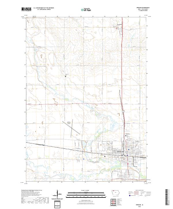 2022 Spencer2022 Print · USGSClay County’s agricultural and civic center is captured in the early 2020s as Spencer continues its role as a regional hub. Researchers can locate established landmarks like the Clay County Courthouse and trace the paths of the Little Sioux River and Ocheyedan River.
 - 2022 Map of Gillett Grove, 2022 Print
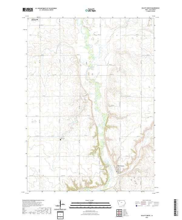 2022 Gillett Grove2022 Print · USGSClay County at the start of the 2020s remains a landscape defined by the winding Little Sioux River and organized rural townships. Researchers can trace the layout of Gillett Grove, locate the Rosehill Cem, and follow the path of Elk Cr.
 - 2022 Map of Greenville, 2022 Print
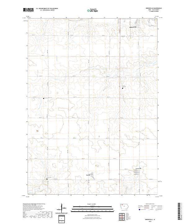 2022 Greenville2022 Print · USGSThe rural landscapes of Clay County are captured here in the early twenty-first century, showing the small agricultural hubs of Greenville and Rossie. Researchers can trace old family sites near Swedish-Lutheran Cem or follow the path of Prairie Cr.
 - 2022 Map of Dickens, 2022 Print
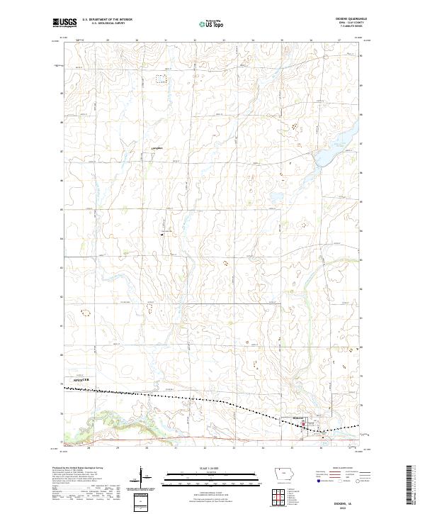 2022 Dickens2022 Print · USGSClay County's agricultural heartland is documented here in the early twenty-first century, centered on the community of Dickens. Researchers can trace old family burial grounds at Fairview Cem and navigate the intricate wetlands of Dan Green Slough and Pickerel Run.
End of results
Showing maps 1-4 of 4
Top cities near Spencer
- Milford historical maps
- Arnolds Park historical maps
- Okoboji historical maps
- Everly historical maps
- Royal historical maps
- Wahpeton historical maps
See more
Top neighborhoods of Spencer
Frequently asked questions
- What are the different types of historical maps available for Spencer?
- What is the oldest map of Spencer?
- Where can I purchase historical maps of Spencer for my home or office?
- Where can I download high-res historical maps of Spencer?
- Are there historical topographic maps available for Spencer?
- Is there historical aerial imagery available for Spencer?
- Where are historical maps of Spencer sourced from?