Old Maps of Guttenberg, Iowa for Genealogy
Trace your family roots with 12 historic maps of Guttenberg. These high-res maps reveal old neighborhoods, homesites, landmarks, and streets — helping you uncover where your ancestors lived and how the area evolved over time.
- Explore historic neighborhoods: Identify where your relatives may have lived in the 1800s or 1900s.
- Compare maps over time: Trace the changes in streets, buildings, and landmarks for multi-generational research.
- Perfect for genealogy & ancestry research: Used by family historians and researchers to map out lineage and migration.
These maps are an incredible resource for exploring your personal connection to Guttenberg's past.
Guttenberg, IA maps
(12)- 1902 Map of Elkader
 1902 Elkader1902 Print · USGSNortheast Iowa at the turn of the century is defined by the deep river valleys of the Mississippi, Turkey, and Volga. Genealogists and historians can trace rail lines and early settlements like Elkader, Guttenberg, and Elkport as they appeared in 1898.4 unique versions available
 - 1959 Map of Dubuque, 1982 Print
 1959 Dubuque1982 Print · USGSThe Tri-State region comes alive in the mid-twentieth century as a hub of river commerce and rail transit. Genealogists and historians can trace the paths of the Illinois Central Gulf through Dubuque or locate the Savanna Ordnance Depot and Lock and Dam No 11.
 - 1961 Map of Dubuque
 1961 Dubuque1961 Print · USGSThe Tri-State region's river-and-rail landscape is captured here during the early sixties, showing the convergence of Iowa, Illinois, and Wisconsin. Trace mid-century rail lines like the Chicago Great Western Ry and explore sites like the Savanna Ordnance Depot and Backbone State Park.
 - 1962 Map of Dubuque
 1962 Dubuque1962 Print · USGSThe Tri-State region's river-and-rail economy is captured here in the early sixties, centered on the Mississippi River bluffs. Genealogists and historians can locate Numerous lead and zinc mines, the New Melleray Abbey Monastery, and rural hubs like Saint Olaf.2 unique versions available
 - 1962 Map of Guttenberg, 1964 Print
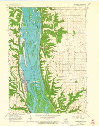 1962 Guttenberg1964 Print · USGSThe Mississippi River corridor appears in transition during the early sixties, marking the state line between Iowa and Wisconsin. Trace old rail lines, family burial sites like Scott Cem, and river navigation landmarks including Lock and Dam No 10.2 unique versions available
 - 1976 Map of Dubuque
 1976 Dubuque1976 Print · USGSThe tri-state borderlands of Iowa, Wisconsin, and Illinois come alive during the mid-seventies, showing a region built on river commerce and mining. Genealogists and historians can trace the paths of the Illinois Central railroad or locate heritage sites like the New Melleray Abbey Monastery and Backbone State Park.
 - 1984 Map of Oelwein, 1985 Print
 1984 Oelwein1985 Print · USGSNortheast Iowa and the Mississippi riverfront appear in detail during the 1980s, showing a land defined by deep river valleys and high ridges. Genealogists and historians can trace the Chicago and North Western rail line and locate rural sites like St Sebald Ch and Quaker Mill Pond.2 unique versions available
 - 2010 Map of Guttenberg, 2010 Print
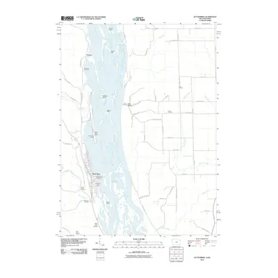 2010 Guttenberg2010 Print · USGSCovers Guttenberg, including Glen Haven, Eckards, and other nearby areas
 - 2013 Map of Guttenberg, 2013 Print
 2013 Guttenberg2013 Print · USGSCovers Guttenberg, including Glen Haven, Eckards, and other nearby areas
 - 2015 Map of Guttenberg, 2015 Print
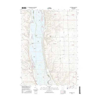 2015 Guttenberg2015 Print · USGSCovers Guttenberg, including Glen Haven, Eckards, and other nearby areas
 - 2018 Map of Guttenberg, 2018 Print
 2018 Guttenberg2018 Print · USGSCovers Guttenberg, including Glen Haven, Eckards, and other nearby areas
 - 2022 Map of Guttenberg, 2022 Print
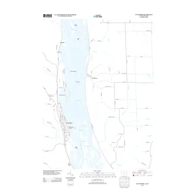
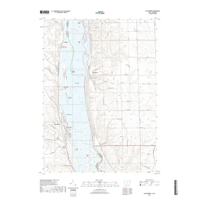
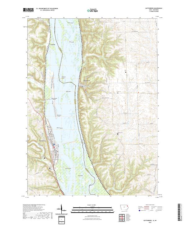 2022 Guttenberg2022 Print · USGSThe Mississippi River valley corridor comes into sharp focus during the 2020s, showing the intricate geography of the Iowa and Wisconsin border. Local historians can trace river features like Swift Slough or locate family plots at Charlotte Cemetery and Scott Cemetery.
End of results
Showing maps 1-12 of 12
Top cities near Guttenberg
- Prairie du Chien historical maps
- Cassville historical maps
- Bridgeport historical maps
- Garnavillo historical maps
- McGregor historical maps
- Beetown historical maps
See more
Frequently asked questions
- What are the different types of historical maps available for Guttenberg?
- What is the oldest map of Guttenberg?
- Where can I purchase historical maps of Guttenberg for my home or office?
- Where can I download high-res historical maps of Guttenberg?
- Are there historical topographic maps available for Guttenberg?
- Is there historical aerial imagery available for Guttenberg?
- Where are historical maps of Guttenberg sourced from?