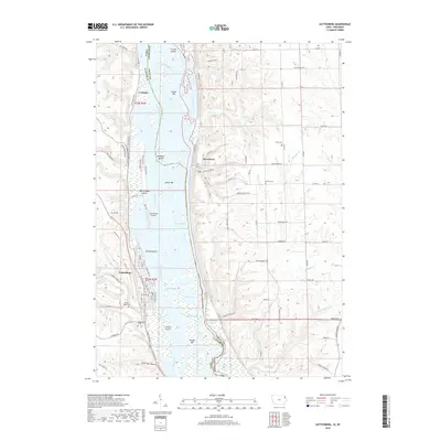
2018 Map of Guttenberg
USGS Topo · Published 2018About this map
The Mississippi River defines this riverfront landscape, serving as the border between Iowa and Wisconsin. On the western bank, the town of Guttenberg is situated on a narrow terrace beneath high bluffs, its grid of streets including South River Park Drive and North 1st Street following the river’s curve. Across the complex network of side channels and islands like McMillan Island and Goetz Island, the village of Glen Haven occupies a small valley on the eastern side. The terrain is characterized by dramatic elevation changes, where features such as Walnut Bluff and Squirrel Hollow overlook the winding Cassville Slough. Local history is preserved in numerous upland cemeteries, including Mount Olivet Cemetery and Scott Cemetery, while the GAA Private Airport and the Great River Road represent the modern transportation infrastructure threading through this ancient river valley.
Find a feature on this map
99 named features on this map. Tap any name to fly to it.
Don’t see what you’re looking for? This feature index may not catch every label — zoom into the map to look around manually.
Map Details
Editions of this 2018 Guttenberg Map
This is the sole edition of this map. No revisions or reprints were ever made.
Other maps of this area

1900 · Lancaster
USGS Topo · 1:125,000

1902 · Elkader
USGS Topo · 1:125,000

1904 · Lancaster
USGS Topo · 1:125,000

1908 · Lancaster
USGS Topo · 1:125,000

1955 · Cassville
USGS Topo · 1:24,000

1957 · Turkey River
USGS Topo · 1:24,000

1957 · Colesburg
USGS Topo · 1:24,000

1959 · Dubuque
USGS Topo · 1:250,000

1961 · Dubuque
USGS Topo · 1:250,000

1962 · Dubuque
USGS Topo · 1:250,000