1900s (20th Century) Maps of Clinton, Iowa
Explore 10 historic maps of Clinton from the 1900s (20th Century). These maps offer a rare glimpse into what life looked like during the 1900s — showing old roads, neighborhoods, homes, and landmarks that have changed or disappeared over time.
Whether you're researching your family's past, planning a metal detecting trip, or studying how Clinton's landscape evolved across the 1900s, these high-resolution maps are a powerful tool for exploring the history of this region.
- Focus on a specific era: All maps on this page are from the 1900s, giving you a focused view of this time period.
- See what’s changed: Compare century-old streets, trails, and buildings to today's modern landscape using overlays and satellite layers.
- Research with precision: Use these maps for genealogy, historical research, land use analysis, or educational projects.
- View, download, or print: Maps are fully viewable online in high resolution, and can be downloaded or printed for your own records.
Start exploring Clinton's history through authentic maps from the 1900s. This is your window into the past.
Clinton, IA maps
(10)- 1952 Map of Clinton, 1953 Print
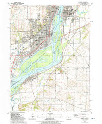
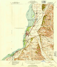 1952 Clinton1953 Print · USGSThe Illinois-Iowa border along the Mississippi River is captured here in the early fifties, showing a landscape defined by industrial rail lines and wildlife refuges. Trace family roots through specific rural landmarks like York Ch, Cottonwood Sch, and Calvary Cem.2 unique versions available
 - 1953 Map of Camanche, 1957 Print
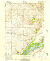 1953 Camanche1957 Print · USGSThe riverfront and rail corridors of Clinton County are captured here in the early fifties, showing the transition from rural farming to mid-century industry. Researchers can trace family roots through several landmarks like Shafton Cemetery, Low Moor, and the Clinton Speedway.3 unique versions available
 - 1953 Map of Clinton, 1977 Print
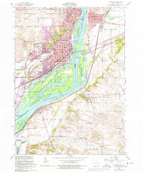 1953 Clinton1977 Print · USGSClinton and the Mississippi River islands are captured here in the 1950s during a period of industrial riverfront activity. Researchers can trace historic schools and cemeteries such as Cedar Creek School, Jane Lamb Memorial Hospital, and St Marys Cemetery across the tri-county area.
 - 1958 Map of Davenport, 1968 Print
 1958 Davenport1968 Print · USGSEastern Iowa and western Illinois thrive along the river during the late fifties, defined by the industrial Quad Cities and a robust rail network. Genealogists can trace family roots through settlements like Oasis and Stanwood or along the Cedar River.2 unique versions available
 - 1961 Map of Davenport
 1961 Davenport1961 Print · USGSThe Quad Cities and the eastern Iowa riverlands are captured here in the early sixties, showing the region's transition into a modern industrial and transit hub. Genealogists and historians can trace the paths of major railroads and find river landmarks like Rock Island Arsenal, Huron Island, and the Coralville Reservoir.
 - 1962 Map of Davenport
 1962 Davenport1962 Print · USGSThe Quad Cities and the Mississippi River corridor are shown at their industrial peak just before the interstate era fully transformed the region. Researchers can trace the sprawling rail networks of the Chicago Rock Island and Pacific and find landmarks like the Rock Island Arsenal and Wild Cat Den State Park.
 - 1967 Map of Clinton NW, 1968 Print
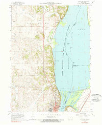 1967 Clinton NW1968 Print · USGSThe Mississippi River bluffs north of Clinton are documented here during the late sixties as industrial and conservation interests shaped the shoreline. Researchers can trace historic family burial sites like Smith Cem or locate the St Irenaeus Sch and Lock and Dam No 13.2 unique versions available
 - 1984 Map of Davenport, 1985 Print
 1984 Davenport1985 Print · USGSThe Quad Cities and the eastern Iowa riverlands are captured in the mid-eighties as industry and conservation converged along the Mississippi. Genealogists and local historians can trace rural roots through Stender Church, Oxford Mills, and the Elmwood Cem burial grounds.2 unique versions available
 - 1991 Map of Clinton, 1992 Print
 1991 Clinton1992 Print · USGSThe Mississippi River corridor comes alive in the early nineties, showcasing the riverfront growth of Iowa and Illinois. Genealogists can trace local roots through Clinton Mem Cem, St Patrick Ch, and school sites like Unity Christian High Sch.
 - 1991 Map of Camanche, 1992 Print
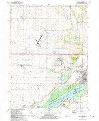 1991 Camanche1992 Print · USGSCamanche and the Clinton County riverfront are captured here in the early nineties, showcasing a region defined by the Mississippi and its surrounding townships. Genealogists can trace family sites at Pleasant Hill Cem or the settlement of Low Moor near the Chicago and North Western rail line.
End of results
Showing maps 1-10 of 10
Top cities near Clinton
- Camanche historical maps
- Fulton historical maps
- Savanna historical maps
- Port Byron historical maps
- Erie historical maps
- Garden Plain historical maps
See more
Top neighborhoods of Clinton
Frequently asked questions
- What are the different types of historical maps available for Clinton?
- What is the oldest map of Clinton?
- Where can I purchase historical maps of Clinton for my home or office?
- Where can I download high-res historical maps of Clinton?
- Are there historical topographic maps available for Clinton?
- Is there historical aerial imagery available for Clinton?
- Where are historical maps of Clinton sourced from?