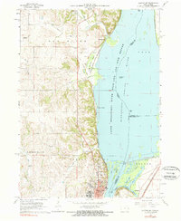
1967 Map of Clinton NW
USGS Topo · Published 1968About this map
Clinton and the surrounding river bluffs are captured here during a period of transition in the late 1960s. The northern reaches of the city are marked by established landmarks like the St Irenaeus Sch, Oakland Cemetery, and the Job Corps Center. Along the riverbank, the Chicago Milwaukee St Paul and Pacific railroad follows the curve of the shoreline near Lyons Chute, passing beneath the heights of Bulgers Hollow.
Find a feature on this map
49 named features on this map. Tap any name to fly to it.
Don’t see what you’re looking for? This feature index may not catch every label — zoom into the map to look around manually.
Map Details
Editions of this 1967 Clinton NW Map
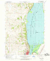
2 editions found
Other maps of this area

1891 · Clinton
USGS Topo · 1:62,500

1892 · Goose Lake
USGS Topo · 1:62,500

1892 · Savanna
USGS Topo · 1:62,500

1894 · Goose Lake
USGS Topo · 1:62,500

1894 · Clinton
USGS Topo · 1:62,500

1899 · Clinton
USGS Topo · 1:125,000

1935 · Miles
USGS Topo · 1:62,500

1941 · Miles
USGS Topo · 1:62,500

1952 · Clinton
USGS Topo · 1:62,500

1952 · Savanna
USGS Topo · 1:62,500