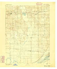
1894 Map of Goose Lake
USGS Topo · Published 1894About this map
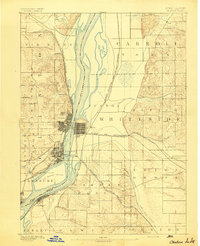
Charlotte and the nearby marshy waters of Goose Lake define this late 19th-century landscape in eastern Iowa. Surveyed in 1890, the map documents a region dominated by township divisions like Waterford, Deep Creek, and Elk River, where the prairie was rapidly being integrated into the national economy via rail. The Chicago and North Western Railroad cuts across the northern and southern portions of the sheet, connecting early depots at Malone, Low Moor, and Bryant. To the southeast, the Mississippi River and the Iowa Illinois Boundary Line mark the edge of the state, with Camanche serving as a riverside hub. Significant watercourses like the Wapsipinicon River and Deer Creek reveal the natural drainage patterns that shaped the placement of farmsteads and the eventual path of the Burlington Cedar Rapids and Northern R.R.
Find a feature on this map
27 named features on this map. Tap any name to fly to it.
Don’t see what you’re looking for? This feature index may not catch every label — zoom into the map to look around manually.
Map Details
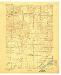
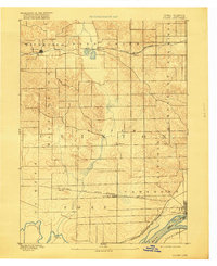
Editions of this 1894 Goose Lake Map
3 editions found
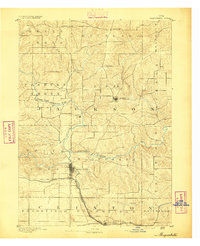
Other maps of this area

1891 · DeWitt
USGS Topo · 1:62,500

1891 · Davenport
USGS Topo · 1:62,500
1891 · Maquoketa
USGS Topo · 1:62,500

1891 · Clinton
USGS Topo · 1:62,500

1892 · Goose Lake
USGS Topo · 1:62,500

1892 · Savanna
USGS Topo · 1:62,500

1892 · Leclaire
USGS Topo · 1:62,500

1893 · Leclaire
USGS Topo · 1:62,500
1894 · Clinton
USGS Topo · 1:62,500

1894 · Davenport
USGS Topo · 1:62,500