
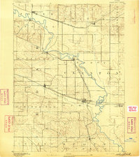
1891 Map of Davenport
USGS Topo · Published 1891About this map
Davenport serves as the focal point of this late 19th-century survey, situated along the north bank of the Mississippi River opposite Rock Island and Moline. The landscape reveals a mature agrarian and transport network, dominated by the diagonal and vertical paths of major rail lines like the Chicago Milwaukee and St Paul Railroad and the Chicago Rock Island and Pacific Railroad. These iron arteries connect smaller inland hubs such as Eldridge Junction, Donahue, and Long Grove to the river economy.
Find a feature on this map
34 named features on this map. Tap any name to fly to it.
Don’t see what you’re looking for? This feature index may not catch every label — zoom into the map to look around manually.
Map Details
Editions of this 1891 Davenport Map
This is the sole edition of this map. No revisions or reprints were ever made.
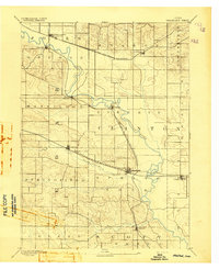
Other maps of this area

1890 · Durant
USGS Topo · 1:62,500

1891 · DeWitt
USGS Topo · 1:62,500
1892 · Wheatland
USGS Topo · 1:62,500

1892 · Goose Lake
USGS Topo · 1:62,500

1892 · Leclaire
USGS Topo · 1:62,500

1893 · Leclaire
USGS Topo · 1:62,500
1894 · Wheatland
USGS Topo · 1:62,500

1894 · Durant
USGS Topo · 1:62,500
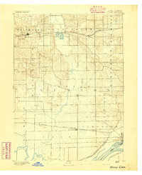
1894 · Goose Lake
USGS Topo · 1:62,500

1894 · Davenport
USGS Topo · 1:62,500
Featured Places
- Davenport, IA
- Moline, IL
- Bettendorf, Pleasant Valley Township
- Rock Island, IL
- Eldridge, Sheridan Township