
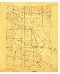
1894 Map of Wheatland
USGS Topo · Published 1894About this map
The Wapsipinicon River winds its way through the landscape, serving as a natural divider between Clinton and Cedar counties in this late nineteenth-century survey. The terrain is characterized by the convergence of major rail lines, with the Chicago Milwaukee and St. Paul Railroad cutting across the northern half and the Chicago and North Western Railroad following the path of Yankee Run to the south.
Find a feature on this map
24 named features on this map. Tap any name to fly to it.
Don’t see what you’re looking for? This feature index may not catch every label — zoom into the map to look around manually.
Map Details
Editions of this 1894 Wheatland Map
2 editions found
Other maps of this area

1889 · Tipton
USGS Topo · 1:62,500

1890 · Durant
USGS Topo · 1:62,500

1890 · Tipton
USGS Topo · 1:62,500

1891 · DeWitt
USGS Topo · 1:62,500

1891 · Davenport
USGS Topo · 1:62,500

1891 · Monticello
USGS Topo · 1:62,500

1891 · Maquoketa
USGS Topo · 1:62,500

1891 · Wilton Junction
USGS Topo · 1:62,500

1891 · Baldwin
USGS Topo · 1:62,500

1892 · Wheatland
USGS Topo · 1:62,500