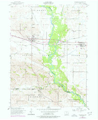
1953 Map of Wheatland
USGS Topo · Published 1977About this map
The Wapsipinicon River carves a winding path through the borderlands of Clinton and Scott Counties, where the agricultural landscape is defined by small railroad towns and scattered country parishes. Wheatland and Calamus serve as primary hubs along the Chicago and Northwestern railroad, which parallels the highway. These settlements are centers of community life, evidenced by features like the Athletic Field and the Calamus Consolidated School.
Find a feature on this map
30 named features on this map. Tap any name to fly to it.
Don’t see what you’re looking for? This feature index may not catch every label — zoom into the map to look around manually.
Map Details
Editions of this 1953 Wheatland Map
2 editions found
Other maps of this area

1890 · Durant
USGS Topo · 1:62,500

1891 · DeWitt
USGS Topo · 1:62,500

1891 · Davenport
USGS Topo · 1:62,500

1892 · Wheatland
USGS Topo · 1:62,500

1894 · Wheatland
USGS Topo · 1:62,500

1894 · Durant
USGS Topo · 1:62,500

1894 · Davenport
USGS Topo · 1:62,500

1901 · Rock Island
USGS Topo · 1:125,000

1910 · Rock Island
USGS Topo · 1:125,000
1953 · Donahue
USGS Topo · 1:24,000