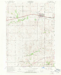
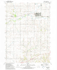
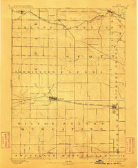
1894 Map of Durant
USGS Topo · Published 1894About this map
The town of Durant straddles the border of Scott and Muscatine counties, serving as a vital rail hub on the Chicago Rock Island and Pacific Railroad in the late 19th century. This survey reveals a landscape organized into a rigid grid of townships such as Farmington and Cleona, where small farming communities like Plain View and Walcott flourished along the tracks. The northern portion of the quadrangle is defined by the Burlington Cedar Rapids and Northern Railroad, which connects the settlements of Bennett and New Liberty across the drainage of Sugar Creek and Walnut Creek. Genealogists will find interest in the precise locations of rural outposts like Round Grove P.O. and Pleasant Prairie, documenting a period when post offices and small rail stops were the primary social and economic anchors for the surrounding prairie homesteads.
Find a feature on this map
31 named features on this map. Tap any name to fly to it.
Don’t see what you’re looking for? This feature index may not catch every label — zoom into the map to look around manually.
Map Details
Editions of this 1894 Durant Map
2 editions found
Historical Maps of Durant Through Time
9 maps found