Old Maps of Decatur County, Iowa
Explore 132 old maps of Decatur County, spanning from 1945 to today. These high-resolution historic maps reveal how streets, neighborhoods, landmarks, and natural features evolved over time — perfect for genealogy, metal detecting, research, and local history exploration.
What you can do with these maps:
- See how Decatur County changed over time: Compare historical maps to modern-day views to trace roads, homesites, rail lines & more.
- View detailed metadata: Each map includes creators, publishers, year, scale, and archive source.
- Overlay maps with satellite & LiDAR: Visualize the past alongside modern tools to explore terrain & human change.
- Trusted historical sources: Maps sourced from the USGS, Library of Congress, and other archives.
- Access maps your way: View online, download high-res files, or order prints for personal or research use.
Start exploring old maps of Decatur County to uncover forgotten places, hidden landmarks, and the deep history beneath your feet.
Decatur County, IA maps
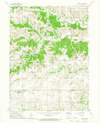
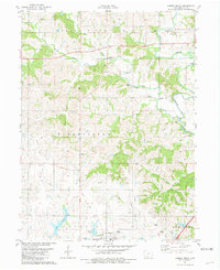
(132)- 1945 Map of Mount Ayr, 1954 Print
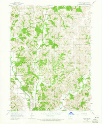
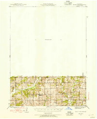 1945 Mount Ayr1954 Print · USGSThe Iowa-Missouri borderlands come into focus at the end of the war, showing a landscape of small townships and family farms. Genealogists can trace local roots through landmarks like Petry Cem, Friendship Ch, and the many rural schools including Lone Rock Sch.2 unique versions available
 - 1945 Map of Lamoni, 1957 Print
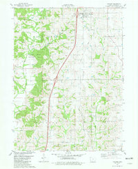
 1945 Lamoni1957 Print · USGSThe Iowa and Missouri borderlands come to life in this mid-century survey of the rural corridor between Harrison and Decatur counties. Researchers can trace the tracks of the Chicago Burlington and Quincy railroad and find local landmarks like Andover, Riverview Ch, and Akron Cem.
 - 1947 Map of Lamoni
 1947 Lamoni1947 Print · USGSThe rural borderlands of Iowa and Missouri are captured here just after the war, showing a dense network of country schools and churches. Genealogists can trace family roots through landmarks like Andover Cem, Lone Star Sch, and the Riverview Ch along the Thompson River.2 unique versions available
 - 1947 Map of Mount Ayr
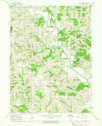
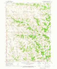
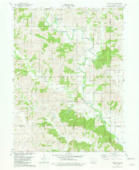
 1947 Mount Ayr1947 Print · USGSThe Missouri-Iowa border comes into focus in the mid-1940s, capturing the rural townships of Lincoln and Hamilton at a peak of local community density. Researchers can trace the exact locations of family homesteads near Hatfield or find the remote Turkey Grove Cem and Arrington Sch.2 unique versions available
 - 1954 Map of Centerville, 1967 Print
 1954 Centerville1967 Print · USGSThe Iowa-Missouri borderlands at mid-century reveal a landscape shaped by river valleys and the height of the regional rail network. Genealogists and historians can trace the paths of the Wabash railroad and locate old townsites like Mystic, Moulton, and Greentop.3 unique versions available
 - 1955 Map of Nebraska City, 1967 Print
 1955 Nebraska City1967 Print · USGSThe four-state region surrounding the Missouri River valley appears here in the mid-1950s, a landscape of rail-dependent market towns and rural school districts. Genealogists can locate family landmarks like the Rock Bluff School, St Oswald Church, and the Clarinda State Hospital.3 unique versions available
 - 1957 Map of Nebraska City
 1957 Nebraska City1957 Print · USGSThe four-state junction of Nebraska, Iowa, Missouri, and Kansas comes alive in this mid-fifties survey of the Missouri River valley. Genealogists and historians can trace the rail-and-road networks connecting Nebraska City, Maryville, and the Squaw Creek National Wildlife Refuge.
 - 1957 Map of Centerville
 1957 Centerville1957 Print · USGSThe Iowa-Missouri borderlands in the mid-fifties reveal a landscape of river-valley agriculture and vital rail corridors. Genealogists and historians can trace family-named landmarks and small-town growth in Centerville, Kirksville, and along the Wabash railroad line.
 - 1958 Map of Centerville
 1958 Centerville1958 Print · USGSThe Iowa-Missouri borderlands come into focus during the mid-fifties, showing a landscape defined by river valleys and intersecting rail lines. Genealogists and local historians can trace family roots through dozens of rural hubs like Bloomfield, Unionville, and Corydon.
 - 1958 Map of Nebraska City
 1958 Nebraska City1958 Print · USGSThe Missouri River Valley and its fertile four-state borderlands are captured here during the mid-century expansion of the regional highway and rail networks. Genealogists can trace family roots through numerous rural landmarks like Moulton School, Shady Grove Church, and the Clarinda State Hospital.
 - 1964 Map of Woodland, 1965 Print
 1964 Woodland1965 Print · USGSThe rural landscape of Decatur and Wayne Counties is captured in the mid-1960s, showing a well-established network of farms and country roads. Genealogists can locate several family-named burial sites like Gollough Cem and Corder Cem or the local Spring Branch Ch.
 - 1964 Map of Pleasanton, 1965 Print
 1964 Pleasanton1965 Print · USGSThe borderlands of Iowa and Missouri come to life in the mid-sixties, centered on the village of Pleasanton. Genealogists can trace family roots through several rural landmarks, including Freedom Ch, South Cem, and the small settlement of Marks.
 - 1964 Map of Leon, 1966 Print
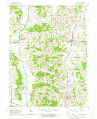
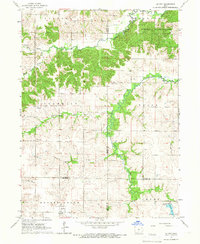
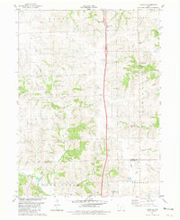
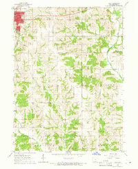 1964 Leon1966 Print · USGSLeon and the rolling farmland of Decatur County are captured here in the mid-sixties, showing the intersection of rail and river life. Researchers can locate the C B & Q rail line and several rural landmarks including St Marys Cem and the New Salem Ch.
 - 1964 Map of Lineville, 1966 Print
 1964 Lineville1966 Print · USGSThe Iowa-Missouri border country comes to life in this mid-sixties survey of the Lineville and Mercer area. Trace family history through numerous rural cemeteries like Evergreen Cemetery and White Oak Cem, or follow the Chicago Rock Island and Pacific rail line.
 - 1965 Map of Weldon, 1966 Print
 1965 Weldon1966 Print · USGSSouthern Clarke County at the mid-century reveals an agrarian landscape centered on the settlement of Weldon. Researchers can trace the Old Railroad Grade and locate family burial sites such as Hebron Cem and Metier Cem.
 - 1965 Map of Garden Grove SW, 1966 Print
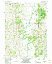
 1965 Garden Grove SW1966 Print · USGSDecatur County's rural townships are captured in the mid-1960s as a landscape of interconnected creek valleys and family farmsteads. Researchers can locate ancestral landmarks like Winters Cem, the Franklin Ch, and the original route of the Chicago Burlington and Quincy railroad.
 - 1965 Map of Le Roy, 1966 Print
 1965 Le Roy1966 Print · USGSSouthern Iowa's rural landscape at the crossroads of four counties is captured here in the mid-1960s. Researchers can trace the path of the Old Railroad Grade or find family sites like Smyrna Cem and the settlement of Last Chance.
 - 1965 Map of Garden Grove, 1967 Print
 1965 Garden Grove1967 Print · USGSDecatur and Wayne Counties are captured in the mid-1960s, showing the agricultural rhythm of southern Iowa before modernization reshaped its rural landscape. Researchers can trace family roots at Green Bay Cem. or locate regional landmarks like the Chicago Burlington and Quincy railroad and the local Drive-in Theater.
 - 1981 Map of Van Wert
 1981 Van Wert1981 Print · USGSDecatur County in the early eighties shows a landscape of quiet township centers and winding river valleys near the Missouri border. Genealogists and local historians can trace family burial sites like McKee Cem and Shy Cem or follow the path of an Old RR Grade.
 - 1981 Map of Lamoni South
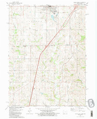 1981 Lamoni South1981 Print · USGSSouthern Iowa and northern Missouri are captured here in the early eighties, centered on the growing community of Lamoni. Genealogists and local historians can trace rural roots through Rose Hill Cem, Sweet Home Cem, and the old Andover townsite.2 unique versions available
 - 1981 Map of Hopeville
 1981 Hopeville1981 Print · USGSThe rural borderlands of Clarke and Decatur Counties are captured in the early eighties, centered on the settlement of Hopeville. Researchers can trace old family burial sites like Warrick Cem and Sanders Cem tucked among the forks of Long Creek.
 - 1981 Map of Akron
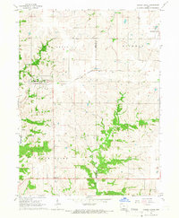
 1981 Akron1981 Print · USGSThe Missouri-Iowa state line was a landscape of quiet river valleys and scattered farmsteads in the early eighties. Researchers can trace rural lineages through the many family-named burial grounds like Miller Cem or explore the Akron Townhall and the grounds of Nine Eagles State Park.
 - 1981 Map of Lamoni North
 1981 Lamoni North1981 Print · USGSDecatur County's rural heartland is documented here in the early eighties, centered on the expansion of Lamoni and the river valleys to its north. Genealogists can locate family landmarks such as Rose Hill Cem, the Bloomington Ch, and the Old Railroad Grade.
 - 1981 Map of Tingley NE
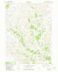
 1981 Tingley NE1981 Print · USGSSouthern Iowa farm country at the dawn of the eighties reveals a landscape defined by the Thompson River and its numbered creeks. Researchers can locate remote rural landmarks like Otterbein Cem, Spring Valley Lake, and Oak Hill Ch among the rolling fields.
 - 1981 Map of Lacelle
 1981 Lacelle1981 Print · USGSSouthern Iowa farmland in the early eighties centers on the rural communities of Lacelle and Leslie. Researchers can trace old family lines at Lacelle Cemetery or follow the intricate paths of Spring Creek and South White Breast Creek through the countryside.
Showing maps 1-25 of 132
Top cities of Decatur County
- Lamoni historical maps
- Leon historical maps
- Grand River historical maps
- Davis City historical maps
- Van Wert historical maps
- Decatur historical maps
See more
Frequently asked questions
- What are the different types of historical maps available for Decatur County?
- What is the oldest map of Decatur County?
- Where can I purchase historical maps of Decatur County for my home or office?
- Where can I download high-res historical maps of Decatur County?
- Are there historical topographic maps available for Decatur County?
- Is there historical aerial imagery available for Decatur County?
- Where are historical maps of Decatur County sourced from?