1980s Maps of Decatur County, Iowa
Explore 14 historic maps of Decatur County from the 1980s. These maps offer a rare glimpse into what life looked like during the 1980s — showing old roads, neighborhoods, homes, and landmarks that have changed or disappeared over time.
Whether you're researching your family's past, planning a metal detecting trip, or studying how Decatur County's landscape evolved across the 1980s, these high-resolution maps are a powerful tool for exploring the history of this region.
- Focus on a specific era: All maps on this page are from the 1980s, giving you a focused view of this time period.
- See what’s changed: Compare century-old streets, trails, and buildings to today's modern landscape using overlays and satellite layers.
- Research with precision: Use these maps for genealogy, historical research, land use analysis, or educational projects.
- View, download, or print: Maps are fully viewable online in high resolution, and can be downloaded or printed for your own records.
Start exploring Decatur County's history through authentic maps from the 1980s. This is your window into the past.
Decatur County, IA maps
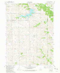
(14)- 1981 Map of Van Wert
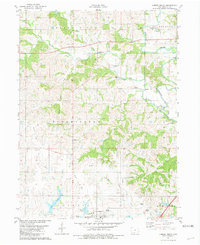
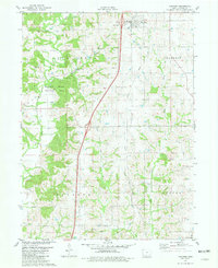 1981 Van Wert1981 Print · USGSDecatur County in the early eighties shows a landscape of quiet township centers and winding river valleys near the Missouri border. Genealogists and local historians can trace family burial sites like McKee Cem and Shy Cem or follow the path of an Old RR Grade.
 - 1981 Map of Lamoni South
 1981 Lamoni South1981 Print · USGSSouthern Iowa and northern Missouri are captured here in the early eighties, centered on the growing community of Lamoni. Genealogists and local historians can trace rural roots through Rose Hill Cem, Sweet Home Cem, and the old Andover townsite.2 unique versions available
 - 1981 Map of Hopeville
 1981 Hopeville1981 Print · USGSThe rural borderlands of Clarke and Decatur Counties are captured in the early eighties, centered on the settlement of Hopeville. Researchers can trace old family burial sites like Warrick Cem and Sanders Cem tucked among the forks of Long Creek.
 - 1981 Map of Akron
 1981 Akron1981 Print · USGSThe Missouri-Iowa state line was a landscape of quiet river valleys and scattered farmsteads in the early eighties. Researchers can trace rural lineages through the many family-named burial grounds like Miller Cem or explore the Akron Townhall and the grounds of Nine Eagles State Park.
 - 1981 Map of Lamoni North
 1981 Lamoni North1981 Print · USGSDecatur County's rural heartland is documented here in the early eighties, centered on the expansion of Lamoni and the river valleys to its north. Genealogists can locate family landmarks such as Rose Hill Cem, the Bloomington Ch, and the Old Railroad Grade.
 - 1981 Map of Tingley NE
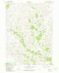
 1981 Tingley NE1981 Print · USGSSouthern Iowa farm country at the dawn of the eighties reveals a landscape defined by the Thompson River and its numbered creeks. Researchers can locate remote rural landmarks like Otterbein Cem, Spring Valley Lake, and Oak Hill Ch among the rolling fields.
 - 1981 Map of Lacelle
 1981 Lacelle1981 Print · USGSSouthern Iowa farmland in the early eighties centers on the rural communities of Lacelle and Leslie. Researchers can trace old family lines at Lacelle Cemetery or follow the intricate paths of Spring Creek and South White Breast Creek through the countryside.
 - 1981 Map of Pawnee
 1981 Pawnee1981 Print · USGSThe rural borderlands between Iowa and Missouri come into focus in the early eighties. Genealogists and local historians can trace family roots through several landmarks including Mt Zion Cem, Lone Rock Ch, and the settlement of Pawnee.
 - 1981 Map of Ellston
 1981 Ellston1981 Print · USGSSouthern Iowa's rural landscape at the start of the 1980s is defined by its small townships and the sprawling Sun Valley Lake. Researchers can trace the path of an Old Railroad Grade or locate family history at Pumptown Cem and Oliver Cem.
 - 1981 Map of Grand River
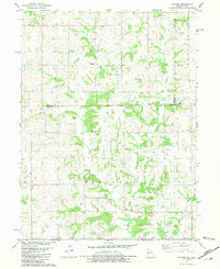
 1981 Grand River1981 Print · USGSDecatur County's river-and-rail landscape is preserved here as it appeared in the early eighties, centered on the Grand River community and the Thompson River. Researchers can trace early family roots through several landmarks, including Westerville, the Old Railroad Grade, and Oak Hill Cem.
 - 1981 Map of Davis City
 1981 Davis City1981 Print · USGSSouthern Iowa's rural landscape is captured here in the early eighties as the Thompson River winds through Decatur County. Genealogists and local historians can trace family roots through the Manchester Cem, Bethel Cem Ch, and the small settlement of Terre Haute.
 - 1981 Map of Leon, 1982 Print
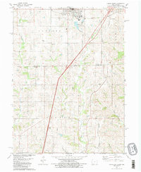
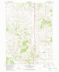
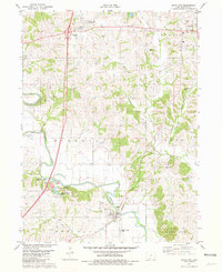
 1981 Leon1982 Print · USGSSouthern Iowa and northern Missouri are captured here in the early eighties as the rural landscape balances traditional agriculture with large-scale water management. Researchers can trace the path of the Burlington Northern through Leon or locate early settlements like Decatur City and New Buda.
 - 1981 Map of Kellerton, 1982 Print
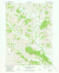
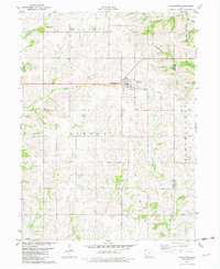 1981 Kellerton1982 Print · USGSSouthern Iowa's rural landscape is captured here in the early eighties, centered on the community of Kellerton. Genealogists and local historians can locate several family burial sites including Maple Row Cem and Woodland Cem, or trace the path of the Old Railroad Grade.
 - 1985 Map of Mount Ayr
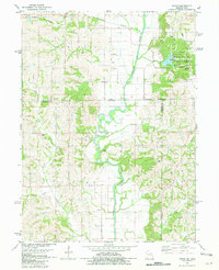
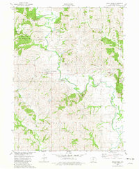
 1985 Mount Ayr1985 Print · USGSThe Iowa-Missouri borderlands are captured here in the mid-eighties, showing a landscape defined by the branching forks of the Platte River and Grand River. Researchers can trace the heritage of rural communities and conservation sites like Lake of Three Fires State Park and Rose Hill Cemetery.2 unique versions available
End of results
Showing maps 1-14 of 14
Top cities of Decatur County
- Lamoni historical maps
- Leon historical maps
- Grand River historical maps
- Davis City historical maps
- Van Wert historical maps
- Decatur historical maps
See more
Frequently asked questions
- What are the different types of historical maps available for Decatur County?
- What is the oldest map of Decatur County?
- Where can I purchase historical maps of Decatur County for my home or office?
- Where can I download high-res historical maps of Decatur County?
- Are there historical topographic maps available for Decatur County?
- Is there historical aerial imagery available for Decatur County?
- Where are historical maps of Decatur County sourced from?