Old Maps of Hamilton County, Iowa for Hiking & Exploration
Hike through history with 128 historic maps of Hamilton County. Explore old trails, ghost towns, and forgotten backroads — perfect for outdoor adventurers and local explorers.
- Rediscover forgotten places: Map out old mining camps, roads, and footpaths that no longer exist on modern maps.
- Layer with modern tools: Combine with LiDAR or satellite views to plan hikes through historical terrain.
- Made for exploration: Popular among hikers, overlanders, and local history lovers.
Use these maps to find adventure and explore the hidden past of Hamilton County.
Hamilton County, IA maps
(128)- 1912 Map of Ames, 1956 Print
 1912 Ames1956 Print · USGSStory and Hamilton counties appear here in the early twentieth century as a thriving network of rail-side towns and rural school districts. Researchers can trace the grounds of Iowa State College or find vanished schoolhouses like Tiernagel School and Hobbs School.3 unique versions available
 - 1914 Map of Ames
 1914 Ames1914 Print · USGSStory County at the start of the twentieth century was a landscape of fertile farmland and burgeoning rail towns like Story City and Ames. Genealogists and researchers can trace the precise locations of dozens of country schoolhouses, including Zenorville School and Espeland School, alongside the grounds of Iowa State College.3 unique versions available
 - 1916 Map of Boone
 1916 Boone1916 Print · USGSBoone and the Des Moines River valley appear here in the decade before the Great War, showing a landscape defined by deep river bluffs and heavy rail traffic. Genealogists can locate dozens of named rural schools such as Incline School and Coal Valley School, or trace the riverside streets of Moingona and Fraser.3 unique versions available
 - 1954 Map of Waterloo, 1968 Print
 1954 Waterloo1968 Print · USGSCentral Iowa at the height of its mid-century agricultural and rail boom features the growing hubs of Waterloo and Cedar Falls. Genealogists and researchers can trace the rail corridors of the Chicago Great Western and find local landmarks like Iowa State College and Brushy Ridge.4 unique versions available
 - 1955 Map of Waterloo
 1955 Waterloo1955 Print · USGSCentral Iowa in the mid-fifties presents a dense landscape of rail-connected farming towns and growing river cities. Researchers can trace ancestral roots and old transport routes through Waterloo, Marshalltown, and Ames, while locating rural Cemeteries and local Quarries.2 unique versions available
 - 1965 Map of Mackey, 1966 Print
 1965 Mackey1966 Print · USGSBoone and Hamilton counties are shown in the mid-1960s as a landscape of rural schoolhouses and family burial grounds. Researchers can trace local lineage at South Marion Cem and Leininger Cem or locate the old St Paul Sch and Mackey.
 - 1965 Map of Fraser, 1966 Print
 1965 Fraser1966 Print · USGSThe Des Moines River valley in the mid-1960s reveals a rural landscape transitioning toward major hydrological management. Researchers can trace ancestral locations at Hardin Cem or Mineral Ridge Cem and locate vanished landmarks near Ridgeport and Fraser.
 - 1975 Map of Ames NW, 1978 Print
 1975 Ames NW1978 Print · USGSThe intersection of Hamilton and Story counties is captured here in the mid-seventies, showing a landscape of fertile township sections and stream valleys. Genealogists can trace family heritage at SS Peter & Paul Cem or Center Cem, and locate the old Chicago and North Western rail line.
 - 1975 Map of Story City, 1978 Print
 1975 Story City1978 Print · USGSStory City and its neighboring prairie townships are captured here in the mid-seventies as the regional rail and river network shaped local life. Researchers can trace family sites at Mt Olive Cem, follow the Chicago and North Western tracks, or locate the Old Railroad Grade near Roland.
 - 1975 Map of Mc Callsburg, 1978 Print
 1975 Mc Callsburg1978 Print · USGSMid-century Story County farmland comes into focus in this survey of the borders with Hamilton and Hardin. Local historians can trace the layouts of Garden City, Roland, and McCallsburg, along with rural landmarks like Zion Ch and Stavanger Cem.
 - 1978 Map of Blairsburg, 1979 Print
 1978 Blairsburg1979 Print · USGSHamilton County agriculture and rail systems are clearly defined in the late seventies. Family historians can locate specific landmarks like Blairsburg Cem, First United Ch, and the rail junction at Kamrar as they appeared decades ago.
 - 1978 Map of Woolstock, 1979 Print
 1978 Woolstock1979 Print · USGSWoolstock and the surrounding farm country of Wright and Hamilton Counties are captured here in the late seventies. Researchers can trace the Chicago and North Western rail line and locate rural landmarks like French Ch Cem and the Flowing Well.
 - 1978 Map of Ellsworth, 1979 Print
 1978 Ellsworth1979 Print · USGSHamilton County farmland meets the river and rail lines of the late seventies, centered on the growing community of Ellsworth. Genealogists and local historians can trace family locations near Homewood Cem or follow the path of the CHICAGO AND NORTH WESTERN railroad along the South Skunk River.
 - 1978 Map of Eagle Grove SW, 1979 Print
 1978 Eagle Grove SW1979 Print · USGSThe rural borders of Webster, Wright, and Hamilton counties are captured here in the late 1970s, showing a landscape defined by industrial agriculture and the Boone River. Genealogists and researchers can locate family sites near Troy Cem or trace the path of the Chicago and North Western railroad.
 - 1978 Map of Webster City, 1979 Print
 1978 Webster City1979 Print · USGSWebster City is captured here during the late seventies, showing the vital intersection of the Boone River and two major rail lines. Genealogists and local historians can locate family plots in Graceland Cem or trace neighborhood growth near Lawn Hill Sch and the Fairground.
 - 1978 Map of Sheldon Creek, 1979 Print
 1978 Sheldon Creek1979 Print · USGSThe Wright and Hamilton County borderland is captured in the late 1970s, showcasing a landscape of prairie agriculture and managed waterways. Genealogists and researchers can locate the Vernon Ch, a rural Townhall, and the expansive Wall Lake.
 - 1978 Map of Stanhope, 1979 Print
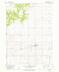 1978 Stanhope1979 Print · USGSHamilton County farmland meets the wooded bluffs of the Boone River during the late seventies. Researchers can trace the Chicago and North Western rail line through Stanhope or locate rural family burial sites at Saratoga Cem and Lawn Hill Cem.
 - 1978 Map of Jewell, 1979 Print
 1978 Jewell1979 Print · USGSJewell and the surrounding Hamilton County townships are shown in detail during the late seventies. Genealogists and local historians can trace the town's footprint from Evergreen Cem to the Chicago and North Western rail lines and Little Wall Lake.
 - 1978 Map of Clarion SW, 1979 Print
 1978 Clarion SW1979 Print · USGSWright and Hamilton Counties in the late seventies showcase a landscape of managed waterways and glacial lakes. Genealogists and local historians can trace rural landmarks like the United Ch and Townhall, or locate the Boat Ramp at Big Wall Lake.
 - 1978 Map of Duncombe, 1979 Print
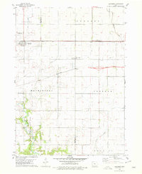 1978 Duncombe1979 Print · USGSIowa's agricultural heartland is documented here in the late seventies, showing the rail-dependent growth of Webster County. Genealogists and local researchers can locate St Josephs Cem and Blanchard Cem or trace the early paths of the Illinois Central Gulf through Duncombe.
 - 1978 Map of Stratford, 1979 Print
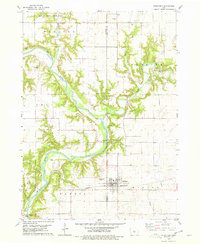 1978 Stratford1979 Print · USGSStratford and the surrounding river bluffs are documented in the late 1970s as the railroad and river define the local economy. Researchers can locate several family and pioneer burial sites like Vegors Cem and Homer Cem, or trace the rail path of the Chicago and North Western.
 - 1978 Map of Williams, 1979 Print
 1978 Williams1979 Print · USGSHamilton County in the late seventies is marked by the massive intersection of major interstates amidst a traditional farming landscape. Genealogists and historians can locate the St Marys Cem, trace the Illinois Central Gulf rail line, and find the Community Hall.
 - 1979 Map of Buckeye West, 1980 Print
 1979 Buckeye West1980 Print · USGSHardin County agriculture and rail transport intersect in the late 1970s as the Chicago and North Western crosses this prairie landscape. Genealogists and local historians can trace the area around Buckeye, find the Buckeye Cem, and locate the Flowing Well County Park along the river.
 - 1979 Map of Popejoy, 1980 Print
 1979 Popejoy1980 Print · USGSThe prairie landscape around Popejoy and Alden is captured here as it appeared in the late seventies. Family historians and researchers can locate the Otis Grove Cem and trace the paths of the Chicago Rock Island and Pacific railroad.
 - 1979 Map of Radcliffe, 1980 Print
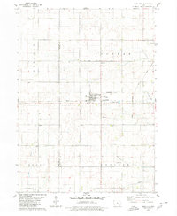 1979 Radcliffe1980 Print · USGSRadcliffe and the surrounding Iowa prairie are documented here in the late seventies, showing a landscape shaped by rail and agriculture. Researchers can trace family history through several local burial grounds including Bethany Cem and Rorem Cem, or locate the site of the old Salem Ch.
Showing maps 1-25 of 128
Top cities of Hamilton County
Frequently asked questions
- What are the different types of historical maps available for Hamilton County?
- What is the oldest map of Hamilton County?
- Where can I purchase historical maps of Hamilton County for my home or office?
- Where can I download high-res historical maps of Hamilton County?
- Are there historical topographic maps available for Hamilton County?
- Is there historical aerial imagery available for Hamilton County?
- Where are historical maps of Hamilton County sourced from?