Old Maps of Howard County, Iowa
Explore 125 old maps of Howard County, spanning from 1954 to today. These high-resolution historic maps reveal how streets, neighborhoods, landmarks, and natural features evolved over time — perfect for genealogy, metal detecting, research, and local history exploration.
What you can do with these maps:
- See how Howard County changed over time: Compare historical maps to modern-day views to trace roads, homesites, rail lines & more.
- View detailed metadata: Each map includes creators, publishers, year, scale, and archive source.
- Overlay maps with satellite & LiDAR: Visualize the past alongside modern tools to explore terrain & human change.
- Trusted historical sources: Maps sourced from the USGS, Library of Congress, and other archives.
- Access maps your way: View online, download high-res files, or order prints for personal or research use.
Start exploring old maps of Howard County to uncover forgotten places, hidden landmarks, and the deep history beneath your feet.
Howard County, IA maps
(125)- 1954 Map of Mason City, 1967 Print
 1954 Mason City1967 Print · USGSSouthern Minnesota and northern Iowa are shown here at the height of the mid-century rail era, centered on the regional hubs of Mason City and Rochester. Researchers can trace the vanished paths of the Chicago Great Western and find local landmarks like Pilot Knob and Bear Lake.2 unique versions available
 - 1957 Map of Mason City
 1957 Mason City1957 Print · USGSThe Minnesota-Iowa border region comes alive in this mid-century survey, from the industrial plants of Mason City to the medical hub of Rochester. Researchers can trace the rail-and-river economy through the Chicago Great Western Railway and the Shell Rock River.
 - 1958 Map of Mason City
 1958 Mason City1958 Print · USGSSouthern Minnesota and northern Iowa are shown during the mid-fifties when railroads still anchored the regional economy. Genealogists and historians can trace the intricate rail networks of the Illinois Central and find local landmarks in Mason City, Albert Lea, and Austin.
 - 1965 Map of Greenleafton, 1966 Print
 1965 Greenleafton1966 Print · USGSAcross the Fillmore County hills in the 1960s, this survey traces the rural settlements of Greenleafton and Bristol along the Minnesota-Iowa border. Researchers can locate numerous family-history sites like St Liquori Cem, Saetersdal Ch, and the many Strip Mines near the South Branch Root River.2 unique versions available
 - 1965 Map of Harmony, 1966 Print
 1965 Harmony1966 Print · USGSThe Minnesota-Iowa borderlands near Harmony are shown in the mid-1960s, a time when rail and river still defined the local geography. Researchers can trace the Milwaukee Road railroad or locate family burial sites at Rice Cem and Old Big Spring Cem.2 unique versions available
 - 1965 Map of Le Roy, 1966 Print
 1965 Le Roy1966 Print · USGSLe Roy was a bustling rail hub in the mid-1960s, situated at the junction of two major lines near the Iowa border. Genealogists and historians can trace local families through St Patricks Cem or explore the early layout of Lake Louise State Park.
 - 1965 Map of Ostrander, 1966 Print
 1965 Ostrander1966 Print · USGSThe borderlands of Fillmore County and Iowa are captured here in the mid-sixties, dominated by rail lines and winding river branches. Researchers can pinpoint early landmarks like Bloomfield Cem, the Ostrander rail corridor, and various Quarry sites.
 - 1965 Map of Cherry Grove, 1967 Print
 1965 Cherry Grove1967 Print · USGSSouthern Minnesota farmland meets the deep valleys of the Root River in the mid-sixties, just as local strip mines and gravel pits dotted the landscape. Researchers can locate the Chicago Great Western rail line and family landmarks like Bethlehem Cem and Pietenpol Landing Field.
 - 1971 Map of Colwell, 1973 Print
 1971 Colwell1973 Print · USGSUpper Iowa farm country and the meeting of four counties are captured here in the early seventies as the rail era left its mark on the land. Genealogists and historians can trace the Old Grade Railroad, find St Cecilia Ch, and locate Beckwith Cem.
 - 1972 Map of Mc Intire, 1974 Print
 1972 Mc Intire1974 Print · USGSThe northern Iowa borderlands near the Minnesota line appear here in the early seventies, centered on the McIntire rail corridor. Researchers can find Wayne Cem, trace the winding Wapsipinicon River, and locate several stretches of Old Railroad Grade.
 - 1972 Map of Riceville, 1974 Print
 1972 Riceville1974 Print · USGSRiceville and the surrounding townships in the early seventies remain centered on the Wapsipinicon River and the Chicago and North Western line. Genealogists and local historians can locate several rural burial grounds like St Peters Cem and Reckner Cem, or trace the small settlement at Dishinger.
 - 1972 Map of Elma, 1976 Print
 1972 Elma1976 Print · USGSThe rural border of Howard and Chickasaw counties comes into focus in the early 1970s as the rail and river networks shaped local life. Genealogists and historians can trace the Chicago and North Western line through Elma and Alta Vista, or locate Deerfield Cem near the river.
 - 1972 Map of Jerico, 1976 Print
 1972 Jerico1976 Print · USGSChickasaw and Howard counties appear in the early seventies as a patchwork of established family farms and creek valleys. Genealogists can trace rural homesteads near Jerico, the Chicago and North Western rail line, and the banks of Crane Creek.
 - 1981 Map of Lourdes, 1982 Print
 1981 Lourdes1982 Print · USGSHoward County's agricultural heartland is documented here in the early eighties, centered on the settlement of Lourdes. Researchers can trace local landmarks like Our Lady of Lourdes Cem, Davis Corners, and several Gravel Pits along the banks of Crane Creek.
 - 1981 Map of Cresco NW, 1982 Print
 1981 Cresco NW1982 Print · USGSNorthwestern Howard County in the early eighties is a landscape of established farmsteads and river valleys along the Minnesota border. Researchers can trace the Chicago Milwaukee St Paul and Pacific rail line and locate ancestral sites at Foreston Cem and Zion Ch.
 - 1981 Map of Cresco NE, 1982 Print
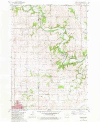 1981 Cresco NE1982 Print · USGSUpper Iowa farm country and the growing community of Cresco are captured here in the early eighties. Researchers can trace family history through sites like St Kierans Cem, Fremont Cem, and the small settlement of Kendallville.
 - 1981 Map of Lime Springs, 1982 Print
 1981 Lime Springs1982 Print · USGSHoward County's northern border comes alive in the early eighties as the Upper Iowa River winds past Lime Springs and Chester. Researchers can trace the Chicago Milwaukee St Paul and Pacific rail line or locate family sites at Pleasant Hill Cem.
 - 1981 Map of Saude, 1982 Print
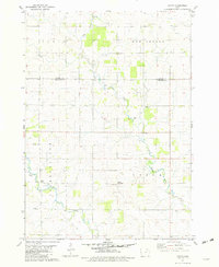 1981 Saude1982 Print · USGSNortheast Iowa’s rural landscape is captured here in the early eighties, spanning the border of Howard and Chickasaw counties. Genealogists and local historians can trace family roots through sites like Reilly Settlement, Yankee Cem, and Saude Ch.
 - 1981 Map of Cresco SE, 1982 Print
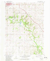 1981 Cresco SE1982 Print · USGSNortheast Iowa farmland and conservation areas are captured here in the early eighties as the Turkey River winds through the border of Howard and Winneshiek counties. You can trace the Milwaukee Road rail line or locate rural landmarks like Community Chapel and United Cem.
 - 1981 Map of Cresco SW, 1982 Print
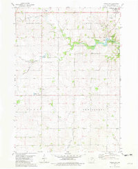 1981 Cresco SW1982 Print · USGSHoward County's rural landscape is documented in the early eighties as the Turkey River and its many branches shaped local townships. Researchers can trace historic sites like Vernon Springs, Schley, and the Holy Cross Ch across this farm-centered terrain.
 - 1981 Map of Lime Springs NW, 1982 Print
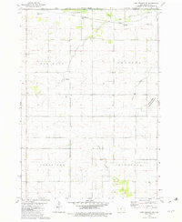 1981 Lime Springs NW1982 Print · USGSHoward County's agricultural heartland is documented here in the early eighties, showing a landscape defined by prairie conservation and rail transport. Researchers can locate the Chester Hill Cem or trace the Milwaukee Road tracks near the Upper Iowa River.
 - 1981 Map of Saratoga, 1982 Print
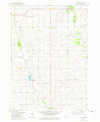 1981 Saratoga1982 Print · USGSHoward County, Iowa, is captured here in the early 1980s as a quiet agricultural landscape defined by its river valleys and rail lines. Researchers can trace family ties at Township Cem, locate the small community of Maple Leaf, or follow the Chicago and North Western tracks.
 - 1981 Map of Protivin, 1982 Print
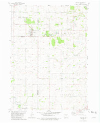 1981 Protivin1982 Print · USGSNortheast Iowa's rural townships are captured here in the early eighties as the agricultural landscape transitions across three county lines. Researchers can find precise locations for St Marys Ch in Little Turkey, the Bohemian National Cem, and the Jirak Landing Strip.
 - 1985 Map of Charles City
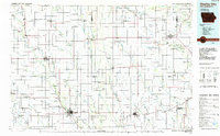 1985 Charles City1985 Print · USGSNorthern Iowa and the Minnesota borderlands are mapped here in the mid-1980s as a thriving network of rail-side towns and river valleys. Trace local history through the Reilly Settlement, Stacyville Junction, and aviation sites like Ellen Church Field.2 unique versions available
 - 1985 Map of Austin
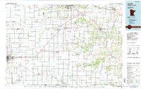 1985 Austin1985 Print · USGSSoutheast Minnesota in the mid-1980s reveals a land of river valleys and agricultural hubs along the Iowa border. Researchers can trace the legacy of regional transport through the Chicago and North Western line and landmarks like Niagara Cave or the Rochester Municipal Airport.2 unique versions available
Showing maps 1-25 of 125
Top cities of Howard County
- Cresco historical maps
- Elma historical maps
- Lime Springs historical maps
- Protivin historical maps
- Chester historical maps
Frequently asked questions
- What are the different types of historical maps available for Howard County?
- What is the oldest map of Howard County?
- Where can I purchase historical maps of Howard County for my home or office?
- Where can I download high-res historical maps of Howard County?
- Are there historical topographic maps available for Howard County?
- Is there historical aerial imagery available for Howard County?
- Where are historical maps of Howard County sourced from?