
1981 Map of Cresco NW
USGS Topo · Published 1982About this map
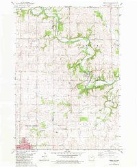
Upper Iowa River meanders through the northern reaches of this rural landscape, carving a prominent valley across the Minnesota Iowa border. This early 1980s topography reveals a well-organized grid of farmland divided into townships such as Forest City, Albion, and Howard Center. The settlement of Florenceville sits near the river in the northeast, while the Chicago Milwaukee St Paul and Pacific railroad corridor anchors the central portion of the map, passing through the village of Bonair. Local history is deeply etched into the land through numerous rural burial grounds, including Foreston Cem, Cedar Hill Cem, and Phillips Cem. Near the southern edge, the map captures the outskirts of Cresco, featuring the Fairground and Calvary Cem. Distinctive civic landmarks such as the Townhall and the County Farm reflect the established agricultural and social structures of the county during this period.
Find a feature on this map
30 named features on this map. Tap any name to fly to it.
Don’t see what you’re looking for? This feature index may not catch every label — zoom into the map to look around manually.
Map Details
Editions of this 1981 Cresco NW Map
This is the sole edition of this map. No revisions or reprints were ever made.
Other maps of this area

1954 · Mason City
USGS Topo · 1:250,000

1957 · Mason City
USGS Topo · 1:250,000

1958 · Mason City
USGS Topo · 1:250,000

1965 · Greenleafton
USGS Topo · 1:24,000

1965 · Harmony
USGS Topo · 1:24,000

1965 · Cherry Grove
USGS Topo · 1:24,000

1981 · Lourdes
USGS Topo · 1:24,000
1981 · Cresco NE
USGS Topo · 1:24,000

1981 · Lime Springs
USGS Topo · 1:24,000
1981 · Cresco SE
USGS Topo · 1:24,000