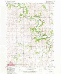
1981 Map of Cresco NE
USGS Topo · Published 1982About this map
Upper Iowa River meanders through the northern reaches of this landscape, carving a valley that separates the rural townships of Albion and Fremont from the Minnesota border. The topography here is defined by the incision of water, where drainage systems like Elliott Creek and Spring Creek feed into the primary river channel. At the turn of the 1980s, the southern portion of the quadrangle shows the steady growth of Cresco, featuring the Crestwood Jr High Sch, West Ward Sch, and the County Hosp.
Find a feature on this map
39 named features on this map. Tap any name to fly to it.
Don’t see what you’re looking for? This feature index may not catch every label — zoom into the map to look around manually.
Map Details
Editions of this 1981 Cresco NE Map
This is the sole edition of this map. No revisions or reprints were ever made.
Other maps of this area

1906 · Decorah
USGS Topo · 1:125,000

1954 · Mason City
USGS Topo · 1:250,000

1957 · Mason City
USGS Topo · 1:250,000

1958 · Mason City
USGS Topo · 1:250,000

1958 · La Crosse
USGS Topo · 1:250,000

1961 · La Crosse
USGS Topo · 1:250,000

1965 · La Crosse
USGS Topo · 1:250,000

1965 · Greenleafton
USGS Topo · 1:24,000

1965 · Harmony
USGS Topo · 1:24,000

1965 · Canton
USGS Topo · 1:24,000