1990s Maps of Oxford Township, Iowa
Explore 2 historic maps of Oxford Township from the 1990s. These maps offer a rare glimpse into what life looked like during the 1990s — showing old roads, neighborhoods, homes, and landmarks that have changed or disappeared over time.
Whether you're researching your family's past, planning a metal detecting trip, or studying how Oxford Township's landscape evolved across the 1990s, these high-resolution maps are a powerful tool for exploring the history of this region.
- Focus on a specific era: All maps on this page are from the 1990s, giving you a focused view of this time period.
- See what’s changed: Compare century-old streets, trails, and buildings to today's modern landscape using overlays and satellite layers.
- Research with precision: Use these maps for genealogy, historical research, land use analysis, or educational projects.
- View, download, or print: Maps are fully viewable online in high resolution, and can be downloaded or printed for your own records.
Start exploring Oxford Township's history through authentic maps from the 1990s. This is your window into the past.
Oxford Township, IA maps
(2)- 1994 Map of Swisher
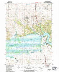 1994 Swisher1994 Print · USGSThe Johnson County river valley and surrounding prairies are captured here in the 1990s as the landscape balances wildlife conservation and rural growth. Researchers can trace numerous family burial grounds including Anderson Cem, Dupont Cem, and Greencastle Cem near the town of Swisher.
 - 1994 Map of Tiffin
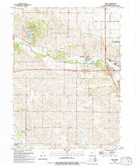 1994 Tiffin1994 Print · USGSIn the early 1990s, Johnson County reveals a transition from traditional rail-and-river geography to modern highway expansion near Tiffin. Genealogists and researchers can trace local roots at St Peter Cem and Oak Hill Cem, or locate landmarks like the Clear Creek-Amana High Sch.
End of results
Showing maps 1-2 of 2
Top cities near Oxford Township
- Cedar Rapids historical maps
- Iowa City historical maps
- Coralville historical maps
- North Liberty historical maps
- Tiffin historical maps
- Williamsburg historical maps
See more
Top neighborhoods of Oxford Township
Frequently asked questions
- What are the different types of historical maps available for Oxford Township?
- What is the oldest map of Oxford Township?
- Where can I purchase historical maps of Oxford Township for my home or office?
- Where can I download high-res historical maps of Oxford Township?
- Are there historical topographic maps available for Oxford Township?
- Is there historical aerial imagery available for Oxford Township?
- Where are historical maps of Oxford Township sourced from?