1930s Maps of Lucas County, Iowa
Explore 4 historic maps of Lucas County from the 1930s. These maps offer a rare glimpse into what life looked like during the 1930s — showing old roads, neighborhoods, homes, and landmarks that have changed or disappeared over time.
Whether you're researching your family's past, planning a metal detecting trip, or studying how Lucas County's landscape evolved across the 1930s, these high-resolution maps are a powerful tool for exploring the history of this region.
- Focus on a specific era: All maps on this page are from the 1930s, giving you a focused view of this time period.
- See what’s changed: Compare century-old streets, trails, and buildings to today's modern landscape using overlays and satellite layers.
- Research with precision: Use these maps for genealogy, historical research, land use analysis, or educational projects.
- View, download, or print: Maps are fully viewable online in high resolution, and can be downloaded or printed for your own records.
Start exploring Lucas County's history through authentic maps from the 1930s. This is your window into the past.
Lucas County, IA maps
(4)- 1934 Map of Humeston
 1934 Humeston1934 Print · USGSSouthern Iowa farmland and small-town commerce define this 1930s landscape, where rail lines and river branches meet. Genealogists can trace family roots at Humeston and Corydon or locate rural landmarks like Eden Ch and the Wayne County Farm.3 unique versions available
 - 1935 Map of Russell, 1958 Print
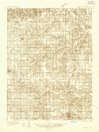
 1935 Russell1958 Print · USGSSouthern Iowa in the mid-thirties was a landscape of river-valley farms and rail-connected towns like Russell and Melrose. Researchers can trace old township school locations such as Brush College Sch and Rabbit Hill Sch or locate the New York Cem.2 unique versions available
 - 1937 Map of Corydon
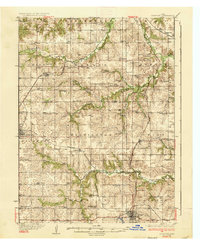 1937 Corydon1937 Print · USGSWayne County and the city of Corydon are captured in the mid-1930s, showing a landscape tightly organized around rail transport and rural education. Genealogists and historians can trace dozens of country schools and churches like Rabbit Ridge Sch, Brown Jug Sch, and Eden Ch.2 unique versions available
 - 1938 Map of Russell
 1938 Russell1938 Print · USGSSouthern Iowa's rural school and rail network are preserved here during the mid-1930s. Genealogists can trace family footprints across dozens of local landmarks like Hilledgeville Cem, Rabbit Hill Sch, and the settlement of Confidence.2 unique versions available
End of results
Showing maps 1-4 of 4
Top cities of Lucas County
- Chariton historical maps
- Russell historical maps
- Lucas historical maps
- Williamson historical maps
- Derby historical maps
Frequently asked questions
- What are the different types of historical maps available for Lucas County?
- What is the oldest map of Lucas County?
- Where can I purchase historical maps of Lucas County for my home or office?
- Where can I download high-res historical maps of Lucas County?
- Are there historical topographic maps available for Lucas County?
- Is there historical aerial imagery available for Lucas County?
- Where are historical maps of Lucas County sourced from?