Old Maps of Lucas County, Iowa for Hiking & Exploration
Hike through history with 107 historic maps of Lucas County. Explore old trails, ghost towns, and forgotten backroads — perfect for outdoor adventurers and local explorers.
- Rediscover forgotten places: Map out old mining camps, roads, and footpaths that no longer exist on modern maps.
- Layer with modern tools: Combine with LiDAR or satellite views to plan hikes through historical terrain.
- Made for exploration: Popular among hikers, overlanders, and local history lovers.
Use these maps to find adventure and explore the hidden past of Lucas County.
Lucas County, IA maps
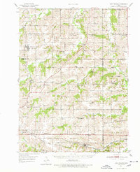
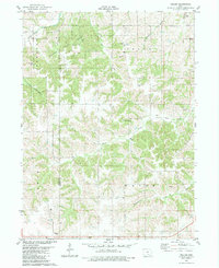
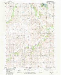
(107)- 1918 Map of Chariton
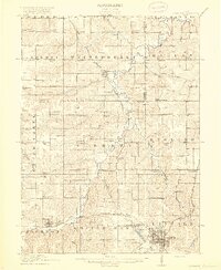 1918 Chariton1918 Print · USGSChariton and its neighboring townships thrive as a rail-connected agricultural hub during the late First World War era. Trace family roots at Chariton or locate rural landmarks like Indianola Junction and the Horstman School.4 unique versions available
 - 1924 Map of Melcher
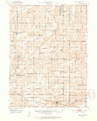
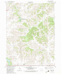
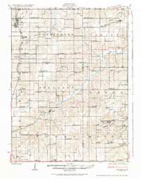 1924 Melcher1924 Print · USGSSouth-central Iowa thrives during the 1920s coal boom, where rail lines and mine shafts transformed the rural landscape. Trace the growth of mining towns like Tipperary and Bucknell, and locate vanished local schools such as Coal Glen School.3 unique versions available
 - 1934 Map of Humeston
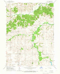
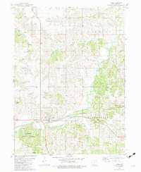
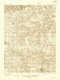 1934 Humeston1934 Print · USGSSouthern Iowa farmland and small-town commerce define this 1930s landscape, where rail lines and river branches meet. Genealogists can trace family roots at Humeston and Corydon or locate rural landmarks like Eden Ch and the Wayne County Farm.3 unique versions available
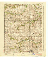
 - 1935 Map of Russell, 1958 Print
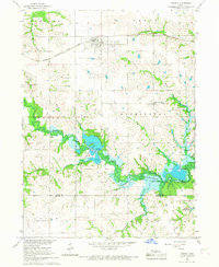
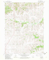
 1935 Russell1958 Print · USGSSouthern Iowa in the mid-thirties was a landscape of river-valley farms and rail-connected towns like Russell and Melrose. Researchers can trace old township school locations such as Brush College Sch and Rabbit Hill Sch or locate the New York Cem.2 unique versions available
 - 1937 Map of Corydon
 1937 Corydon1937 Print · USGSWayne County and the city of Corydon are captured in the mid-1930s, showing a landscape tightly organized around rail transport and rural education. Genealogists and historians can trace dozens of country schools and churches like Rabbit Ridge Sch, Brown Jug Sch, and Eden Ch.2 unique versions available
 - 1938 Map of Russell
 1938 Russell1938 Print · USGSSouthern Iowa's rural school and rail network are preserved here during the mid-1930s. Genealogists can trace family footprints across dozens of local landmarks like Hilledgeville Cem, Rabbit Hill Sch, and the settlement of Confidence.2 unique versions available
 - 1950 Map of New Virginia, 1978 Print
 1950 New Virginia1978 Print · USGSThe rural borders of Warren and Clarke counties come into focus at mid-century, showing a landscape of small settlements and neighborhood schoolhouses. Genealogists can trace family roots through numerous sites like Mt Tabor Cem, Ottawa Sch, and the Chicago Burlington and Quincy rail line.
 - 1952 Map of New Virginia
 1952 New Virginia1952 Print · USGSSouthern Iowa rural life in the early fifties is mapped here in fine detail across the border of Warren and Clarke counties. Genealogists can locate family landmarks like Mt Tabor Cem, Ottawa, and numerous local schoolhouses including Quiet Dell Sch and Cool School.2 unique versions available
 - 1954 Map of Centerville, 1967 Print
 1954 Centerville1967 Print · USGSThe Iowa-Missouri borderlands at mid-century reveal a landscape shaped by river valleys and the height of the regional rail network. Genealogists and historians can trace the paths of the Wabash railroad and locate old townsites like Mystic, Moulton, and Greentop.3 unique versions available
 - 1954 Map of Des Moines, 1973 Print
 1954 Des Moines1973 Print · USGSCentral Iowa's evolving landscape is captured here in the early seventies, just as major reservoirs were reshaping the river valleys. Genealogists and historians can trace the rail corridors of the Burlington Northern or locate family roots near Pella, Indianola, and Knoxville.2 unique versions available
 - 1956 Map of Des Moines
 1956 Des Moines1956 Print · USGSCentral Iowa in the mid-fifties shows a landscape defined by bustling rail hubs and deep-rooted agricultural research. Genealogists and researchers can trace the growth of Des Moines and Ames, locate the Sac and Fox Indian Reservation, or study the paths of the Skunk River and South Skunk River.
 - 1957 Map of Des Moines
 1957 Des Moines1957 Print · USGSCentral Iowa's post-war landscape is defined here by the converging rail lines and river valleys that shaped its earliest settlements. Genealogists and historians can trace the paths of the Rock Island Railroad and locate community landmarks in Des Moines, Ames, and Newton.
 - 1957 Map of Centerville
 1957 Centerville1957 Print · USGSThe Iowa-Missouri borderlands in the mid-fifties reveal a landscape of river-valley agriculture and vital rail corridors. Genealogists and historians can trace family-named landmarks and small-town growth in Centerville, Kirksville, and along the Wabash railroad line.
 - 1958 Map of Centerville
 1958 Centerville1958 Print · USGSThe Iowa-Missouri borderlands come into focus during the mid-fifties, showing a landscape defined by river valleys and intersecting rail lines. Genealogists and local historians can trace family roots through dozens of rural hubs like Bloomfield, Unionville, and Corydon.
 - 1965 Map of Le Roy, 1966 Print
 1965 Le Roy1966 Print · USGSSouthern Iowa's rural landscape at the crossroads of four counties is captured here in the mid-1960s. Researchers can trace the path of the Old Railroad Grade or find family sites like Smyrna Cem and the settlement of Last Chance.
 - 1966 Map of Russell, 1967 Print
 1966 Russell1967 Print · USGSThe Lucas and Wayne County borderlands are seen here in the mid-sixties, just as the landscape was being reshaped by the coming Rathbun Reservoir. Genealogists and historians can trace the rail corridor of the Chicago Burlington and Quincy and locate local sites like Ragtown Cem and Center Community Ch.
 - 1969 Map of Des Moines
 1969 Des Moines1969 Print · USGSCentral Iowa's fertile plains and growing capital are captured here during the late sixties, a time of major highway expansion and reservoir construction. Genealogists and researchers can trace rural township boundaries, local cemeteries, and rail lines serving towns like Pella, Grinnell, and Oskaloosa.
 - 1981 Map of Leon, 1982 Print
 1981 Leon1982 Print · USGSSouthern Iowa and northern Missouri are captured here in the early eighties as the rural landscape balances traditional agriculture with large-scale water management. Researchers can trace the path of the Burlington Northern through Leon or locate early settlements like Decatur City and New Buda.
 - 1982 Map of Weller, 1983 Print
 1982 Weller1983 Print · USGSMonroe and Lucas Counties in the early eighties were defined by dense forests and a legacy of early coal and rail industry. Genealogists can locate several family burial sites like Allen Cem and Prather Cem or trace the Old Railroad Grade to the Bucknell Ruins.
 - 1982 Map of Olmitz, 1983 Print
 1982 Olmitz1983 Print · USGSThe rural landscape around Lucas County in the early eighties shows a region shaped by both its timbered state forests and agricultural roots. Genealogists can locate family sites like Oxford Cem, Bethel Ch, and the community Townhall.
 - 1982 Map of Lucas, 1983 Print
 1982 Lucas1983 Print · USGSSouthern Iowa's rail and timber landscape comes to life in the early 1980s as the Burlington Northern line cuts through the heart of Lucas. Researchers can trace old family burial sites like Rose Hill Cem and Grimes Cem or explore the wooded reaches of Stephens State Forest.
 - 1982 Map of Derby, 1983 Print
 1982 Derby1983 Print · USGSSouthern Iowa's rural landscape is captured here in the early 1980s, centered on the village of Derby. Genealogists and local historians can trace rural family sites like Webb Cem and Woods Cem, or follow the course of The Cinder Path.
 - 1982 Map of Corydon NE, 1983 Print
 1982 Corydon NE1983 Print · USGSThe rural borderlands of Lucas and Wayne Counties are captured here in the early 1980s, centered on the Chariton River valley. Genealogists can trace family locations near Waynick Cem, Salem Ch, and the Burlington Northern rail line.
 - 1982 Map of Chariton, 1983 Print
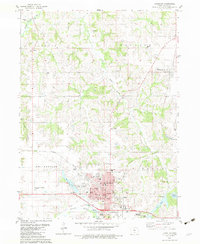 1982 Chariton1983 Print · USGSChariton and the surrounding Lucas County townships are captured in the early eighties as the area balanced its railroad heritage with modern recreation. Researchers can locate family landmarks like Mt Zion Cem, the County Home, and the village of Williamson.
 - 1982 Map of Melrose, 1983 Print
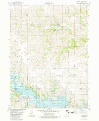 1982 Melrose1983 Print · USGSSouthern Iowa's landscape is captured here in the early eighties as the waters of Rathbun Lake shaped the region's recreation and conservation. Genealogists can locate family landmarks like Mt Calvary Cem and Evans Cem, while tracing the Burlington Northern rail line through Melrose.
Showing maps 1-25 of 107
Top cities of Lucas County
- Chariton historical maps
- Russell historical maps
- Lucas historical maps
- Williamson historical maps
- Derby historical maps
Frequently asked questions
- What are the different types of historical maps available for Lucas County?
- What is the oldest map of Lucas County?
- Where can I purchase historical maps of Lucas County for my home or office?
- Where can I download high-res historical maps of Lucas County?
- Are there historical topographic maps available for Lucas County?
- Is there historical aerial imagery available for Lucas County?
- Where are historical maps of Lucas County sourced from?