1970s Maps of Little Rock, Iowa
Explore 2 historic maps of Little Rock from the 1970s. These maps offer a rare glimpse into what life looked like during the 1970s — showing old roads, neighborhoods, homes, and landmarks that have changed or disappeared over time.
Whether you're researching your family's past, planning a metal detecting trip, or studying how Little Rock's landscape evolved across the 1970s, these high-resolution maps are a powerful tool for exploring the history of this region.
- Focus on a specific era: All maps on this page are from the 1970s, giving you a focused view of this time period.
- See what’s changed: Compare century-old streets, trails, and buildings to today's modern landscape using overlays and satellite layers.
- Research with precision: Use these maps for genealogy, historical research, land use analysis, or educational projects.
- View, download, or print: Maps are fully viewable online in high resolution, and can be downloaded or printed for your own records.
Start exploring Little Rock's history through authentic maps from the 1970s. This is your window into the past.
Little Rock, IA maps
(2)- 1972 Map of Little Rock, 1975 Print
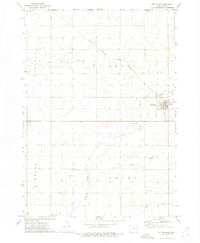 1972 Little Rock1975 Print · USGSThe Lyon County prairie meets the Minnesota state line in the early 1970s, centered on the railroad crossing at Little Rock. Local researchers can trace family landmarks like Zion Cem, Bethel Ch, and the old Rock Island and Pacific rail line.
 - 1972 Map of Sibley West, 1975 Print
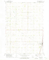 1972 Sibley West1975 Print · USGSOsceola County at the start of the seventies shows a landscape defined by the intersection of major rail lines and a thriving agricultural grid. Genealogists can locate family sites near Holman Cem, Argo, and the Sibley town site.
End of results
Showing maps 1-2 of 2
Top cities near Little Rock
- Sibley historical maps
- Adrian historical maps
- George historical maps
- Ellsworth historical maps
- Ashton historical maps
- Rushmore historical maps
See more
Frequently asked questions
- What are the different types of historical maps available for Little Rock?
- What is the oldest map of Little Rock?
- Where can I purchase historical maps of Little Rock for my home or office?
- Where can I download high-res historical maps of Little Rock?
- Are there historical topographic maps available for Little Rock?
- Is there historical aerial imagery available for Little Rock?
- Where are historical maps of Little Rock sourced from?