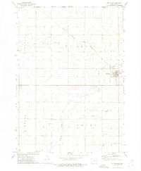
1972 Map of Little Rock
USGS Topo · Published 1975About this map
Little Rock occupies the eastern edge of this agricultural landscape in Lyon County, situated where the Chicago Rock Island and Pacific railroad crosses the Little Rock River. The topography is defined by the drainage patterns of Tom Creek, Whitney Creek, and the Argo Slough, which weave through the townships of Elgin, Midland, Liberal, and Grant. This 1970s survey illustrates a well-established rural community organized around section lines and local institutions.
Find a feature on this map
19 named features on this map. Tap any name to fly to it.
Don’t see what you’re looking for? This feature index may not catch every label — zoom into the map to look around manually.
Map Details
Editions of this 1972 Little Rock Map
This is the sole edition of this map. No revisions or reprints were ever made.
Other maps of this area

1954 · Fairmont
USGS Topo · 1:250,000

1955 · Sioux Falls
USGS Topo · 1:250,000

1958 · Sioux Falls
USGS Topo · 1:250,000

1958 · Fairmont
USGS Topo · 1:250,000

1967 · Rushmore
USGS Topo · 1:24,000

1967 · Adrian SW
USGS Topo · 1:24,000

1967 · Ellsworth
USGS Topo · 1:24,000

1971 · Edna
USGS Topo · 1:24,000

1971 · George West
USGS Topo · 1:24,000

1972 · Ashton
USGS Topo · 1:24,000