2020s Maps of Saint Ansgar, Iowa
Explore 2 historic maps of Saint Ansgar from the 2020s. These maps offer a rare glimpse into what life looked like during the 2020s — showing old roads, neighborhoods, homes, and landmarks that have changed or disappeared over time.
Whether you're researching your family's past, planning a metal detecting trip, or studying how Saint Ansgar's landscape evolved across the 2020s, these high-resolution maps are a powerful tool for exploring the history of this region.
- Focus on a specific era: All maps on this page are from the 2020s, giving you a focused view of this time period.
- See what’s changed: Compare century-old streets, trails, and buildings to today's modern landscape using overlays and satellite layers.
- Research with precision: Use these maps for genealogy, historical research, land use analysis, or educational projects.
- View, download, or print: Maps are fully viewable online in high resolution, and can be downloaded or printed for your own records.
Start exploring Saint Ansgar's history through authentic maps from the 2020s. This is your window into the past.
Saint Ansgar, IA maps
(2)- 2022 Map of Osage SW, 2022 Print
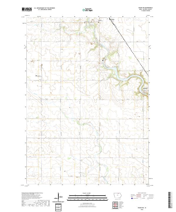 2022 Osage SW2022 Print · USGSThe Cedar River valley in Mitchell County is documented here during the early 2020s, showing a landscape defined by riverside settlements and rural heritage. Genealogists can locate several local burial sites, including Riverview Cem near Mitchell and the Immanuel Lutheran Cem.
 - 2022 Map of Saint Ansgar, 2022 Print
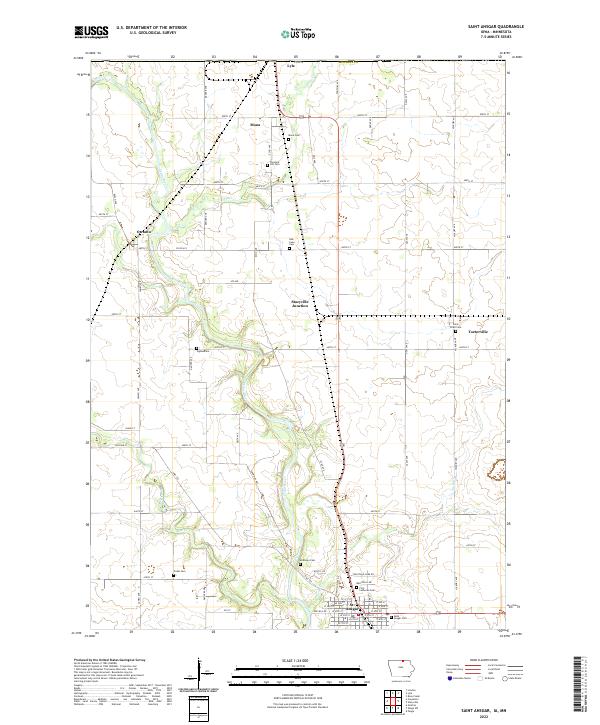 2022 Saint Ansgar2022 Print · USGSMitchell County, Iowa, and the Minnesota borderlands are mapped here in the early twenty-first century as the agricultural and river-linked communities continue to thrive. Genealogists can trace family plots across several sites, including Mona Cem, Saint Peter Cem, and the streets of St. Ansgar.
End of results
Showing maps 1-2 of 2
Top cities near Saint Ansgar
- Mason City historical maps
- Osage historical maps
- Adams historical maps
- Lyle historical maps
- Stacyville historical maps
- Plymouth historical maps
See more
Frequently asked questions
- What are the different types of historical maps available for Saint Ansgar?
- What is the oldest map of Saint Ansgar?
- Where can I purchase historical maps of Saint Ansgar for my home or office?
- Where can I download high-res historical maps of Saint Ansgar?
- Are there historical topographic maps available for Saint Ansgar?
- Is there historical aerial imagery available for Saint Ansgar?
- Where are historical maps of Saint Ansgar sourced from?