2020s Maps of Conesville, Iowa
Explore 2 historic maps of Conesville from the 2020s. These maps offer a rare glimpse into what life looked like during the 2020s — showing old roads, neighborhoods, homes, and landmarks that have changed or disappeared over time.
Whether you're researching your family's past, planning a metal detecting trip, or studying how Conesville's landscape evolved across the 2020s, these high-resolution maps are a powerful tool for exploring the history of this region.
- Focus on a specific era: All maps on this page are from the 2020s, giving you a focused view of this time period.
- See what’s changed: Compare century-old streets, trails, and buildings to today's modern landscape using overlays and satellite layers.
- Research with precision: Use these maps for genealogy, historical research, land use analysis, or educational projects.
- View, download, or print: Maps are fully viewable online in high resolution, and can be downloaded or printed for your own records.
Start exploring Conesville's history through authentic maps from the 2020s. This is your window into the past.
Conesville, IA maps
(2)- 2022 Map of Columbus Junction, 2022 Print
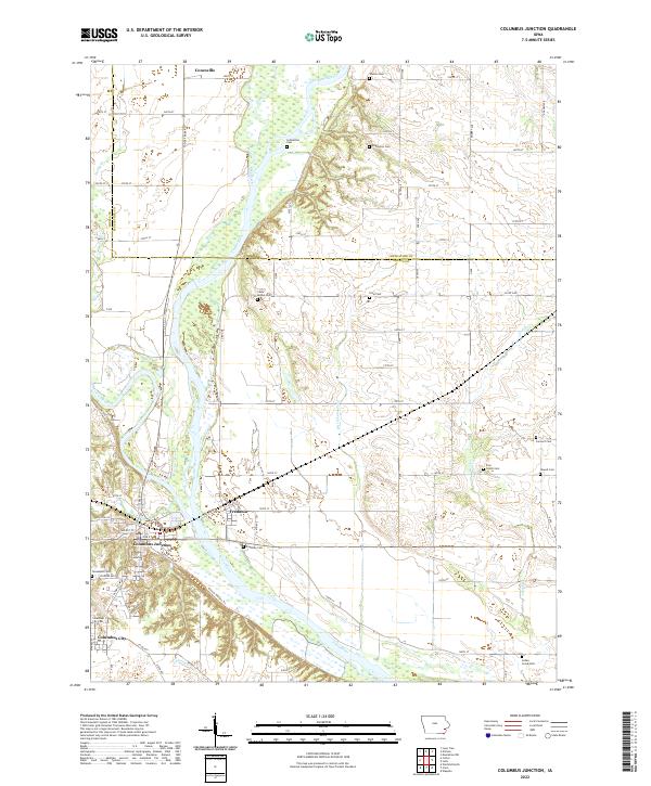 2022 Columbus Junction2022 Print · USGSLouisa and Muscatine Counties are documented here in the early twenty-first century as the Iowa River and Cedar River converge. Local historians can trace numerous rural burial grounds like Schmeltzer Cem, Tennessee Cem, and Indian Creek Cem across the river valley.
 - 2022 Map of Nichols, 2022 Print
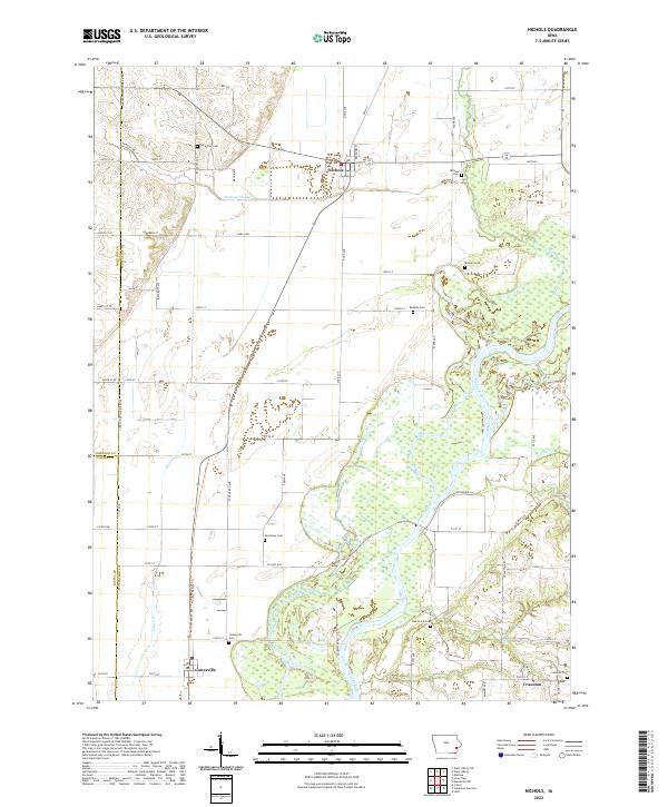 2022 Nichols2022 Print · USGSMuscatine County's river valleys and rural townships are captured in this recent survey of the Cedar River basin. Genealogists and local historians can trace family plots at Nichols Cemetery, Brockway Cemetery, and Oak Grove Cemetery.
End of results
Showing maps 1-2 of 2
Top cities near Conesville
- Iowa City historical maps
- Muscatine historical maps
- West Liberty historical maps
- Wapello historical maps
- Columbus Junction historical maps
- Lone Tree historical maps
See more
Frequently asked questions
- What are the different types of historical maps available for Conesville?
- What is the oldest map of Conesville?
- Where can I purchase historical maps of Conesville for my home or office?
- Where can I download high-res historical maps of Conesville?
- Are there historical topographic maps available for Conesville?
- Is there historical aerial imagery available for Conesville?
- Where are historical maps of Conesville sourced from?