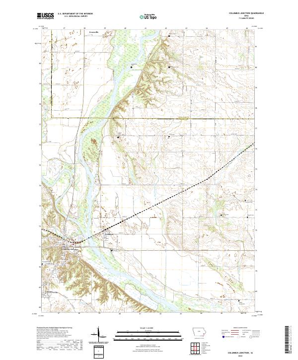
2022 Map of Columbus Junction
USGS Topo · Published 2022About this map
Columbus Junction and Columbus City anchor the southern portion of this landscape, situated near the significant confluence where the Iowa River meets the Cedar River. The terrain is defined by the broad, low-lying floodplains of these major waterways, which are crisscrossed by smaller tributaries like Pike Cr, Honey Cr, and Johnny Cr. The presence of numerous family and community burial sites, including the Schmeltzer Cem, Teeters Cem, and Edgington Cem, provides a detailed record of early settlement patterns in Louisa Co and Muscatine Co.
Find a feature on this map
65 named features on this map. Tap any name to fly to it.
Don’t see what you’re looking for? This feature index may not catch every label — zoom into the map to look around manually.
Map Details
Editions of this 2022 Columbus Junction Map
This is the sole edition of this map. No revisions or reprints were ever made.
Other maps of this area

1946 · Wapello
USGS Topo · 1:62,500

1948 · Muscatine
USGS Topo · 1:62,500

1949 · Wapello
USGS Topo · 1:62,500

1958 · Davenport
USGS Topo · 1:250,000

1961 · Davenport
USGS Topo · 1:250,000

1962 · Davenport
USGS Topo · 1:250,000

1965 · Letts
USGS Topo · 1:24,000
1965 · Muscatine NW
USGS Topo · 1:24,000
1965 · Wapello
USGS Topo · 1:24,000
1969 · Lone Tree
USGS Topo · 1:24,000