Old Maps of Muscatine, Iowa
Explore 18 old maps of Muscatine, spanning from 1916 to today. These high-resolution historic maps reveal how streets, neighborhoods, landmarks, and natural features evolved over time — perfect for genealogy, metal detecting, research, and local history exploration.
What you can do with these maps:
- See how Muscatine changed over time: Compare historical maps to modern-day views to trace roads, homesites, rail lines & more.
- View detailed metadata: Each map includes creators, publishers, year, scale, and archive source.
- Overlay maps with satellite & LiDAR: Visualize the past alongside modern tools to explore terrain & human change.
- Trusted historical sources: Maps sourced from the USGS, Library of Congress, and other archives.
- Access maps your way: View online, download high-res files, or order prints for personal or research use.
Start exploring old maps of Muscatine to uncover forgotten places, hidden landmarks, and the deep history beneath your feet.
Muscatine, IA maps
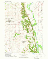
(18)- 1916 Map of Edgington
 1916 Edgington1916 Print · USGSCovers Muscatine, including Blue Grass, Edgington, and other nearby areas3 unique versions available
 - 1938 Map of Edgington, 1955 Print
 1938 Edgington1955 Print · USGSCovers Muscatine, including Blue Grass, Edgington, and other nearby areas
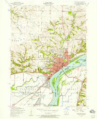
 - 1948 Map of Muscatine
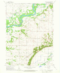
 1948 Muscatine1948 Print · USGSCovers Muscatine, including Fruitland, Grandview, and other nearby areas2 unique versions available
 - 1953 Map of Blanchard Island, 1958 Print
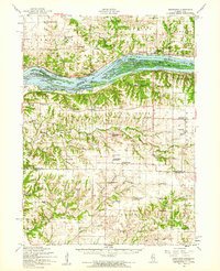
 1953 Blanchard Island1958 Print · USGSCovers Muscatine, including Fruitland, Kammerer Trailer Court, and other nearby areas2 unique versions available
 - 1953 Map of Illinois City, 1958 Print
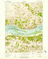 1953 Illinois City1958 Print · USGSCovers Muscatine, including New Era, Fairport, and other nearby areas2 unique versions available
 - 1953 Map of Muscatine, 1958 Print
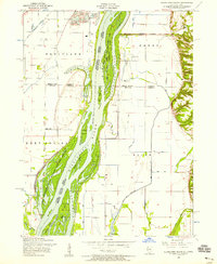
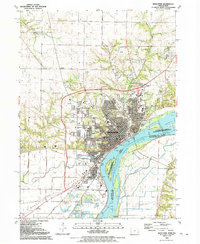
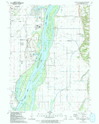
 1953 Muscatine1958 Print · USGSCovers Muscatine, including Rock Island County, Muscatine County, and other nearby areas3 unique versions available
 - 1953 Map of Edgington, 1960 Print
 1953 Edgington1960 Print · USGSCovers Muscatine, including Blue Grass, Edgington, and other nearby areas
 - 1958 Map of Davenport, 1968 Print
 1958 Davenport1968 Print · USGSCovers Muscatine, including Cedar Rapids, Davenport, and other nearby areas2 unique versions available
 - 1961 Map of Davenport
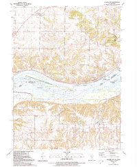
 1961 Davenport1961 Print · USGSCovers Muscatine, including Cedar Rapids, Davenport, and other nearby areas
 - 1962 Map of Davenport
 1962 Davenport1962 Print · USGSCovers Muscatine, including Cedar Rapids, Davenport, and other nearby areas
 - 1965 Map of Letts, 1966 Print
 1965 Letts1966 Print · USGSCovers Muscatine, including Fruitland, Grandview, and other nearby areas
 - 1965 Map of Muscatine NW, 1966 Print
 1965 Muscatine NW1966 Print · USGSCovers Muscatine, including Dayfield, Ardon, and other nearby areas
 - 1984 Map of Muscatine, 1985 Print
 1984 Muscatine1985 Print · USGSCovers Muscatine, including Fairfield, Washington, and other nearby areas2 unique versions available
 - 1984 Map of Aledo, 1985 Print
 1984 Aledo1985 Print · USGSCovers Muscatine, including Davenport, Moline, and other nearby areas
 - 1989 Map of Aledo
 1989 Aledo1989 Print · USGSCovers Muscatine, including Davenport, Moline, and other nearby areas
 - 1991 Map of Muscatine, 1992 Print
 1991 Muscatine1992 Print · USGSCovers Muscatine, including Rock Island County, Muscatine County, and other nearby areas
 - 1991 Map of Illinois City, 1992 Print
 1991 Illinois City1992 Print · USGSCovers Muscatine, including New Era, Fairport, and other nearby areas2 unique versions available
 - 1991 Map of Blanchard Island, 1992 Print
 1991 Blanchard Island1992 Print · USGSCovers Muscatine, including Fruitland, Kammerer Trailer Court, and other nearby areas
End of results
Showing maps 1-18 of 18
Top cities near Muscatine
- West Liberty historical maps
- Wilton historical maps
- Durant historical maps
- Buffalo Prairie historical maps
- Fruitland historical maps
- Grandview historical maps
See more
Frequently asked questions
- What are the different types of historical maps available for Muscatine?
- What is the oldest map of Muscatine?
- Where can I purchase historical maps of Muscatine for my home or office?
- Where can I download high-res historical maps of Muscatine?
- Are there historical topographic maps available for Muscatine?
- Is there historical aerial imagery available for Muscatine?
- Where are historical maps of Muscatine sourced from?